
Interested in working with us in the future?
Follow to see new jobs and posts in your feed.
No news yet.
History

Ancient times
The area now known as Baotou was inhabited by nomads, some of whose descendants would later be categorized as Mongols. Near the end of the Han dynasty (206 BC–220 AD), Lü Bu, a particularly noteworthy warrior, was born in today's Jiuyuan District of Baotou.
Foundation of the town
Compared to the capital of Inner Mongolia, Hohhot, Baotou's construction as a city came relatively late, being incorporated as a town in 1809. The city's site was chosen because it was in an arable region of the Yellow River's Great Bend.
Early 20th century
The Gelaohui secret society and the Hui Muslim General Ma Fuxiang came to an agreement in 1922, in which Ma Fuxiang agreed to allow the Gelaohui to extort protection money from wool merchants in Baotou.
A railway from Beijing was constructed in 1923, and the city began spurring some industrial sites. A German-Chinese joint-venture in 1934 constructed the Baotou Airport and opened a weekly route connecting Baotou with Ningxia and Lanzhou.
When young Owen Lattimore visited Baotou in 1925, it was still "a little husk of a town in a great hollow shell of mud ramparts, where two busy streets made a traders' quarter", but already an important railhead. Qinghai and Gansu wool and hides were brought down the Yellow River by raft and boat from Lanzhou to Baotou, and shipped from Baotou by rail to the east (in particular, to Tianjin for export). The river traffic was one-way only, however, as the fast current made sailing up the Yellow River impractical. To travel from Baotou back to Lanzhou or Yinchuan, one would use a cart and camel road. There were also caravan roads from Baotou to Ordos and the Alxa League.
Second Sino-Japanese War
Baotou was under Japanese control from 1937 until 1945.
Chinese civil war
On September 19, 1949, after the September 19 Rebellion, Baotou fell under Communist control. The People's Government was formed in February 1950.
Economy
Baotou is the largest economy of the Inner Mongolia Autonomous Region, and accounted for approximately 21.3% of Inner Mongolia's total gross domestic product (GDP) as of 2012. As of 2018, the city's GDP is 295.180 billion renminbi (RMB), a 7.22% increase from the previous year, but much lower than the city's peak of 386.763 billion RMB in 2016.
Baotou's secondary sector has proven crucial to the city's economy. As of 2016, it contributed 182.215 RMB to the city's economy, 47.11% of the city's total GDP. However, like the city's total economy, it has shrunk since then. As of 2020, the city's secondary sector contributed 115.300 billion RMB to Baotou's economy.
Baotou Xingsheng Economic & Technological Development Zone is an industrial zone in Baotou.
As noted, in the early Communist years, Baotou served as an industrial centre, with a significant portion of its economy coming from its industry around metals, mostly steel. The Iron and Steel Base of Bautou was constructed with the help of the Soviet Union to help China in developing its economy; it was one of the 156 Projects that the Soviets helped build for that purpose in the 1950s and 1960s.
Baotou is a major center for rare-earth metals. Rare-earth minerals from the Bayan Obo Mining District, about 120 kilometres from Baotou, are processed in the city. They are used in many electrical and electronic devices, such as smartphones, TVs, wind turbines, and electric vehicle motors. The toxic byproducts from the refineries are contained by the Baotou Tailings Dam.
Demographics

According to the 2020 Chinese Census, Baotou has a permanent population of about 2,709,400 people, up about 59,000 from the 2010 Census. The average household in Baotou comprises 2.27 people, down from 2.65 as of 2010.
Age and sex distribution
Baotou, like many places in China, has an aging population. As per the 2020 Census, 20.19% of Baotou's population is aged 60 and older, 1.49 percentage points above the Chinese national average of 18.70%. 13.70% of Baotou's population is aged 65 and older, 0.20 percentage points above the Chinese national average of 13.50%. The number of people aged 60 and older has grown by 7.42% since 2010, and the number of people aged 65 and older has grown by 4.88% during that same span.
Per the census, 50.7% of the city's population is male, and 49.3% is female.
Floating population
As of 2020, there are approximately 1,026,400 floating residents of Baotou, that is, residents of the city with a hukou registration elsewhere. This population has increased by 144,100, or 22.37%, since 2010.
Urbanization
As of the 2020 Census, 2,334,400 people, or 86.16% of the city's population, lives in urban areas. The remaining 375,000 people, 13.84% of the city's population, lives in rural areas.
Prominent locations

The 39,000 capacity Baotou Olympic Sports Centre Stadium(包头奥林匹克体育中心) is the main sports venue in the city and is used mostly for football matches.
Saihantalah Grasslands Park (赛汗塔拉城中草原) or Ecological Reserve is a large urban park in Qingshan district. The 5.5 km square park is home to thirty wild animal and bird species and is reputedly one of the largest urban parks in China. It is a popular recreational location and attracts 2 million visitors a year.
The largest Tibetan Buddhist monastery in Inner Mongolia, Badekar Monastery is located in Shiguai District.
The Baotou Tailings Dam or Weikuang Dam is a tailings dam about 20 kilometres outside the main city of Baotou. It is owned by Baotou Steel and contains the toxic waste from rare-earth mineral refineries. Since as early as 2012, there have been reports of serious contamination of the surrounding environment.
Transportation
Baotou is a terminus for both the Baolan Railway and the Jingbao Railway, heading for Lanzhou in the west and Beijing in the east, respectively. The city is served by two main railway stations, Baotou East Railway Station, and Baotou Railway Station.
Baotou Donghe International Airport serves the city with regular service to Beijing, Shanghai and Hong Kong.
The city is connected by the Hubao Expressway to Inner Mongolia's capital, Hohhot.
Geography
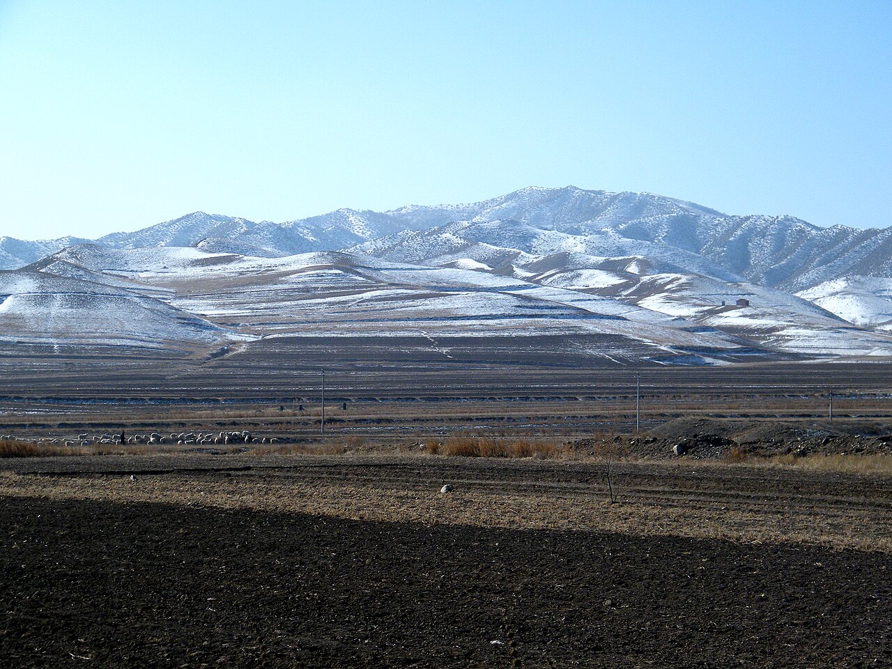
Baotou is located in the west of Inner Mongolia, located at the junction of two economic zones: the Bohai Economic Rim and the Upper Yellow River Natural Resources Enrichment Zone (黄河上游资源富集区). Its administrative area borders Mongolia's Dornogovi Province to the north, while the Yellow River, which flows for 214 kilometres (133 mi) in the prefecture, is south of the urban area itself. The Tumochuan Plateau (土默川平原), Hetao Plateau, and Yin Mountains cross the urban area and central part of the prefecture. Baotou City ranges in latitude from 41° 20' to 42° 40' N and in longitude from 109° 50' to 111° 25' E.
Climate
Baotou features a cold semi-arid climate (Köppen BSk), marked by long, cold and very dry winters, hot, somewhat humid summers, and strong winds, especially in spring. Temperatures often fall below −15 °C (5 °F) in winter and rise above 30 °C (86 °F) in summer. The annual precipitation is approximately 300 millimetres (11.8 in), with more than half of it falling in July and August alone. Due to the aridity and elevation, temperature differences between day and night can be large, especially in spring. In 2002, there were 12 instances of dust storms. Temperature extremes recorded since 1951 range from −31.4 °C (−25 °F) on 27 January 1971 (though an unofficial record low of −32.8 °C (−27 °F) on 23 December 1935) to 40.4 °C (105 °F) on 22 June 2005.
Administrative divisions

Baotou is divided into 10 county-level divisions, including 7 districts, 1 county and 2 banners.
Kaynak: Wikipedia – Baotou · CC BY-SA 4.0

Tarihçe
Günümüzde Baotou olarak bilinen bölge başta Moğollar olmak üzere göçebeler tarafından antik zamanlardan bu yana yerleşime başlanmıştır. 1809 yılında ise şehir statüsü almıştır.
1923 yılında şehri Pekin'e bağlayan bir demiryolu inşa edilmiştir ve şehirde endüstri gelişmeye başlamıştır. Baotou Havalimanı, 1934 yılında Çin-Alman ortaklığı ile inşa edilmiştir.
Baotou, Çin İç Savaşı'nın ardından komünistlerin kontrolüne geçti. Şehir, 1950 ve 1960'larda Sovyetler Birliği'nin yardımı ile önemli bir çelik endüstrisi merkezi haline geldi.
Coğrafya
Baotou, İç Moğolistan'ın batısında Bohai Ekonomik Bölgesi ile Yukarı Sarı Nehir Doğal Kaynaklar Zenginleştirme Bölgesi'nin kavşağında yer almaktadır. Şehrin sınırlarını kuzeyde Moğolistan sınırı ile güneyde 214 km Sarı Irmak oluşturmaktadır. Şehrin kentsel alanı ise güneybatıda Sarı Irmak kıyısında yer almaktadır.
Baotou, soğuk bir yarı kurak iklime (Köppen BSk) sahip olup kışlar uzun, soğuk ve kuru, yazlar ise sıcak ve nemli geçmektedir ve özellikle bahar aylarında kuvvetli rüzgarlar yaşanmaktadır. Sıcaklıklar genellikle kış aylarında -15 °C'nin altına kadar düşerken, yaz aylarında ise 30 °C'nin üzerine çıkmaktadır. Yıllık yağış, yaklaşık 300 milimetre olup bunun yarısından fazlası tek başına Temmuz ve Ağustos aylarında düşmektedir.
İdari bölümler

Baotou şehri, yedi semt, bir ilçe ve iki sancağa ayrılmaktadır.
Ekonomi
Baotou, 2012 yılı itibarı ile 340.95 milyar RMB GSYİH ile İç Moğolistan Özerk Bölgesi'nin en büyük ekonomisi olup bölge GSYİH'inin yaklaşık %21,3'ünü oluşturmaktadır.
Baotou'da Xingsheng Ekonomik ve Teknolojik Kalkınma Bölgesi bulunmaktadır. Bayan Obo'daki madenler dünyadaki en büyük nadir toprak element kaynağı olup 2005 yılında dünya üretiminin %45'ı gerçekleştirilmiştir.
Kaynak: Wikipedia – Baotou · CC BY-SA 4.0