
Interested in working with us in the future?
Follow to see new jobs and posts in your feed.
No news yet.
History

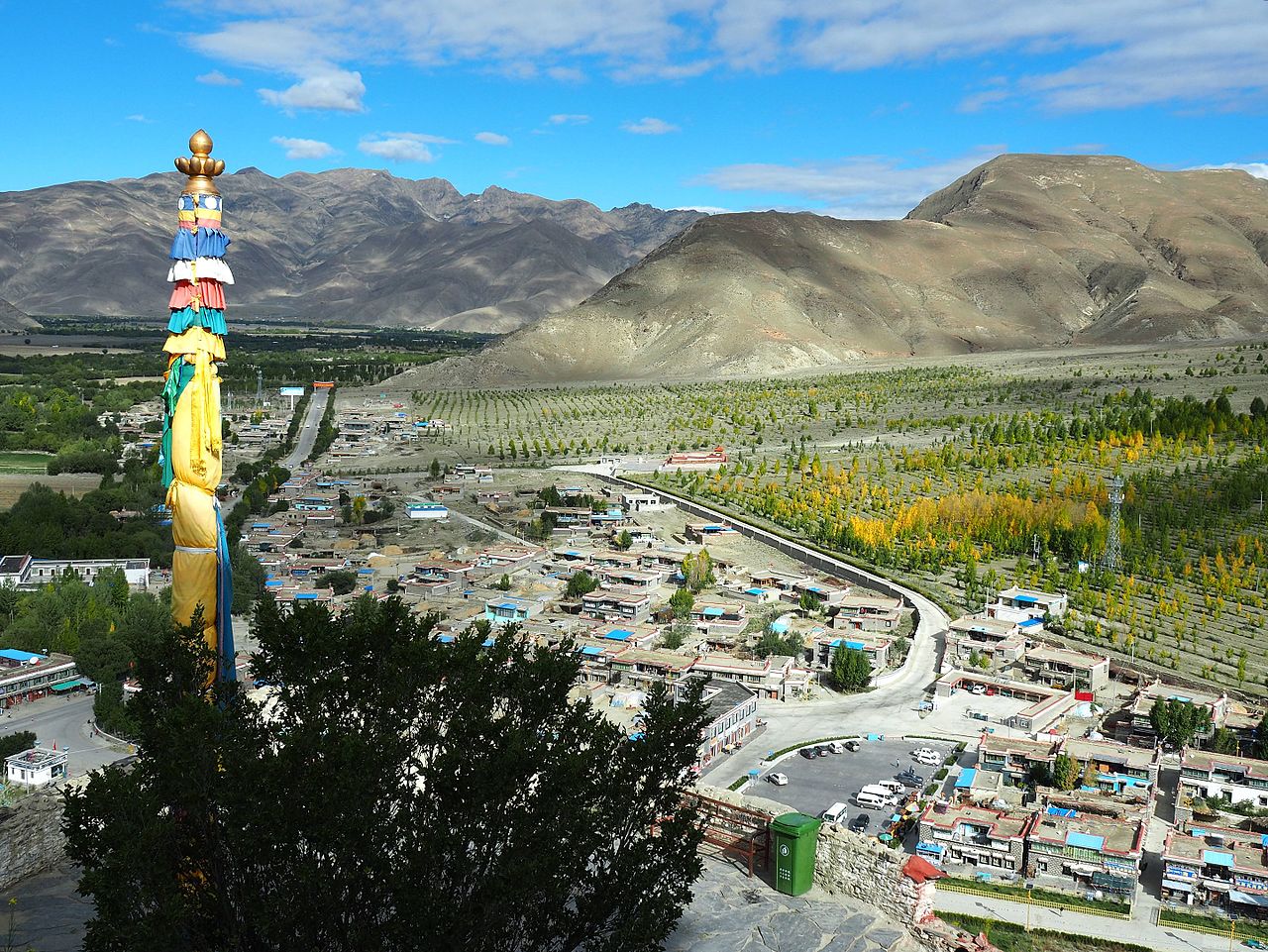
A legend that attests to the position of Lhoka region in the annals of Tibetan history states that human beings are the creation of a union between a sacred monkey and women. According to archaeological findings and legends and ancient documents, people lived in this area up to four million years ago. A primitive civilization grew up in the Yarlung Valley and a field in the village of Sare near Tsetang Town, is said to be the first farming field in Tibet. The first king in Tibetan history, Nyatri Tsenpo, really a mere chief of the Yarlong tribe, began ruling over the Yarlung valley in the beginning of second century BC. He founded the Fan Kingdom and established a hereditary monarchy. During the reign of the ninth king, Budegong, agriculture flourished and he was able to mobilize the people to excavate canal, channelling water to irrigate the flatland. A formal forming system came into existence during the reign of Yixiulie, the eleventh king, when he devised standard measurement units for allocating farmland and counting livestock. Six palaces were built in the region between the rule of the ninth and fifteenth kings.
Around the 6th century AD, the Yarlung Valley became a society which smelted a variety of materials including iron, copper and silver to produce weapons and other objects. The 31st king of Yarlung, Namri Songtsen, was an expansionist and invaded neighbouring tribes, expanding the territory of Yarlung. The 33rd king (who was also the first emperor of Tibet), Songtsän Gampo, conquered Subi tribe, Yangtong tribe and many others and established the Tibetan Empire. Although transferred his capital city from Qiongjie to Lhasa, many of his descendant of the royal lineage still lived in the Lhoka region. He made Yungbulakang Palace his summer palace, which by this time was an important centre for Buddhism and the storage of Buddhist scriptures. In 641 AD, Gampo married Princess Wencheng of the Tang dynasty.
Geography
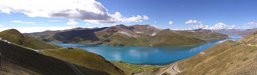
Lhoka region forms one-fifteenth of the total area of the Tibet Autonomous Region. It comprises 12 counties, out of which the eight northern counties are the Nedong, Qusum, Qonggyai, Sangri, Comai, Zhanang, Gyacha and Cona in the middle valley of the Yarlung Zangbo, and the remaining four namely, the Gonggar, Lhunzi, Lohozhag and Nagarze are in the Himalayan belt. The Cona, Lhongzi, Nanggarze and Lhozha counties form the International Border. The city's district and counties have 144 townships of which 71 townships are in agricultural sector, 18 are in animal husbandry sector and the balance 55 are a mix of the two sectors. There are also five neighbourhood committees and 719 village committees. The wide Yarlung River flowing from west to east (between Quxu and Gyacha) also known as Tsongpo and the Brahmaputra River in India and Jamuna in Bangladesh, and its tributaries flows through the middle and lower stretches of the city and is bounded by Lhasa on the north, Nyingchi on the east, Shigatse to the west and international border that extends to 630 kilometres (390 mi) with India and Bhutan. The river system has provided large perennial source of water in the region of fertile land. The valley created by the river system has very green pasture land and thick forests.
The region is studded with hills, valleys, rivers, streams, lakes, hot springs, limestone (karst) caves and many natural scenic regions. The region is also credited with the first "cultivated lands, measured fields, water irrigation, storing the forage grass, moulding metal, and many other techniques".
The natural scenic regions of the city have been categorized under four types. The Yarlung State Scenic Region is one type which has the snow-covered mountains, glaciers, pastures, river valley, alpine vegetation and historical monuments and folk customs and art forms.
Administrative sub-divisions

Shannan is marked by China with a geographical area of 79,700 square kilometres (30,800 mi2) distributed over 1 district and 11 counties with a total population of 330,000. However, a large part of the counties of Lhunze (隆子县) and Cona (错那县), covering an area of 28,700 square kilometres (11,100 mi2) and collectively known as part of South Tibet, are shown by the Chinese government to be Tibetan Autonomous Region's territory (although currently in the control of India) and hence marked disputed. The details of the names of the county, its transliterated names in Simplified Chinese, Hanyu Pinyin, Wylie, Tibetan, population (as of 2003), area and density of population are given in the following table.
Demographics

The population of the city was 330,100 in 2007. Tibetans accounted for 96% of Shannan's total population.
There are 14 ethnic groups, including Tibetans, the Han, the Menba, and the Luoba, living in the area.
Economy

The economy of the city has undergone substantial progress in recent years following the reform policy and opening of the area by the Tibet Autonomous Region to development support from China and other countries. The economy of the city in 2007 consisted of GDP of RMB 3.3 billion (US$441 million), which ranked sixth in the Tibet Autonomous Region. The composition of this GDP consisted of the Agriculture sector (smallest contributor)-10.1%, Secondary Industry of Industry & Construction sector −37.4% and the service sector is the Tertiary Industry as the largest contributor accounted for the balance 52.5%. The PDP per capita was RMB 7,407 (US$1,005). Consumer goods alone accounted for substantial GDP. In terms of value-added industrial output, it ranked third, next to Lhasa and Qamdo / Chamdo / Changdu.
Tourism is also an important sector contributing to the economy of the region. A Report of 2007 records a tourist footfall of 703,000. However, this sector is not fully open and is subject to the permit system controlled by many governmental agencies, and many areas are out of bounds for visitors as they are military zones or sensitive areas.
The city had 450,000 hectares (1,100,000 acres) of land (350,000 hectares (860,000 acres) were irrigated, which was 77% of the cultivated area) under cultivation in 1999, producing 4,725 kilograms (10,417 lb) of grain per hectare, which marked Shannan as an important commercial grain production centre in Tibet. Animal husbandry, another agrarian sector covered 2.2 million ha of posture land with all farmhouse holds involved in animal husbandry; there were 2.14 million heads of domestic animals (comprising 12 percent yaks, 10 percent cows, 50 percent sheep and goats 20 percent goats). Its agricultural tradition is traced to the ancient Yarlong tribes when the city was known as "the grain store of Tibet".
Landmarks

The city has very unusual and rich historical monuments, natural geological features such as lakes and caves, scenic regions and religiously linked mountains. This has given a boost to the tourism industry. Some of the important landmarks are; the Lagyable Palace; the Yungbulakang Palace, the first palace in Tibet; the Tombs of Tibetan Kings; Jagsamqionpori, Gangobari of Zatong and Habort mountains, which are venerated; lakes such as Yamzogh Yumcog in Nagarzê County and the Lhamai Laco of Gyacha, which are considered as sacred; and religious places of worship such as the Dorje Drak Monastery (also spelt Do-rje-brag, or Dorjezha Monastery), the Quamzhub Monastery which is under state control, the Samding Monastery, the Samyas Monastery (the first monastery built in Tibet), Quinpu Meditation Cave and the Zayang Zang Karst Cave. Some of the notable monuments and monasteries are in the National Heritage list.
Yumbulakhar Palace
Yumbulakhar (or Yungbulakhang) Palace was the earliest palace built in Tibet between 400 BC and 200 BC, during the reign of the first King Nyatri Tsanpo, in ancient Yarlung Valley, in Nêdong District. It is 8 kilometres (5.0 mi) to the south of Zetang Town, the capital of the city. It is stated to be "several ten metres high and its magnificent contour looks like a part of the cliff." It is built like a fortress, on the apex of Mt. Tashitseri on the east bank of Yarlung River. The palace looks down over the entire Yarlung Valley. According to folk legend, the king Nyatri descended from heaven, as also the first Tibetan scriptures and few religious objects were set down here from the heaven, during the rule of the 28th King Lhatotorinyetsan. The palace walls are built in stone while the roof structure is made of earth and timber. It overlooks a farmland which is stated to be the "first farm land in Tibet." The palace is approached through a series of steps built as a measure to defend the palace from enemy attack.
Festivals

Many festivals are held in Lhoka region in its counties, district, monasteries and villages to celebrate the harvest season, the New Year or Losar and natural elements such as birds.
A colourful and widely celebrated festival is the Ongkor (Bumper Harvest) Festival which is observed in June according to the Tibetan calendar, in the riverine areas to mark good harvests of the season.
The festival for worship of birds is called in Chinese 'yingniao jie.' It is a religious festival that is special to the Bon or Bonpo community, which still practices the original pre-Buddhist religion of Tibet known as Bön. During this festival, cuckoo, the spring bird, which is considered the king of all birds arrives in the naidong qiasalakang temple in Tsedang, the Bird's temple; according to a specific Tibetan calendar date, corresponding to May as per Gregorian calendar. The festival is also observed in a different month at the Reting Monastery and celebrated until the Cuckoo is seen chirping and accepting food offerings in the monastery grounds. The bird temple has a large Buddha statue cast by King Baikezan. On this occasion birds are given a red carpet welcome at Linka with a tribute of food items such as the Tibetan Highland barley, wheat, peas and other grains on a platter placed on a table. Two butter lamps are also lighted near the table. Two lamas are specially deputed from Lhasa to organise and perform this religious festival. The first cuckoo bird known locally as "Kuda" arrives as a messenger of the Cuckoo king of birds and after a survey of the arrangements made in the Linka, the chief Cuckoo bird arrives formally by performing "Xiezha" at the grounds where a table is set with offerings for the bird. Arrival of these spring birds every year and hearing its chirping is considered as an auspicious sign by the Tibetan people to usher a good cropping season; the birds have been the mascot for Tibetan people since ancient times.
Education
Shannan has emerged from a 90% illiteracy rate in the 1950s to 65.4 literacy rate now. It now has public-run schools from kindergarten, primary school, middle school, secondary teachers school and secondary vocational school. Further, adult education through night schools, continued education classes, literacy classes and technical training classes are functioning in most villages.
Health
Health care has been given priority attention in the city and its 1 district and 11 counties, and as a result it is reported that the life span of individuals has shown a dramatic rise, from 36 years in 1951 to 65 years in 1997. Family planning measures have been effective, resulting in a growth rate of less than 12 per thousand.
Shannan has a People's Hospital functioning since 1951, 195 medical and health centres with 747 hospital beds, a health and quarantine station with sub centres in the counties and the Health Care Hospital for Women and Children; the main hospitals have modern equipment such as fibre gastroscopy, B-type ultrasound diagnostic equipment, electrocardiogram and electroencephalogram, x-ray machines and several other diagnostic and treatment tools.
Apart from modern medical facilities, the traditional Tibetan Medicinal practice has also been promoted in the prefecture and as a result a traditional Tibetan medicine hospital has been set up with 80 hospital beds. Tibetan medicines have been well received by people, with the Tibetan Hospital Pharmaceutical Factory in Shannan producing about 170 varieties of Tibetan medicines.
Transport and infrastructure

The city has a very large network of roads amounting to 3,700 kilometres (2,300 mi), covering all villages and towns. The road emanates from the Tsetang town and spreads to all its 12 counties. The strategic bridge, Qu Shui Bridge across the Yarlung Zangbo River, links Shannan with Lhasa. The city also has the Lhasa Gonggar Airport in Gonggar County, which is 65 kilometres (40 mi) from Lhasa and which is known as the "air way door" to Tibet, as well as the Shannan Longzi Airport in Lhünzê County. The Lhasa airport has direct air links with Beijing, Chengdu, Shanghai, Guangzhou, Chongqing, Xi'an, and Kunming. In addition, there are also international flights to Kathmandu and Hong Kong. It is 191 km (119 mi) from Lhasa. Regular buses operate from the two cities of Tsetang and Lhasa every day to the airport.
From the time Tibet Autonomous Region has been opened for other countries, development of many infrastructure and social sectors have recorded dramatic progress such as education, telecommunications and tourism.
The posts and telecommunications facilities first established in 1956 have now optical fiber link between Zetang and Lhasa. As a result, program-controlled telephones, personal pagers, mobile telephones and other modern communication facilities are linked with the national network. Zetang also has landlines, microwave and satellite communications and postal delivery vehicles.
Kaynak: Wikipedia – Shannan, Tibet · CC BY-SA 4.0