


Overview
長久手市(ながくてし)は、愛知県の尾張地域に位置する市。
Interested in working with us in the future?
Follow to see new jobs and posts in your feed.
No news yet.
About

長久手市(ながくてし)は、愛知県の尾張地域に位置する市。
Kaynak: Wikipedia · CC BY-SA 4.0
概要

長久手市の北東に隣接する瀬戸市と共に、2005年日本国際博覧会(愛知万博)の開催地であり、日本初の実用的な磁気浮上式鉄道であるリニモが運行されている。
2008年(平成20年)5月1日に推計人口が5万人を突破したことに伴い、2012年(平成24年)1月4日に愛知郡長久手町が市制施行した。
地理

市域は尾張丘陵と尾張平野が接する位置にあるため複雑な地形となっている。標高は北西部が低く(最低地点標高:約43 m)、南東部は高い(最高地点標高:約184 m )。市域には一級河川の香流川(庄内川水系)を含む13の河川が流れており、うち井堀川と愛知県農業総合試験場付近を源流とする北新田川とその支流の福井川が天白川水系である他は香流川に流入している。香流川(一級河川)源流域が南東部に存在しその流路は、概ね愛知県道215号田籾名古屋線に沿うように市の北西部へと流下する。
人口
人口は年々増加している。藤が丘駅や名古屋ICが本市域から近いこともあり、隣接する名古屋市名東区に近い地域ほど人口が多い。
歴史
沿革
1906年(明治39年)5月10日 - 愛知郡上郷村・長湫村・岩作村が新設合併し、長久手村が発足。
2012年(平成24年)1月4日 - 長久手町が市制施行して長久手市が発足。愛知県内の単独市制施行は、2010年(平成22年)1月4日のみよし市以来2年ぶりだった。愛知郡では1994年(平成6年)10月1日の日進市以来17年ぶりだった。
行政
市章・市旗
1971年(昭和46年)4月1日、長久手村が町制施行し長久手町となったのを機に制定。以来、2012年(平成24年)1月4日に市制施行し長久手市となった後も受け継いでいる。ながくての「な」を象ったもので、2つの輪の結びつきで融和を表すとともに、左右に伸びた円幅で発展と飛躍を表している。
議会
市議会
令和5年8月27日執行の長久手市長選挙に、さとうゆみ議員、佐野尚人議員が立候補し、公職選挙法第90条の規定に基づき、令和5年8月20日付けで失職。また、令和8年1月27日をもって、にしだ亮太議員が辞職。よって、議員定数18人に対し、現在の議員数は15人。(欠員3人)
施設

医療
愛知医科大学病院(長久手市岩作雁又) - 基幹災害拠点病院(救命救急センターの指定を受けているものから選定し、平常時からの研修・訓練等を通じて県下全域の災害医療体制の機能強化の役割を担う)として愛知県から指定。愛知医科大学病院の新病院が2013年5月9日開院。
公立陶生病院(瀬戸市西追分町) - 出資する一部事務組合 公立陶生病院組合を構成する地方自治体に長久手市も参加している。
日本国外
2005年(平成17年)に開催された愛知万博では「一市町村一国フレンドシップ事業」が行われた。名古屋市を除く愛知県内の市町村が120の万博公式参加国をフレンドシップ相手国として迎え入れた。
日本国内
瀬戸市・春日井市・小牧市・尾張旭市・豊明市・日進市・清須市・北名古屋市・東郷町・豊山町(愛知県)
2017年(平成29年)7月31日 愛知県東尾張地区における災害時相互応援協定締結
生活基盤
本市を担当する中部電力パワーグリッドの営業所は、尾張旭市にある旭名東営業所である。
市外局番は市内全域で0561(瀬戸MA)が使用される。市内局番は、かつて市外局番が05616だった名残で主に60番台(61 - 65)を使用する。ただし最近では瀬戸MA内共通の他の市内局番も見られる。
交通

鉄道
市西部の一部からは名古屋市営地下鉄東山線の藤が丘駅または本郷駅まで徒歩で行くことが可能である。地下鉄車庫(藤が丘工場)の一部は当市域にある。
はなみずき通駅 - 杁ヶ池公園駅 - 長久手古戦場駅 - 芸大通駅 - 公園西駅 - 愛・地球博記念公園駅
なお、愛知県の市の中では、田原市とともにJRと名鉄の両方が全く通らない市である。
バス
市内に名鉄バス名古屋営業所がある。長らくバス以外の公共交通機関が存在しなかったため、地下鉄藤が丘駅など名古屋市方面への路線が充実している。
名鉄バスセンター - 栄 - 引山 - 長久手市役所 - 長久手古戦場駅 - トヨタ博物館前(基幹バス)
他には、名古屋市営バスが猪高緑地(愛知淑徳大学)、日進市巡回バス「くるりんばす」と高速バス「山の湊号」(豊鉄バス)、「VIPライナー」が長久手古戦場駅、尾張旭市営バスあさぴー号、瀬戸市コミュニティバスが愛知医科大学病院、高速バス「WILLER EXPRESS」が愛・地球博記念公園へ乗り入れている。また、本市の櫨木付近に名古屋市営バスの「藤里町」バス停(幹藤丘1、藤丘12)が存在する。
高速道路
この他東名高速道路が市域を通るが、市内にIC等はないものの、名古屋インターチェンジは市内の熊田のすぐ近くに存在する。
市内の道路通称名
市内の都市計画道路を中心とした道路に愛称を付けるため市民から募集し、選考委員会により道路愛称が決定した。自動車交通量の多い比較的大きな道路に付けられている。
県道215号田籾名古屋線「西原」交差点 - 東名高速道路との交差付近まで。その先はそのまま「けやき通り」へ続く。
名古屋市境(名古屋市交通局藤が丘車庫南) - 「長湫仲田」交差点まで。全区間が県道6号力石名古屋線である。
尾張旭市境 - 県道6号・60号「杁ヶ池」交差点まで。「長湫仲田」交差点 - 「杁ヶ池」交差点間は県道6号力石名古屋線(うち「長久手郵便局前」交差点 - 「杁ヶ池」交差点間は県道60号名古屋長久手線重複)である。
県道6号豊田市境 - 「杁ヶ池」交差点および県道60号「杁ヶ池」交差点 - 名古屋市名東区の東名名古屋ICまで。
県道215号「消防署北」交差点 - 県道57号瀬戸大府東海線「山野田」交差点まで。うち「消防署北」交差点 - 「香桶」交差点は、県道75号春日井長久手線である。
リニモ芸大通駅付近・県道233号岩作諸輪線との丁字路 - 愛知県立芸術大学構内まで。
東名高速道路との交差付近 - 日進市境まで。実質的に先述の「長久手西通り」の延長である。これにより「丁子田」交差点設置。日進市側は「日進はなみずき通り」の愛称が付いている。
名所・旧跡・観光スポット

文化財
長久手古戦場 附:御旗山、首塚、色金山(「古戦場公園」などの小牧・長久手の戦いにちなんだ施設・塚などが存在)
名所・旧跡
熊張神明社 - 寛文2年(1662年)建立の石造鳥居(市指定文化財)や神明社古墳群(市指定史跡)がある
観光スポット
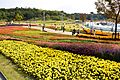
愛・地球博記念公園 - 愛称:モリコロパーク。2006年7月15日に第1期開園、以降、順次整備された。
色金山歴史公園 - 小牧・長久手の戦いの際に、徳川家康が山頂に陣取ったと言われる。茶室、展望テラス併設。
マスコットキャラクター
クーテシガーナ - ながくてアートフェスティバルのキャラクター。市内在住の美術作家が制作。市の応援ソング「クーテシガーナ」が名前の由来。利用規定はないため、市の広報ナビゲーターなど様々なところで利用されている。
ナッキー - 長久手市商工会のキャラクター。公募により、「ながくてがげんき」の前後を取って名付けられた。長久手市に伝わる警固祭の若武者をイメージして、のぼりと鉄砲を持ち、髪の緑は緑の豊かな長久手をイメージしている。
こめこさん - 長久手米粉PRキャラクター。愛知県立芸術大学の協力のもと誕生。
どーべるくん - 長久手市危険物安全協会のキャラクター。協会設立40周年を機に誕生。
あすりー・すいっとり - 長久手市ごみ減量キャラクター。2015年1月23日誕生。
なおいずれのキャラクターも管理者や目的が異なるため、市が著作権を管理していない。
Kaynak: Wikipedia – 長久手市 · CC BY-SA 4.0
Kardeş şehirler
Waterloo, Belçika (8 Ekim 1992'den beri)
Kaynak: Wikipedia – Nagakute · CC BY-SA 4.0
Geography
Nagakute is located in the Owari Hills of central Aichi Prefecture, at an elevation of 43 to 184 meters, and is bordered by the metropolis of Nagoya to the west. Thirteen rivers flow through the city.
Climate
The city has a climate characterized by hot and humid summers, and relatively mild winters (Köppen climate classification Cfa). The average annual temperature in Nagakute is 15.5 °C. The average annual rainfall is 1641 mm with September as the wettest month. The temperatures are highest on average in August, at around 27.9 °C, and lowest in January, at around 4.0 °C.
Demographics
Per Japanese census data, the population of Nagakute has increased dramatically over the past 50 years. The median age of a population in 2020 was 40.2 years old, the youngest in Japan.
History
Feudal period
During the Sengoku period, the Battle of Komaki and Nagakute was held in this vicinity.
Early modern period
During the Edo period area of modern Nagakute was part of the holdings of Owari Domain.
Late modern period
Nagakute Village was established within Aichi District on May 10, 1906, through the merger of the hamlets of Nagakute (different spelling as 長湫村), Kamigō and Yazako.
Contemporary history
Nagakute was elevated to town status on April 1, 1971.
Expo 2005 was a major boost to the local economy, and led to the construction of the Linimo, a commercial linear motor train, to connect the area with the Nagoya metropolis.
The Nagakute hostage incident occurred within the town limits in May 2007.
Nagakute was elevated to city status on January 4, 2012.
Government

Nagakute has a mayor-council form of government with a directly elected mayor and a unicameral city legislature of 18 members.
The city contributes one member to the Aichi Prefectural Assembly.
In terms of national politics, the city is part of Aichi District 7 of the lower house of the Diet of Japan.
Sister cities
International
Waterloo, Belgium, since October 8, 1992
National
Nagiso, Nagano Prefecture, since October 21, 2006
Takarazuka, Hyōgo Prefecture, since October 27, 2012
Economy
Manufacturing
Due to its location, Nagakute's economy is centered around the automobile industry.
Toyota Central R&D Labs., Inc. is located in the city, as is electrical systems manufacturer Nitto Kogyo.
Nagakute is also the head office of the Aichi Rapid Transit Co., Ltd., better known as the operator of the Linimo Maglev High Speed Surface Transport.
Education

University
Aichi Prefectural University of Fine Arts and Music
Primary education
Nagakute has six public elementary schools and three public junior high schools operated by the city government, and one public high school operated by the Aichi Prefectural Board of Education. There is also one private high school.
International Schools
International Christian Academy of Nagoya (closed)
Transportation

Conventional lines
Tōbu Kyūryō Line: - Hanamizuki-dōri – Irigaike-kōen – Nagakute Kosenjō – Geidai-dōri – Kōen-nishi – Aichikyūhaku-kinen-kōen -
Buses
The Meitetsu Bus, which serves Nagakute and the surrounding municipalities, operates the Nagoya depot within the city limits.
Nagakute is also served by the N-Bus, which is a community bus owned by the city of Nagakute and operated by Meitetsu Bus.
Expressways
The Nagoya Seto Expressway, which is designated as a Regional High-Standard Highway, starts from Nagakute and funnels traffic in to the Tōmei Expressway, which passes through Nagakute has no interchange within city limits. However, the Nagoya Interchange, which serves the Tomei and Mei-Nikan Expressways, is close to city limits.
Local attractions
Site of the Battle of Komaki and Nagakute
Notable people from Nagakute
Shinta Fukushima, professional soccer player
Kaynak: Wikipedia – Nagakute · CC BY-SA 4.0