
Interested in working with us in the future?
Follow to see new jobs and posts in your feed.
No news yet.

Tarihçe
MÖ 1200'lü yıllarda bütün Hitit toprakları gibi Bolu da Friglerin elindeydi. MÖ 6. asırda Persler bölgeye hakim oldular. MÖ 336'da Büyük İskender Persleri yenerek Anadolu'nun birçok yeri gibi Bolu'yu da ele geçirdi. Büyük İskender'in ölümü üzerine Makedonya yıkılınca Bolu bölgesinde Bitinya Krallığı kuruldu. Yazılı belgeler, o dönemlerden kalan arkeolojik eserler ve tarihî kaynaklara göre, Trak göçleri sonunda Sakarya ve Filyos Nehri'nin yayı içine yerleşen halk "Bithyn" ismi ile anılıyordu. Bu yüzden Bolu'nun da içinde bulunduğu Kuzeybatı Anadolu'ya "Bithynia" denilmiştir. Bithynler tarafından Salonia Campus denilen Bolu Ovası ve çevresinin adı Romalılar tarafından "Claudio Polis" olarak değiştirilmiştir. Bolu isminin de "Polis"ten geldiği sanılmaktadır. Üç tepe üzerinde kurulmuş olan şehir içte ve dışta surlara sahipti. Şehrin kuzeyinde Halı Hisarı bölgesinde bu surların kalıntıları görülebilmektedir.
1071 Malazgirt zaferinden sonra batıya yayılan Türkmenler 3 yıl sonra Bolu’ya yerleştiler. Selçuklu Devleti’nin komutanları Artuk, Tutuk, Danişmend, Karateki ve Saltuk Beyler Süleyman Şah’ın emrinde İstanbul sınırına dayandılar. Bu akınlar sırasında Bolu, Horasanlı Aslahaddin tarafından fethedilmiştir.
Bolu Yöresine Osmanlı akını ilk kez Osman Gazi tarafından başlatılmıştır. Bolu yöresinin tümüyle fethedilmesi ise Orhan Gazi döneminin ilk yıllarına (1324-1326) rastlar. Bir başka rivayete göre Osmanlılar zamanında bölgede, bol olarak Uluğ - Alim olması nedeniyle önceleri "Bol Uluğ", zamanla "BOLU" olarak isimlendirilmiştir. Yıldırım Beyazid'in ölümü ile başlayan şehzadeler savaşına Bolu, birçok kez sahne oldu. Bolu, Ankara Savaşı sonrası Timur'un talan ettiği bölgelerin dışında kaldığı gibi, bu tehlike bitinceye kadar, Osmanlı Devleti'nin ikinci kurucusu sayılan Mehmed Çelebi'yi de Kızık Yaylasında barındıran belde oldu. Mehmed Çelebi'nin Osmanlı Devleti'nin birliğini sağlamasından sonra ise Bolu, düzenli bir yönetime kavuştu.
Turizm ve gezilecek yerler
Aşçılık ve Turizm Festivali
Aşçılık ve Turizm Festivali, Bolu'nun Mengen ilçesinde, her yıl Haziran ayında düzenlenmektedir. Türkiye'de tek aşçılık okulunun bulunduğu yer olan Mengen'de düzenlenen festivalde çeşitli etkinlikler düzenlenmektedir.
Coğrafya
Türkiye yüzölçümünün %1,015'lik bölümünü kaplayan Bolu ili, 8.313 km² yüz ölçümü ile Karadeniz Bölgesi'nin Batı Karadeniz bölümünde yer alır. İl arazisinin yaklaşık %18'ini tarım alanları oluşturmaktadır. Orman alanları ise %64'lük bir oran ile Türkiye ormanları içinde %2,55'lik paya sahiptir. Çayır ve meraların kapladığı alan yaklaşık %15'tir. Geriye kalan %8 dolayında alan ise tarım dışı alanlardır.
Ortalama rakım 1.000 m, merkez ilçe rakımı ise 725 m civarındadır. Bolu'nun matematiksel konumu, 30°32′ ile 32°36′ doğu boylamları ve 40°06′ ile 41°01′ kuzey enlemleri arasındadır.
Bolu il merkezine göre; Dörtdivan, Yeniçağa ve Gerede ilçeleri doğuda, Mengen kuzeydoğuda, Göynük ve Mudurnu ilçeleri güneybatıda, Seben ve Kıbrıscık ilçeleri ise güneyde yer almaktadır. Bolu'nun, batısında Düzce ve Sakarya, güneybatısında Bilecik ve Eskişehir, güneyinde Ankara, doğusunda Çankırı, kuzeyinde Zonguldak ve kuzey doğusunda Karabük illeri yer alır.
Düzce'nin 584 Sayılı Kanun Hükmünde Kararname ile (09.12.1999 tarih ve 23901 sayılı Resmi Gazete) il olmasıyla, Bolu'nun denizle bağlantısı kalmamıştır.
Dağlar: Dağlar il topraklarının %56'sını kaplamaktadır. Bolu Dağları, güneybatı-kuzeydoğu doğrultusunda uzanır; en yüksek noktası 1.980 m ile Çele Doruğu'dur. Bu sırada Abant Dağları (1.748 m), Gerede'nin kuzeyinde Arkot Dağı (1.877 m) ve Göl Dağları (1.112 m) yer alır. En güneyde ilk iki sıradan daha yüksek olan ve genel olarak Köroğlu Dağları (en yüksek noktası 2.499 m) olarak adlandırılan volkanik dağlar uzanır. Bolu'nun güneyindeki uzantısı Seben Dağları 1.854 m, Mudurnu civarında Ardıç Dağları 1.443 m ve güneydeki Çal Tepesi ise 1.640 m yüksekliğindedir.
Ovalar: İl yüzölçümünün %8'ini kaplayan ovalar genel olarak batı – doğu istikametinde uzanırlar. 725 m yükseltideki Bolu Ovası ve 1.300 m yükseltideki Gerede Ovaları en genişleridir. Diğer ovalar ise Yeniçağa Ovası, Mudurnu Ovası ve Göynük ilçesinin güneyinde bulunan Himmetoğlu Ovasıdır.
Kaynak: Wikipedia – Bolu · CC BY-SA 4.0
History

Antiquity
Bolu was part of one of the Hittite kingdoms around 2000 BC and later 500 BC became one of the leading cities of the Greek Kingdom of Bithynia (279 BC - 79 BC). Bebryces, Mariandynes, Koukones, Thyns and Paphlagons are native people of the area in antique era. Strabo (XII, 4, 7) mentions a Hellenistic town, Bithynium (Greek: Βιθύνιον), celebrated for its pastures and cheese, which according to Pausanias (VIII, 9) was founded by Arcadians from Mantinea.
In the Ancient Roman era, as is shown by its coins, the town was commonly called Claudiopolis (Greek: Κλαυδιούπολις) after Emperor Claudius. It was the birthplace of Antinous, the posthumously deified lover of the Roman Emperor Hadrian, who was very generous to the city, and his name was later added to that of Claudius on the coins of the city. Emperor Theodosius II (408-50) made it the capital of a new province, formed out of Bithynia and Paphlagonia, and called by him Honorias in honour of his younger son and successor Honorius. The town was also known as Hadriana during the late Roman period.
Middle Ages
During the Byzantine period, the city continued to be referred to as Claudiopolis. After the Battle of Manzikert in 1071, in which the Byzantine Empire suffered a defeat against the Seljuks, Turkomans migrating west occupied the city. It was recaptured by the Byzantines in 1097, and became a frontier town during the Komnenian period. Torwards the end of 1179, the Turks laid siege to Claudiopolis, attempting to starve its inhabitants, but emperor Manuel I Komnenos rapidly moved to the area, causing the Turks to abandon the siege and flee. According to Niketas Choniates:
Manuel, unwilling to wait for news of disaster, rose up the next day and set out for Claudiopolis as fast as possible via Nikomedia. He took with him none of the royal luxuries—not even royal pavilion, bed, or mattress—but only the horse trappings and armor woven of chain mail. He extended the distance of the day's march in his eagerness to reach the besieged before they should suffer dangers beyond description. [..] The barbarians positioned about Claudiopolis caught sight of him as he approached, first aware of his arrival from the military standards of his divisions and the radiant splendor of their arms, and forthwith took flight.
Ecclesiastical history
(Arch)Bishopric
As secular capital of the Roman province of Honorias, in the civil Diocese of Pontus, the bishopric of Claudiopolis became the metropolitan see, in the sway of the Patriarchate of Constantinople, with five suffragan sees: Heraclea Pontica, Prusias ad Hypium, Tium, Cratia and Hadrianopolis in Honoriade. It appears as such in the Notitiae Episcopatuum of Pseudo-Epiphanius of about 640 and in that of Byzantine Emperor Leo VI the Wise of the early 10th century, ranking sixteenth viz. seventeenth among the Patriarchate's Metropolitans. In the late 13th century, during the reign of Andronikos II, Claudiopolis lost its metropolitan dignity to Heraclea Pontica. It ceased to exist as a residential bishopric in the 15th century.
Michel Lequien mentions twenty bishops of the see to the 13th century; documentary mentions are available for the following incumbent (arch)bishops:
the first is St. Autonomus, said to be an Italian missionary who suffered martyrdom under Diocletian.
Callicrates (mentioned in 363 in Socrates Scholasticus' church history)
Gerontius (first actual historically documented bishop, in 394 attending the council against Metropolitan Bagadius of Bosra.
Hypatus (circa 518) [dismissed by Janin]
Vincentius (in 553) [dismissed by Janin]
Janin also includes a bishop Sisinnius, attending the council in Trullo (692), but apparently assigns the same to namesake see Claudiopolis in Isauria
Ignatius, a friend and correspondent of Patriarch Photios I of Constantinople
Titular see
The archdiocese was nominally restored by the Roman Catholic Church as a Latin Metropolitan titular archbishopric no later than the seventeenth century, first named Claudiopolis (Latin) / Claudiopoli (Curiate Italian), renamed in 1933 as Claudiopolis in Honoriade (Latin) / Claudiopoli di Onoriade (Italiano) / Claudiopolitan(us) in Honoriade (Latin).
Places of interest

The countryside around Bolu offers excellent walking and other outdoor pursuits. There are hotels in the town. Sights near the town include:
The 14th-century grand mosque, Yıldırım Bayezid Camii (C pronounced as J).
Bolu Museum holding artifacts from Hittite, Roman, Byzantine, Seljuk and Ottoman periods.
Lake Abant and village of Gölköy, near the university campus.
The famous volcanic crater lake called Gölcük.
Hayreddin-i Tokadi, the local saint whose shrine is visited by folk in an annual festival and on Eid holidays.
Aslahaddin Mosque, where an early Muslim martyr rests
The ruins of the ancient stadion of Claudiopolis
Culture
Architecture and sights
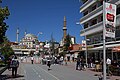
Bolu is home to examples of Ottoman architecture. The Bayezid Grand Mosque dates to 1899, commissioned by Sultan Abdul Hamid II, but was originally built by Bayezid the Thunderbolt and is home to decorations that resemble embroideries. The Kadı Mosque is perhaps the best example of classical Ottoman architecture in the city, having been built in 1499 and having its entrance embroidered with ornate kündekari works. Other Ottoman mosques in the city include the İmaret Mosque, built in the 16th century, Saraçhane Mosque, built in 1750, Ilıca Mosque, built in 1510–11, Karaköy Cuma Mosque, built in 1562-63 and Tabaklar Mosque, built in 1897.
The remains of the ancient city of Bithynium have been found in four hills in the city centre, Kargatepe, Hisartepe, Hıdırlıktepe and the Uğurlunaip Hill. In Hıdırlıktepe, a tomb and the remains of a theatre have been uncovered. In Hisartepe, a temple believed to have been built by the Roman emperor Hadrian for his lover Antinous has been excavated. In 1911, it was noted that "in and around [Bolu] are numerous marbles with Greek inscriptions, chiefly sepulchral, and architectural fragments."
Bolu Museum was established in 1975 to display and protect artifacts found in the Bolu area. It functions as both an archaeological and an ethnographic museum and is home to 3286 archaeological and 1677 ethnographic artifacts, as well as 12,095 historical coins. The archaeological artifacts chronicle the history of the area from Neolithic to Byzantine eras.
Cuisine
Local specialities include a sweet made of hazelnuts (which grow in abundance here) and an eau-de-cologne with the scent of grass. One feature of Bolu dear to the local people is the soft spring water (kökez suyu) obtained from fountains in the town.
Media
Bolu is home to 12 local newspapers published in the city centre, two local TV channels (Köroğlu TV and Abant TV), three local radio stations and six local magazines.
Economy
Bolu is a busy market town rather than a large city. It has one long shopping street and an attractive forested mountain countryside. Students from the university and soldiers based in Bolu make an important contribution to the local economy, which traditionally depended on forestry and handicrafts. Market day is Monday, when people from the surrounding villages come into town for their weekly shop.
The main road from Istanbul to Ankara used to cross Mount Bolu, although more people would stop at the roadside restaurants than actually come into the town, and anyway now the Mount Bolu Tunnel is open most people will rush by on the motorway rather than climb up into Bolu, especially in winter when the road has often been closed due to ice and snow. Some of the service stations on the mountain road have already announced their closure or moved elsewhere.
Climate
Bolu has a borderline oceanic climate and humid continental climate (Köppen climate classification: Cfb, or Trewartha climate classification: Dcb), with chilly, snowy winters and warm summers with cool nights. Bolu is a fairly cloudy and foggy city and annual sunshine hours are about 1,800. Unlike the low-lying, sheltered city center, many parts of the province, like Gerede, have a colder humid continental climate (Dfb/Dcb), due to cold winters.
Highest recorded temperature:42.8 °C (109.0 °F) on 15 August 2023Lowest recorded temperature:−31.5 °C (−24.7 °F) on 5 January 1942
Sources and external links
This article incorporates text from a publication now in the public domain: Pétridès, Sophrone (1908). "Claudiopolis". In Herbermann, Charles (ed.). Catholic Encyclopedia. Vol. 4. New York: Robert Appleton Company.
Chisholm, Hugh, ed. (1911). "Boli" . Encyclopædia Britannica (11th ed.). Cambridge University Press.
Izzet Baysal University official website
Anatolia.com - Bolu Archived 2020-08-04 at the Wayback Machine
Konrad Eubel, Hierarchia Catholica Medii Aevi, vol. 2, p. 130; vol. 4, p. 153; vol. 5, p. 161; vol. 6, p. 169
Raymond Janin, lemma '1. Claudiopolis', in Dictionnaire d'Histoire et de Géographie ecclésiastiques, vol. XII, Paris 1953, coll. 1077–1079
Michel Lequien, Oriens christianus in quatuor Patriarchatus digestus, Paris 1740, Vol. I, coll. 567-572
Heinrich Gelzer, Ungedruckte und ungenügend veröffentlichte Texte der Notitiae episcopatuum, in: 'Abhandlungen der philosophisch-historische classe der bayerische Akademie der Wissenschaften, 1901, pp. 529–641
Pius Bonifacius Gams, Series episcoporum Ecclesiae Catholicae, Leipzig 1931, p. 442
Kaynak: Wikipedia – Bolu · CC BY-SA 4.0