
Carmel
Carmel es una ciudad ubicada en el condado de Hamilton en el estado estadounidense de Indiana.
Government administration · United States · 0 followers
Overview
Carmel es una ciudad ubicada en el condado de Hamilton en el estado estadounidense de Indiana. En el Censo de 2010 tenía una población de 79191 habitantes y una densidad poblacional de 629,81 personas por km².
Interested in working with us in the future?
Follow to see new jobs and posts in your feed.
No news yet.
About

Carmel es una ciudad ubicada en el condado de Hamilton en el estado estadounidense de Indiana. En el Censo de 2010 tenía una población de 79191 habitantes y una densidad poblacional de 629,81 personas por km².
Kaynak: Wikipedia · CC BY-SA 4.0
Geografía
Carmel se encuentra ubicada en las coordenadas 39°57′56″N 86°8′54″O. Según la Oficina del Censo de los Estados Unidos, Carmel tiene una superficie total de 125.74 km², de la cual 122.93 km² corresponden a tierra firme y (2.23%) 2.81 km² es agua.
Demografía
Según el censo de 2010, había 79191 personas residiendo en Carmel. La densidad de población era de 629,81 hab./km². De los 79191 habitantes, Carmel estaba compuesto por el 85.43% blancos, el 2.97% eran afroamericanos, el 0.16% eran amerindios, el 8.85% eran asiáticos, el 0.03% eran isleños del Pacífico, el 0.72% eran de otras razas y el 1.84% pertenecían a dos o más razas. Del total de la población el 2.54% eran hispanos o latinos de cualquier raza.
Kaynak: Wikipedia – Carmel (Indiana) · CC BY-SA 4.0
History
In the 1820s, the government put the lands in the area on sale, leading many farmers to settle on the west bank of White River. The original settlers were predominantly Quakers.
Carmel was originally called "Bethlehem". It was platted and recorded in 1837 by Daniel Warren, Alexander Mills, John Phelps, and Seth Green, who donated their adjoining properties of equal size to create the town. The donated parcels were situated along the Indianapolis-Peru Road (now Westfield Boulevard). The Carmel Clay Historical Society also started its first activities in 1837.
The plot first established in Bethlehem, located at the intersection of Rangeline Road and Main Street, was marked by a clock tower donated by the local Rotary Club in 2002.
A post office was established as "Carmel" in 1846 because Indiana already had a post office called Bethlehem. The name Carmel is a reference to 1 Samuel 25:2 mentioning the biblical settlement Carmel. The town of Bethlehem was renamed "Carmel" and incorporated in 1874.
The Monon Railroad started operations in the city in 1883. Electricity and telephone lines arrived during the first decade of the 20th century. The city's first library was started by the local Wednesday Literary Club and schoolteacher Mahlon Luther Hains in 1904. With a grant from the Carnegie Foundation, the library was built at 40 East Main Streett in 1913. During the first half of the 20th century, the city was the host on and off of the Carmel Horse Show. The town's only bank closed in 1930.
In 1924, one of the first automatic traffic signals in the U.S. was installed at the intersection of Main Street and Rangeline Road. The signal was the invention of Leslie Haines and is currently in the old train station on the Monon Trail.
The Carmel Monon Depot, John Kinzer House, and Thornhurst Addition are listed on the National Register of Historic Places.
Geography
Carmel occupies the southwestern part of Hamilton County, adjacent to Indianapolis and, with the annexation of Home Place in 2018, is now entirely coextensive with Clay Township. It is bordered to the north by Westfield, to the northeast by Noblesville, to the east by Fishers, to the south by Indianapolis in Marion County, and to the west by Zionsville in Boone County. The center of Carmel is 15 miles (24 km) north of the center of Indianapolis.
According to the 2010 census, Carmel has a total area of 48.545 square miles (125.73 km2), of which 47.46 square miles (122.92 km2) (or 97.76%) is land and 1.085 square miles (2.81 km2) (or 2.24%) is water.
Major east–west streets in Carmel generally end in a 6 and include 96th Street (the southern border), 106th, 116th, 126th, 131st, 136th, and 146th (which marks the northern border). The numbering system is aligned to that of Marion and Hamilton counties. Main Street (131st) runs east–west through Carmel's Art & Design District; Carmel Drive runs generally east–west through the main shopping area, and City Center Drive runs east–west near Carmel's City Center project.
North–south streets are not numbered and include (west to east) Michigan, Shelborne, Towne, Ditch, Spring Mill, Meridian, Guilford, Rangeline, Keystone, Carey, Gray, Hazel Dell, and River. Some of these roads are continuations of corresponding streets in Indianapolis. Towne Road replaces the name Township Line Road at 96th Street, while Westfield Boulevard becomes Rangeline north of 116th Street. Meridian Street (US 31) and Keystone Parkway (formerly Keystone Avenue/SR 431) are the major thoroughfares, extending from 96th Street in the south and merging just south of 146th Street. The City of Carmel is noted for having well over 100 roundabouts within its borders.
Demographics

2020 census
As of the 2020 census, Carmel had a population of 99,757. The median age was 40.1 years. 25.5% of residents were under the age of 18 and 15.0% of residents were 65 years of age or older. For every 100 females there were 95.2 males, and for every 100 females age 18 and over there were 92.8 males age 18 and over.
99.9% of residents lived in urban areas, while 0.1% lived in rural areas.
There were 37,821 households in Carmel, of which 36.0% had children under the age of 18 living in them. Of all households, 62.3% were married-couple households, 12.9% were households with a male householder and no spouse or partner present, and 20.5% were households with a female householder and no spouse or partner present. About 23.0% of all households were made up of individuals and 8.5% had someone living alone who was 65 years of age or older.
There were 39,927 housing units, of which 5.3% were vacant. The homeowner vacancy rate was 1.1% and the rental vacancy rate was 8.6%.
Income and housing
According to a 2024 estimate, the median household income in the city was $134,602.
The median home price between 2019 and 2023 was $455,500.
2010 census
As of the census of 2010, there were 79,191 people, 28,997 households, and 21,855 families residing in the city. The population density was 1,668.6 inhabitants per square mile (644.3/km2). There were 30,738 housing units at an average density of 647.7 units per square mile (250.1 units/km2). The racial makeup of the city was 85.4% White, 3.0% African American, 0.2% Native American, 8.9% Asian, 0.7% from other races, and 1.8% from two or more races. Hispanic or Latino people of any race were 2.5% of the population.
There were 28,997 households, of which 41.7% had children under the age of 18 living with them, 66.6% were married couples living together, 6.3% had a female householder with no partner present, 2.4% had a male householder with no partner present, and 24.6% were non-families. 20.8% of all households were made up of individuals, and 6.7% had someone living alone who was 65 years of age or older. The average household size was 2.71 and the average family size was 3.18.
Economy
The Meridian Corridor serves as a large concentration of corporate office space within the city. It is home to more than 40 corporate headquarters and many more regional offices. Several large companies reside in Carmel, and it serves as the national headquarters for OPENLANE (formerly KAR Global), Allegion, CNO Financial Group, MISO, and Delta Faucet. Carmel also serves as the global headquarters for several fraternities and sororities.
Clay Terrace is one of the largest retail centers in Carmel and sits adjacent to Village Park Plaza, another retail hub lying just across the municipal border with Westfield. Other shopping areas include Carmel City Center, Mohawk Trails Plaza, and Merchants' Square. The Carmel Arts & Design District has a number of retail establishments along Main Street, Range Line Road, 3rd Avenue, and 2nd Street.
Founded in 2017, Carmel Christkindlmarkt is an open air Christmas market known for its Glühwein Pyramid, a 33-foot tall (10 m) structure lit with 3,000 bulbs. The market is one of Indiana's top tourist attractions hosting over 400,000 visitors annually.
Top employers
As of January 2017, the city's 10 largest employers were:
Arts and culture

Festivals
CarmelFest is the city's annual 4th of July celebration that has occurred since 1988. Since at least 2001, the festival has taken place over two days: July 3 and 4. CarmelFest includes a parade on July 4 that starts on AAA Way, heads west on E Carmel Drive, north on Rangeline Rd, east on Main St, and ends at the intersection of Main St and 4th Ave. The festival itself consists of live music and booths at both Carter Green and around the Carmel Fountain, connected by the Monon Trail. Petting zoos and carnival rides are set up in the parking lot behind City Hall. Fireworks are launched for 30 minutes and livestreamed. CarmelFest is organized by the Carmel Rotary Club and financially supported by local businesses including Republic Airways and Allied Solutions.
Carmel Pride is an annual Pride festival that takes place on Carter Green during the month of June, featuring performances, activities, and booths for food and merchandise vendors, and organizations. The festival was first organized by a group of Carmel High School students in 2021 and again in 2022. Later, the festival transitioned to having both adult and student organizers. In 2025, organizers stated it was the second-largest Pride festival in the state after Indy Pride with over 3,000 attendees. Carmel Pride has featured an evening drag show since its inception.
The Chinese Mooncake Festival has been held annually between August and October since 2013. It is a celebration of the Chinese Mid Autumn Festival and features a dragon parade and free mooncakes and tea. Initially, the festival took place at the green space bordering the Monon trail and Main St, but moved to the parking lot at 200 Rangeline Rd in 2016 after that space was developed. Since 2022, the festival has taken place at Midtown Plaza.
Indy GreekFest is a celebration of Greek Culture organized by the Holy Trinity Greek Orthodox Cathedral in Carmel, with proceeds supporting the church and a local food pantry. The festival includes Greek music, dance troupes, and vendors selling Greek food. GreekFest was founded in 1974 and moved to Carmel in 2009.
Parks and recreation

The Monon Greenway is a multi-use trail that is part of the Rails-to-Trails movement. It runs from 10th Street near downtown Indianapolis through Broad Ripple and then crosses into Carmel at 96th Street and continues north through 146th Street into Westfield and continues to Sheridan.
A water park and fitness center is the centerpiece of Carmel's Central Park.
Ground was broken for the Japanese Garden south of City Hall in 2007. The garden was dedicated in 2009 as the 15th anniversary of Carmel's Sister City relationship with Kawachinagano, Japan, was celebrated. An Azumaya-style tea gazebo was constructed in 2011 and dedicated on May 2 of that year.
Government
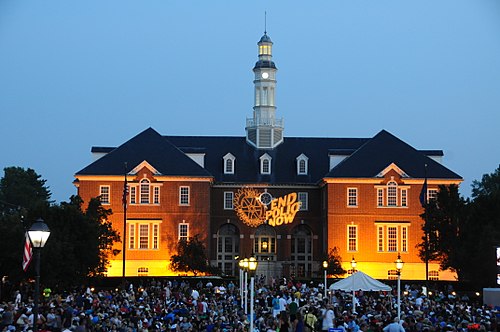
The government consists of a mayor and a city council. The current mayor is Sue Finkam, who has served since 2024. The city leans Republican on a municipal level, but also leans Democratic in state and national elections since 2020, and is generally socially liberal.
Planned development
In mid-2017, the city council was considering a multimillion-dollar bond issue that would cover the cost of roundabouts, paths, roadwork, land acquisition by the Carmel Redevelopment Commission and would include the purchase of an antique carousel from a Canadian amusement park for an estimated purchase price of CAD $3 million, approximately US$2.25 million. However, a citizen-led petition drive against the purchase caused the city council to remove it from the bond issue.
According to the Indiana Department of Local Government Finance, as of 2019 the City of Carmel had an overall debt load of $1.3 billion.
Education

Public schools
The municipality is almost entirely in the Carmel Clay Schools school district. The Carmel Clay Schools district has 11 elementary schools (Kindergarten - Grade 5), three middle schools (Grades 6–8), and one high school (Grades 9–12). Student enrollment for the district is above 14,500.
Carmel Elementary (Feeds into Carmel Middle School)
Cherry Tree Elementary (Feeds into Clay Middle School)
Clay Center Elementary (Feeds into Creekside Middle School)
College Wood Elementary (Feeds into Creekside Middle School)
Forest Dale Elementary (Feeds into Carmel Middle School)
Mohawk Trails Elementary (Feeds into Clay Middle School)
Prairie Trace Elementary (Feeds into Clay Middle School)
Smoky Row Elementary (Feeds into Carmel Middle School)
Towne Meadow Elementary (Feeds into Creekside Middle School)
West Clay Elementary (Feeds into Creekside Middle School)
Woodbrook Elementary (Feeds into Clay Middle School)
All middle schools feed into Carmel High School.
A small piece of Carmel is in the Westfield-Washington Schools school district.
Private schools
Carmel has several private schools, including:
Coram Deo Academy (Kindergarten–Grade 12)
Our Lady of Mount Carmel Catholic School (Kindergarten–Grade 8)
St. Elizabeth Seton Preschool (Preschool, Pre-Kindergarten, and Kindergarten)
Walnut Grove Christian Prep School (Kindergarten–Grade 12)
Transportation
Unusually for a city of this size, Carmel does not have a fixed-route bus system. The only public transportation available in the city is a van service similar to paratransit systems in other cities, Hamilton County Express. It requires making reservations in advance, and had a ridership of about 76,000 in 2024.
Sister cities
Current
Carmel has six sister cities as designated by Sister Cities International.
Kawachinagano, Osaka Prefecture, Japan (1994)
Visakhapatnam, Andhra Pradesh, India (2023)
Kaynak: Wikipedia – Carmel, Indiana · CC BY-SA 4.0