
Corona
Corona es una ciudad del condado de Riverside en el estado estadounidense de California.
Government administration · United States · 0 followers
Overview
Corona es una ciudad del condado de Riverside en el estado estadounidense de California. En el año 2000 tenía una población de 124 966 habitantes y una densidad poblacional de 1372.7 personas por km². La ciudad de Norco colinda al nordeste con Chino Hills y Yorba Linda al oeste, y el Bosque Nacional Cleveland al sureste.
Interested in working with us in the future?
Follow to see new jobs and posts in your feed.
No news yet.
About

Corona es una ciudad del condado de Riverside en el estado estadounidense de California. En el año 2000 tenía una población de 124 966 habitantes y una densidad poblacional de 1372.7 personas por km². La ciudad de Norco colinda al nordeste con Chino Hills y Yorba Linda al oeste, y el Bosque Nacional Cleveland al sureste.
Kaynak: Wikipedia · CC BY-SA 4.0
Geografía
Según la Oficina del Censo, la ciudad tiene un área total de 91,1 km² (35,2 mi²), de la cual 91 km² (35,1 mi²) es tierra y 0,1 km² (0 mi²) (0,06%) es agua.
Demografía
Según el censo del año 2000, había 124.996 personas, 37.839 hogares, y 30.384 familias residiendo en la ciudad. La densidad poblacional era de 3555.5 personas por milla cuadrada (1.372.7/km²). Había 39 271 casas unifamiliares en una densidad de 1117.3/sq mi (431.4/km²). La demografía de la ciudad era de 65 % caucásica, 6.43 % afrodescendiente, 0.87 % amerindia, 7.54 % asiática, 0.31 % isleños del pacífico, 17.52 % de otras razas y 5.30 % de dos o más razas. El 35.5 % de la población era hispana o latina.
Según la Oficina del Censo en 2000 los ingresos medios por hogar en la localidad eran de $98 615, y los ingresos medios por familia eran $83 505. Los hombres tenían unos ingresos medios de $44 752 frente a los $31 884 para las mujeres. La renta per cápita para la localidad era de $21 001. Alrededor del 8.3 % de la población estaban por debajo del umbral de pobreza.
Gobierno
El Instituto para Mujeres de California (CIW), una prisión para mujeres del Departamento de Correcciones y Rehabilitación de California (CDCR) tiene una dirección postal que dice «Corona, California», pero el CIW se encuentra en la ciudad de Chino.
Educación
El Distrito Escolar Unificado de Corona y Norco (CNUSD) gestiona las escuelas públicas de la ciudad.
Kaynak: Wikipedia – Corona (California) · CC BY-SA 4.0
Etymology
Corona is Spanish for crown or wreath. Originally called South Riverside, citizens wanted to distinguish their city from the larger city of Riverside to the north. When it came time to incorporate the city a number of different names were considered, but the name Corona was chosen to play upon a unique feature of the city, the one-mile diameter drive that circled the center of the town.
History

Indigenous
Prior to the late eighteenth century, the area was primarily inhabited by the Tongva and Payómkawichum, who lived in a series of villages throughout the area. What is now Corona stood at the southeastern extent of Tovaangar, or the Tongva world, and at the northern edge of Payómkawichum territory.
The primary settlement in the area was the village of Paxauxa, which was established along the banks of the Temescal Creek at about where Corona is situated today. The settlement was shared by both the Tongva and Payómkawichum people. Cooperation and marriage between the two villages was common. High above the city of Corona, the village of Pamajam was also located in a small valley of the Santa Ana Mountains.
Colonial period
The founding of Mission San Juan Capistrano in 1776 and Mission San Luis Rey in 1798 saw the introduction of Spanish soldiers and missionaries in the area. This resulted in villagers being brought to the mission to be baptized and as labor.
Spanish influence increased in the area with the establishment of the San Antonio de Pala Asistencia in 1816. Two years following the construction of this mission outpost, the Temescal Valley's first European resident, Leandro Serrano, was given permission by the Spanish to use the area for cattle grazing. His first order was to kill the local bear and mountain lion population for the imported herds.
After the secularization of the Spanish missions by the First Mexican Republic in 1833, the land under influence by the missions in Alta California was gradually granted to large landowners as ranches. In 1848, Californio governor Pio Pico issued this land to Bernardo Yorba, which included present-day city of Corona.
Establishment
Corona was founded at the height of the Southern California citrus boom in 1886, and is situated at the upper end of the Santa Ana River Canyon, a significant pass through the Santa Ana Mountains. The town of Corona was once the "Lemon Capital of the World". A museum there presents the lemon's former role in the local economy. The city's name means crown in Spanish due to the circular shape of a crown and the circular shape of Grand Blvd. The nickname of Corona is "The Circle City" from the unique layout of its streets, with a standard grid enclosed by the circular Grand Boulevard, 2.75 miles (4.43 km) in circumference. The street layout was designed by Hiram Clay Kellogg, a civil engineer from Anaheim who was an influential figure in the early development of Orange County.
Geography and climate
Corona is located in western Riverside County, east of Orange County.
According to the United States Census Bureau, the city has a total area of 38.9 square miles (101 km2), of which 38.8 square miles (100 km2) of it is land and 0.1 square miles (0.26 km2) of it, or 0.27%, is water.
Corona experiences a hot Mediterranean climate (Köppen climate classification: CSa) and has mild to cool winters and hot summers. Most of the rainfall (as in all of Southern California) occurs during winter and early spring.
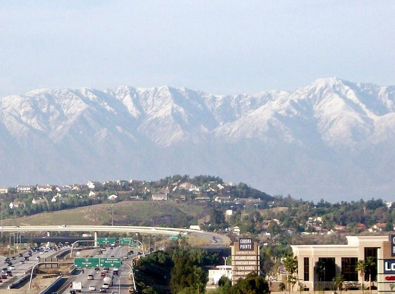
Winter days are pleasant, with the average highs staying in the mid to upper 60s. But compared to other areas in Southern California, winter lows are colder, with common frost and chilly mornings. Snowfall within city limits is rare. Snow flurries will occasionally fall, usually once every other year, but it very rarely snows to the point where it accumulates. The nearby Santa Ana Mountains receive a dusting of snow a few times each winter.
Spring brings pleasant weather with daytime temperatures in the mid to upper 70s, and nighttime lows in the upper 40s. Spring showers are common during the beginning of the season but are a rarity by late May.
Summertime is hot, with highs averaging in the low to mid 90s. During the hottest months, daytime temperatures in Corona can exceed 100 °F (38 °C). In early summer, Corona receives common overcast weather known as "May Gray" and "June Gloom". Summer thunderstorms are sporadic and usually happen between July and September from the North American Monsoons, bringing increased humidity and scattered thunderstorms.
Autumn features warm days and sharply cooler evenings, but can be windy due to the Santa Ana winds, blowing in two or three times a year from October to December.
Economy

Businesses and organizations with global, national or major regional headquarters in Corona include:
Monster Beverage, a worldwide manufacturer of soft drinks, including Hansen's beverages and the Monster Energy drink line.
Circle K, an international convenience store chain.
Saleen, manufacturer of specialty, high-performance sports cars.
Fender, world-famous manufacturer of electric guitars, amplifiers, and musical equipment. The Fender Custom Shop is also based in the same building.
Zumiez, youth and action sports clothing and accessory retailer. Corona is home to the Zumiez distribution center.
Troy Lee Designs, makers of various motocross and mountain bike accessories and apparel.
LuLaRoe, controversial and legally embattled multi-level marketing distributor of women's apparel.
Sterno, manufacturers of portable cooking fuel.
SPJA (Society for the Promotion of Japanese Animation), a 501(c)3 non-profit organization that promotes the Japanese anime industry and related cultures. The SPJA is the organizer for Anime Expo, the largest anime convention in North America.
Top employers
According to the city's 2024 Comprehensive Annual Financial Report, the top employers in the city are:
Demographics
2020
The 2020 United States census reported that Corona had a population of 157,136. The population density was 3,934.2 inhabitants per square mile (1,519.0/km2). The racial makeup of Corona was 40.1% White, 5.5% African American, 1.5% Native American, 12.0% Asian, 0.4% Pacific Islander, 23.0% from other races, and 17.3% from two or more races. Hispanic or Latino of any race were 46.5% of the population.
The census reported that 99.3% of the population lived in households, 0.3% lived in non-institutionalized group quarters, and 0.3% were institutionalized.
There were 48,108 households, out of which 41.6% included children under the age of 18, 57.6% were married-couple households, 6.7% were cohabiting couple households, 21.6% had a female householder with no partner present, and 14.2% had a male householder with no partner present. 15.4% of households were one person, and 6.1% were one person aged 65 or older. The average household size was 3.24. There were 38,198 families (79.4% of all households).
The age distribution was 24.3% under the age of 18, 10.3% aged 18 to 24, 27.1% aged 25 to 44, 26.9% aged 45 to 64, and 11.5% who were 65 years of age or older. The median age was 36.3 years. For every 100 females, there were 97.3 males.
There were 49,584 housing units at an average density of 1,241.4 units per square mile (479.3 units/km2), of which 48,108 (97.0%) were occupied. Of these, 63.0% were owner-occupied, and 37.0% were occupied by renters.
In 2023, the US Census Bureau estimated that the median household income was $106,438, and the per capita income was $40,453. About 7.5% of families and 9.1% of the population were below the poverty line.
2010
The 2010 United States census reported that Corona had a population of 152,374. The population density was 3,914.0 inhabitants per square mile (1,511.2/km2). The racial makeup of Corona was 90,925 (59.7%) White (40.1% Non-Hispanic White), 8,934 (5.9%) African American, 1,153 (0.8%) Native American, 16,205 (10.6%) Asian, 552 (0.4%) Pacific Islander, 28,003 (18.4%) from other races, and 7,759 (5.1%) from two or more races. Hispanic or Latino of any race were 66,447 persons (41.9%); 33.7% of Corona's population are Mexican-American, 2.1% Puerto Rican, 1.2% Cuban, 1.2% Salvadoran, 1.1% Guatemalan, 0.5% Colombian, 0.5% Peruvian, 0.5% Argentine, 0.3% Honduran, 0.2% Nicaraguan, and 0.2% Ecuadorian. Among Asian-Americans, 2.3% of Corona's population were Filipino, 2.1% Vietnamese, 1.7% Korean, 1.4% Indian-Americans, 1.1% Chinese, 0.7% Japanese, 0.4% Pakistani, 0.2% Thai, and 0.1% Bangladeshi. The second largest group of Corona's population is made up of White Americans; the largest groups were 11.1% German-American, 6.7% Irish, 6.2% English, 4.0% Italian, 2.7% French, 1.6% Polish, 1.3% Dutch, 1.2% Norwegian, 1.1% Scottish, 1.1% Swedish.
Government
In the United States House of Representatives, Corona is split between two districts, California's 41st congressional district, represented by Republican Ken Calvert, and California's 40th congressional district, represented by Republican Young Kim.
In the United States Senate, California is represented by Democrats Adam Schiff and Alex Padilla.
In the California State Senate, Corona is located in the 31st senatorial district, represented by Democrat Sabrina Cervantes, and in the 32nd senatorial district, represented by Republican Kelly Seyarto.
In the California State Assembly, Corona is located in the 58th Assembly district, represented by Republican Leticia Castillo, and in the 63rd Assembly district, represented by Republican Natasha Johnson
In the Riverside County Board of Supervisors, Corona is in the Second District, represented by Karen Spiegel.
Infrastructure

Transportation
The city's downtown area is circled by Grand Boulevard, which is unique for being perfectly circular. The street is approximately 1 mi (1.6 km) in diameter.
The city is served by the Corona (SR 71), Interstate 15 (I-15), and Riverside (SR 91) freeways.
There is a proposal to erect a new four-lane freeway along or near Cajalco Road to connect Interstates 15 and 215, although the plan remains controversial. In addition, there is a possibility of constructing a 7.5 mi (12.1 km) tunnel under the Santiago Peak Mountains to the Eastern Transportation Corridor of the FastTrak toll-road company system in Orange, due to increased commuter traffic on State Route 91, which needs to be reduced by another freeway between Orange and Riverside counties.
Corona Municipal Airport (FAA designator: AJO) serves the city and has a 3,200-foot (980 m) runway. On January 20, 2008, two small passenger aircraft collided over Corona, killing all four men aboard the planes and another man on the ground. In the past ten years, there have been five fatal plane crashes around Corona.
Public transportation
The city is linked with the 91/Perris Valley Line and Inland Empire–Orange County Line of the Metrolink commuter rail system, providing service to Los Angeles, Perris, San Bernardino, and Oceanside from Corona–North Main station in the Downtown area and Corona–West station in Corona's west side.
The City of Corona operates its own transportation system called the Corona Cruiser. It consists of two circular routes around the city.
Corona's public transportation also includes the following bus lines: RTA route 1 from West Corona to UC Riverside, RTA route 3 from Corona Regional Medical Center to Swan Lake in nearby Eastvale, RTA route 214 from Downtown Corona to The Village shopping center in Orange, RTA route 206 from Downtown Corona to Temecula, OCTA bus route from Anaheim to South Corona Walmart (Ontario Avenue), and the Corona Cruiser blue and red lines.
Neighborhoods
Downtown District
Centered around Grand Boulevard Historic District (GBHD), Downtown District is the oldest area of the city by far, and encompasses portions of the neighborhoods of Civic Center and Circle City along with the entirety of GBHD.
North Main Street District
The area north of Grand Boulevard Circle centered around N Main St, named North Main Street District, underwent drastic rebranding, redevelopment, and repair beginning in 2017, particularly on the west side of N Main St. Metro at Main - a large mixed-use development featuring apartments atop retail with additional retail along the property - is a commuter community due to its close proximity to Metrolink's Corona - North Main Station, and both SR 91 and I-15 freeways. The east side of N Main St - particularly E Harrison St and E Blaine ST between N Main St and N Joy St - will be converted to a mixed-use community featuring apartments and retail, further making use of the close proximity to Corona - North Main Station.
Historic South Main Street Palms District
Beginning at the intersection of S Main St and Olive St - one block south of the Grand Boulevard Circle - Historic South Main Street Palms District is a long stretch of varying species of palms that were planted and integrated into the landscaping plan for South Corona in the early 20th century. It includes all of the houses and businesses along S Main St between Olive St and Chase Dr.
Arts and culture
Performing arts
The Arts Alive Council is a non-profit organization created with the purpose to "foster, promote, and increase the public knowledge and appreciation of the arts and cultural activities in the greater Corona Area." Members include the Corona Symphony Orchestra, Circle City Chorale, Christian Arts and Theater, and Corona Dance Academy.
Off Broadway Corona Theater (OBCTheater) is a non-profit organization. They produce two to three theatrical productions each year that are presented at the Corona Civic Center Auditorium.
Sister cities
The following are Corona's sister cities as designated by Sister Cities International.
Kaynak: Wikipedia – Corona, California · CC BY-SA 4.0