


El Paso
El Paso es una ciudad ubicada en el condado homónimo, en el extremo oeste del estado estadounidense de Texas.
Government administration · United States · 0 followers
Overview
El Paso es una ciudad ubicada en el condado homónimo, en el extremo oeste del estado estadounidense de Texas. En el censo de 2010 tenía una población de 649 121 habitantes y una densidad poblacional de 978 hab./km², siendo la sexta ciudad más poblada de Texas, y la vigésimo primera más poblada en los Estados Unidos. El Paso es la segunda ciudad más importante a lo largo de la frontera entre Estados Unidos y México, después de San Diego. Se encuentra frente a Ciudad Juárez, Chihuahua (México), ciudades separadas por el Río Bravo o Río Grande. Entre ambas forman un área metropolitana de dos millones y medio de personas.
Interested in working with us in the future?
Follow to see new jobs and posts in your feed.
No news yet.
About

El Paso es una ciudad ubicada en el condado homónimo, en el extremo oeste del estado estadounidense de Texas. En el censo de 2010 tenía una población de 649 121 habitantes y una densidad poblacional de 978 hab./km², siendo la sexta ciudad más poblada de Texas, y la vigésimo primera más poblada en los Estados Unidos. El Paso es la segunda ciudad más importante a lo largo de la frontera entre Estados Unidos y México, después de San Diego. Se encuentra frente a Ciudad Juárez, Chihuahua (México), ciudades separadas por el Río Bravo o Río Grande. Entre ambas forman un área metropolitana de dos millones y medio de personas.
Kaynak: Wikipedia · CC BY-SA 4.0
Historia
Existe evidencia arqueológica en Keystone Wetlands y Hueco Tanks que indican que estos sitios albergaron asentamientos humanos desde hace miles de años en la región de El Paso. Los primeros exploradores españoles encontraron pueblos mansos, sumas y jumanos habitando la región, que fueron asimilados por la población que se asentó, integrándose a una cultura mestiza. Otros pueblos habrían de integrarse con los mescaleros, quienes durante muchos años habrían de asolar la región. Desde el año 1985 se estableció el Salón de la Fama de las mujeres de El Paso que honra y reconoce los éxitos de sus mujeres.
El explorador español Juan de Oñate, nacido en Pánuco (Zacatecas) en 1550, fue el primer novo hispano (México) explorador conocido por haber observado el Rio Grande, cerca de El Paso, en 1598, celebrando una Misa de Acción de Gracias el 30 de abril de 1598 (décadas antes que la acción de gracias de los Peregrinos). Por lo tanto, los cuatro sobrevivientes de la expedición de Narváez, Alvar Núñez Cabeza de Vaca, Alonso del Castillo Maldonado, Andrés Dorantes de Carranza y su esclavo Estebanico, estuvieron pasando a través del área a mediados de 1530s. El Paso del Norte (hoy Ciudad Juárez), fue fundado en el sur del banco del Río Bravo del Norte (Río Grande), en 1659 por Fray García de San Francisco. En 1680, la pequeña villa de El Paso fue temporalmente una base del gobierno español en el territorio de Nuevo México, como resultado de la Rebelión de los indios Pueblo, hasta el 14 de septiembre de 1692 cuando Santa Fe fue reconquistado y otra vez fue la capital.
Siglo XIX
La Revolución de Texas (1836) no fue muy sentida en la región porque la población estadounidense era pequeña, aproximadamente el 10 % de la población. Por lo tanto, la región fue reclamada por Texas como parte del tratado firmado con México, y numerosos intentos fueron hechos por Texas para reforzar estos reclamos. Por lo tanto, las villas que consistían en lo que ahora es El Paso y los alrededores permanecieron esencialmente como una comunidad segura gobernada por ambos representantes del gobierno Mexicano y del gobierno Texano, entrando en negociaciones por su control, hasta que Texas tomó el control irrevocable en 1846. Durante este interludio de 1836-1848, estadounidenses continuaron formando asentamientos en la región. A mediados de la década de 1840 hubo extensos asentamientos hispanos, como el Rancho San Juan María Ponce de León, asentamientos anglosajones, como Simeón Hart y Hugh Stephenson, establecidos a través de las comunidades de asentamientos estadounidenses a los reclamos de Texas. Stephenson, quien se había casado con una aristócrata hispana, estableció el Rancho de San José de la Concordia, que sería el núcleo de asentamiento anglo e hispano llegando a los límites actuales de El Paso en 1844. La República de Texas reclamó el área, queriendo una parte del comercio de Santa Fe. El Tratado de Guadalupe-Hidalgo hizo efectivos estos asentamientos en el norte del banco del río en la parte de los Estados Unidos, separando el Old El Paso del Norte del lado mexicano. La frontera actual de Texas-Nuevo México llevó a El Paso de una situación dudosa a ser parte de Texas en el Compromiso de 1850.
Geografía

Ubicación
Según la Oficina del Censo de los Estados Unidos, El Paso tiene una superficie total de 663.7 km², de la cual 661.05 km² corresponden a tierra firme y (0.4 %) 2.64 km² es agua. El Paso se encuentra a una altitud de 1140 m sobre el nivel medio del mar. El rústico y rojo Pico Franklin Norte en la Sierra de los Mansos (o sierra de Franklin, del inglés: Franklin Mountains) se eleva a 2192 m sobre el nivel del mar, es el punto más alto dentro de la ciudad y puede ser visto dentro de un radio de cien kilómetros a la redonda. El Río Bravo o Río Grande cruza a lo largo del Valle del Río Grande en el límite sur de la sierra de los Mansos. Conforme el río desciende desde Nuevo México, al norte, va definiendo el límite entre El Paso y el Condado de Doña Ana, en Nuevo México. Después interseca la frontera con México y determina el límite entre El Paso y Ciudad Juárez al sur de la ciudad. El volcán extinto Cristo Rey se eleva en el Valle del Río Grande justo al oeste de El Paso, en la margen del estado de Nuevo México. Otros rasgos volcánicos se encuentran cerca de la ciudad como son el Hoyo de Kilbourne y el de Hunt, que son cráteres volcánicos de Maar ubicados a treinta kilómetros al oeste de la sierra de los Mansos (sierra de Franklin).
Barrios
La Montaña Franklin se extiende a lo largo de El Paso desde el norte y claramente divide la ciudad en diversas secciones, junto con los sectores ocupados por Fort Bliss y el Aeropuerto Internacional de El Paso:
El Paso Noroeste (más conocido como El Paso Oeste)
El Paso Valle de las Misiones (antes conocido como Valle Bajo e Ysleta)
Clima
Según la Clasificación climática de Köppen, El Paso tiene un clima semiárido con veranos muy cálidos casi sin humedad e inviernos templados y secos.
La temperatura varía desde los 15 °C de máxima y 1 °C de mínima en enero, hasta los 36 °C de máxima y 23 °C de mínima entre junio y agosto.
Demografía

Según el censo de 2010, había 649 121 habitantes residiendo en El Paso. La densidad de población era de 978.04 hab./km². De los &&&&&&&&&0649121.&&&&&0649 121 habitantes, El Paso estaba compuesto en un 80.84 % por blancos; el 3.39 % eran afroamericanos; el 0.73 %, amerindios; el 1.19 %, asiáticos; el 0.14 %, isleños del Pacífico; el 11 % eran de otras razas; y el 2.7 % pertenecían a dos o más razas. Del total de la población el 80.68 % eran hispanos de cualquier raza.
En el Censo de 2000, de los &&&&&&&&&0182063.&&&&&0182 063 hogares, el 42.4 % tienen niños menores de dieciocho años, el 54.6 % son parejas casadas, el 18.5 % tienen una mujer sin marido presente y el 22.5 % no son familias. El 19.2 % de los habitantes de estos hogares son solteros y el 7.2 % tienen a algún mayor de sesenta y cinco años viviendo solo.
La población de la ciudad se distribuye, según la edad, de la siguiente manera: menores de dieciocho años: 31 %; de dieciocho a veinticuatro años: 10 %; entre veinticinco y cuarenta y cuatro años: 29.1 %; de cuarenta y cinco a sesenta y cuatro años: 19.2 %; mayores de sesenta y cinco años: 10.7 %. La edad media es de treinta y un años. Por cada 100 mujeres hay 90.4 hombres. Por cada 100 mujeres de más de dieciocho años hay 85 hombres.
En 2010, el ingreso medio por hogar en la ciudad era de 44 431 dólares, y el de una familia, de 50 247 dólares. Los hombres tienen unos ingresos medios de 28 989 dólares frente a los 21 540 dólares de las mujeres. Los ingresos per cápita de la ciudad son de 14 388 dólares. El 22.2 % de la población y el 19 % de las familias están por debajo del umbral de la pobreza. De toda la población, el 29.8 % de los menores de dieciocho y el 17.7 % de los mayores de sesenta y cinco están por debajo del umbral de pobreza.
En El Paso vive una significativa comunidad alemana, debido a que el cuartel general de la Fuerza Aérea Alemana para Norteamérica se encuentra allí. Una escuela alemana en El Paso atiende a todos los grados, aunque a partir de 1996, la mayoría de sus estudiantes comienzan a asistir a escuelas estadounidenses en la secundaria. La escuela alemana se encuentra en Fort Bliss.
Educación
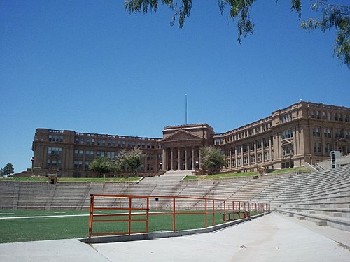
El Distrito Escolar Independiente de El Paso, el Distrito Escolar Independiente de Ysleta, el Distrito Escolar Independiente de Socorro y el Distrito Escolar Independiente de Canutillo gestionan escuelas públicas que dan cobertura a la Ciudad de El Paso.
Socorro ISD gestiona las escuelas del este de la ciudad.
Deportes
El Paso no tiene equipos en las principales ligas de América del Norte, pero cuenta con equipos de ligas menores y equipos de UTEP. Además, cuenta con la empresa de lucha libre profesional Cinta de Oro Promotions.
Relaciones internacionales
Ciudades hermanadas
La ciudad de El Paso está hermanada con 12 ciudades alrededor del mundo
Kaynak: Wikipedia – El Paso (Texas) · CC BY-SA 4.0
Kardeş şehirler
El Paso'nun resmen 6 tane kardeş şehri vardır:
Kaynak: Wikipedia – El Paso · CC BY-SA 4.0
History

Early years
The El Paso region has had human settlement for thousands of years, as evidenced by Folsom points from hunter-gatherers found at Hueco Tanks. This suggests 10,000 to 12,000 years of human habitation. The earliest known cultures in the region were maize farmers. When the Spanish arrived, the Manso, Suma, and Jumano tribes populated the area. These were subsequently incorporated into the mestizo culture, along with immigrants from central Mexico, captives from Comanchería, and genízaros of various ethnic groups. The Mescalero Apache were also present.
The Chamuscado and Rodríguez Expedition trekked through present-day El Paso and forded the Rio Grande where they visited the land that is present-day New Mexico in 1581–1582. The expedition was led by Francisco Sánchez, called "El Chamuscado", and Fray Agustín Rodríguez, the first Spaniards known to have walked along the Rio Grande and visited the Pueblo Indians since Francisco Vásquez de Coronado 40 years earlier. Spanish explorer Don Juan de Oñate was born in 1550 in Zacatecas, Zacatecas, Mexico, and was the first New Spain (Mexico) explorer known to have rested and stayed 10 days by the Rio Grande near El Paso, in 1598, celebrating a Thanksgiving Mass there on April 30, 1598. Four survivors of the Narváez expedition, Álvar Núñez Cabeza de Vaca, Alonso del Castillo Maldonado, Andrés Dorantes de Carranza, and an enslaved native of Morocco, Estevanico, are thought to have crossed the Rio Grande into present-day Mexico about 75 miles south of El Paso in 1535. El Paso del Norte (present-day Ciudad Juárez) was founded on the south bank of the Río Bravo del Norte (Rio Grande), in 1659 by Fray Garcia de San Francisco. In 1680, the small village of El Paso became the temporary base for Spanish governance of the territory of New Mexico as a result of the Pueblo Revolt, until 1692, when Santa Fe was reconquered and once again became the capital.
Geography

El Paso is located at the intersection of three states (Chihuahua, New Mexico, and Texas) and two countries (Mexico and the U.S.). It is the only major Texas city in the Mountain Time Zone. Ciudad Juarez was once in the Central Time Zone, but both cities are now on Mountain Time.
El Paso is closer to the capital cities of four other states: Phoenix, Arizona (430 miles or 690 kilometers away); Santa Fe, New Mexico (273 miles or 439 kilometers away); Ciudad Chihuahua, Chihuahua, (218 miles or 351 kilometers away), and Hermosillo, Sonora (325 miles or 523 kilometers away)—than it is to the capital of its own state, Austin (528 miles or 850 kilometers away). It is closer to Los Angeles, California (700 miles or 1,100 kilometers away) than it is to Orange, Texas (858 miles or 1,381 kilometers away), the easternmost town in the same state as this city.
El Paso is located within the Chihuahuan Desert, the easternmost section of the Basin and Range Region. The Franklin Mountains extend into El Paso from the north and nearly divide the city into two sections; the west side forms the beginnings of the Mesilla Valley, and the east side expands into the desert and lower valley. They connect in the central business district at the southern end of the mountain range.
The city's elevation is 3,740 ft (1,140 m) above sea level. North Franklin Mountain is the highest peak in the city at 7,192 ft (2,192 m) above sea level. The peak can be seen from 60 mi (100 km) in all directions. Additionally, this mountain range is home to the famous natural red-clay formation, the Thunderbird, from which the local Coronado High School gets its mascot's name. According to the United States Census Bureau, the city has a total area of 256.3 sq mi (663.7 km2).
The 24,000-acre (9,700 ha) Franklin Mountains State Park, one of the largest urban parks in the United States, lies entirely in El Paso, extending from the north and dividing the city into several sections along with Fort Bliss and El Paso International Airport.
Demographics
2020 census
As of the 2020 census, El Paso had a population of 678,815. The median age was 35.4 years. 24.5% of residents were under the age of 18 and 14.8% of residents were 65 years of age or older. For every 100 females there were 92.7 males, and for every 100 females age 18 and over there were 89.4 males age 18 and over.
99.4% of residents lived in urban areas, while 0.6% lived in rural areas.
There were 243,598 households in El Paso, of which 36.0% had children under the age of 18 living in them. Of all households, 44.6% were married-couple households, 18.3% were households with a male householder and no spouse or partner present, and 31.7% were households with a female householder and no spouse or partner present. About 24.6% of all households were made up of individuals and 9.7% had someone living alone who was 65 years of age or older. The census counted 162,460 families residing in the city.
There were 261,229 housing units, of which 6.7% were vacant. The homeowner vacancy rate was 1.3% and the rental vacancy rate was 7.7%.
2010 census
At the 2010 U.S. census, 649,121 people, 216,694 households, and 131,104 families resided in the city.
The population density was 2,263.0 inhabitants per square mile (873.7/km2) in 2010. There were 227,605 housing units at an average density of 777.5 per square mile (300.2/km2). Of the 216,894 households in 2010, 37.6% had children under 18 living with them, 48.5% were married couples living together, 20.7% had a female householder with no husband present, and 25.3% were not families. About 21.5% of all households were made up of individuals, and 24.9% had someone living alone who was 65 years of age or older. The average household size was 2.95 and the average family size was 3.47.
In the city, the age distribution was 29.1% under the age of 18, 7.5% from 20 to 24, 26.2% from 25 to 44, 22.8% from 45 to 64, and 11.1% who were 65 or older. The median age was 32.5 years according to census statistics from 2010.
Economy

El Paso has a diversified economy focused primarily within international trade, military, government civil service, oil and gas, health care, tourism, and service sectors. The El Paso metro area had a GDP of $29.03 billion in 2017. There was also $92 billion worth of trade in 2012. Over the past 15 years the city has become a significant location for American-based call centers. Cotton, fruit, vegetables, and livestock are also produced in the area. El Paso has added a significant manufacturing sector with items and goods produced that include petroleum, metals, medical devices, plastics, machinery, defense-related goods, and automotive parts. On July 22, 2020, Amazon announced plans to open the first 625,000 square foot fulfillment center in El Paso. Owing to its location on a border, the city is the second-busiest international crossing point in the U.S. behind San Diego.
El Paso is home to one Fortune 500 company, Western Refining, which is listed on the New York Stock Exchange (NYSE). This makes the city one of six Texas metro areas to have at least one Fortune 500 company call it home; the others being Houston, Dallas-Fort Worth, San Antonio, Austin, and Corpus Christi. The second publicly traded company is Helen of Troy Limited, a NASDAQ-listed company that manufactures personal health-care products under many labels, such as OXO, Dr. Scholl's, Vidal Sassoon, Pert Plus, Brut, and Sunbeam, and the third is El Paso Electric listed on the NYSE, a public utility engaging in the generation, transmission, and distribution of electricity in West Texas and southern New Mexico. The fourth publicly traded company is Western Refining Logistics, also traded in the NYSE. It is a Western Refining subsidiary, which owns, operates, develops, and acquires terminals, storage tanks, pipelines, and other logistics assets.
Arts and culture

The culture of El Paso, Texas is influenced heavily by the mixing of American and Mexican cultures, due to the city's position on the U.S. Mexico border, its large Chicano population, and its history as part of Hispanic America and Mexico.
Annual cultural events and festivals
The Amigo Airsho is one of El Paso's premier events, and is ranked as one of the top-10 air shows in the country, filled with air entertainment and ground activities. Acts include the Franklin's Flying Circus, where performers walk on the wings of an airborne plane. Ground activities include a jet-powered school bus. After 31 years of being held at Biggs Army Airfield, the show was moved to Dona Ana Airport in 2014.
The KLAQ Great River Raft Race is an annual event celebrated on the second to last Saturday of June. Participants are encouraged to ride the river and float the Rio Grande with family and friends. The organizers encourage the building of unique rafts that get down the river, with prizes and trophies awarded for the most points earned, best-looking crew, and best-decorated raft. The race starts at the Vinton Bridge and ends 3 miles downstream at the Canutillo Bridge.
The Southwestern International PRCA Rodeo is the 17th-oldest rodeo in the nation and El Paso's longest-running sporting event. Consistently ranked as one of the top 50 shows in the country by the Professional Rodeo Cowboys Association, this charitable event is a celebration of western culture and heritage.
La Fiesta de las Flores is one of the oldest Hispanic festivals in the Southwest. The three-day fiesta is held each year during the Labor Day weekend and emphasizes El Paso's Hispanic heritage and culture. The festival attracts 20,000 to 30,000 visitors from El Paso County, New Mexico, West Texas, and the State of Chihuahua, Mexico. Activities included in the fiesta are crowning of the queen, a Fiesta Parade, Senior Appreciation Dance, Military Appreciation Day, and live entertainment. The fiesta is also well known for the authentic regional cuisine, arts and crafts, games, and services available for the enjoyment of all attendees. Over 80 booths, sponsored by local vendors and nonprofit organizations, create the Hispanic ambience and culture.
Sports

El Paso is home to the Sun Bowl, the second-oldest consecutive college football contest (after the Rose Bowl). Its first game was held in 1935.
On September 18, 2012, the city council voted to approve the demolition of its city hall to make way for Southwest University Park, the new home of the El Paso Chihuahuas Triple-A team (San Diego Padres affiliate); it opened in 2014. The team was purchased by Mountainstar Sports Group of El Paso. City Hall was demolished on April 14, 2013.
The El Paso Marathon takes place annually since 2007. The El Paso Locomotive FC soccer team began playing in 2019 in the USL Championship. They play their home matches at the Southwest University Park.
Parks and recreation

El Paso is home to the largest urban park in the nation. The Franklin Mountains State Park, with its more than 24,248 acres (9,813 ha), is completely located within the city limits. It is considered a small range (23 miles long, 3 miles (4.8 km) wide) that extends from the city north into New Mexico. It is home to the highest peak in the county North Franklin Mountain at 7,192 feet.The park is open year-round for recreation including hiking, mountain biking, picnicking, scenic driving and views of the city. Scenic Drive runs along the mountain range, and is designated as a city park to allow better vandalism control and cleanup, Roads are closed to vehicles on certain Sundays to allow walking, running, cycling, and skating. The road offers views of El Paso, as well as nearby Ciudad Juárez, across the Mexico–United States border.
The Wyler Aerial Tramway is operated by the Texas Parks and Wildlife Department and is in the Franklin Mountains State Park. The tramway complex covers 196 acres (0.79 km2) on the east side of the Franklin Mountains. The gondolas travel along two 2,600-foot (790 m) 1+3⁄8-diameter steel cables to Ranger Peak, 5,632 feet (1,717 m) above sea level. The trip takes about four minutes and lifts riders 940 feet (290 m) above the boarding area.The tramway was built in 1959 by KTSM radio to aid in the construction of a transmitter tower. Karl O. Wyler managed the project. First opening to the public as the El Paso Aerial Tramway, the facility provided rides from 1960 to 1986, when high liability insurance costs forced the tram to stop public operations. The tram was only used to service the transmitter towers. Wyler donated the tramway for public use in his will. The Texas Parks and Wildlife Department accepted the donation in 1997 and renovated and re-opened the tramway to the public in 2001. The tramway was closed indefinitely on September 18, 2020.
Government
City
The city government is officially nonpartisan. Mayors and city council members are elected for four year terms and may not serve more than two full terms or for more than ten years total in their respective offices. Municipal elections were held in May in odd-numbered years until a voter-approved charter amendment changed this to November in even-numbered years, beginning in 2018.
The city operates under a council–manager form of government. Power is concentrated in the eight-member elected city council and mayor, who hire a manager to carry out its directives and oversee the delivery of public services. The current city manager is Dionne Mack, and the current mayor of El Paso is Renard Johnson, who was elected to the office in 2024.
County
The El Paso County Judge is Ricardo Samaniego, and the County Commissioners are Jackie Arroyo Butler (Precinct 1), David Stout (Precinct 2), Iliana Holguin (Precinct 3), and Sergio Coronado (Precinct 4). The commissioners and the county judge are Democrats.
Stout was first elected to his position in 2014, was re-elected in 2018 and 2022, and defeated in the 2026 Democratic primary. Samaniego was first elected in 2018, and was re-elected unopposed in 2022. Holguin was first elected to her position in 2020 and re-elected unopposed in 2024. Coronado was first elected to his position in 2022, and defeated in the 2026 Democratic primary. Arroyo Butler was first elected to her position in 2024.
State
The El Paso metropolitan area is represented in the Texas State House by Democrats Eddie Morales, Mary Gonzalez, Joe Moody, Claudia Ordaz, and Vincent Perez, and in the State Senate by Cesar Blanco (D-El Paso).
The Texas Department of Criminal Justice operates both the El Paso I District Parole Office in the city, as well as the Rogelio Sanchez State Jail . The El Paso II District Parole Office is in an unincorporated area east of Horizon City.
Education

El Paso is home to the University of Texas at El Paso, a Tier 1 doctoral research university and the largest public university in the region. UTEP was ranked as the 7th best university in Washington Monthly's 2013 National University Rankings, just behind Stanford and ahead of Harvard. Also, the university's School of Engineering is the nation's top producer of Hispanic engineers with M.S. and Ph.D. degrees.
El Paso is also home to Texas Tech University Health Sciences Center at El Paso, Paul L. Foster School of Medicine, Texas Tech College of Architecture at El Paso, Park University and Southwest University. Also due to its proximity, many El Paso students attend New Mexico State University where the school offers in-state tuition to El Paso County residents.
The El Paso Community College's boundary includes all of El Paso County. There are several technical schools and for profit schools. El Pasoans also have access to the Doña Ana Community College with campuses in Sunland Park, Anthony and Chaparral, New Mexico: This community college is a part of the New Mexico State University system.
El Paso area students attend public schools in four school districts that cover portions of the city limits: El Paso Independent School District, Ysleta Independent School District, Socorro Independent School District and Canutillo Independent School District; there are nine independent school districts in the county. Numerous accredited private preparatory schools also serve El Paso students. These include various pre-high school religious (Christian, Jewish) affiliates and Montessori schools, Cathedral High School, Loretto Academy, Father Yermo High School, Lydia Patterson Institute, Faith Christian Academy, El Paso Jewish Academy, Rose of Sharon Christian Academy, Zion Lutheran Day School and Radford School. The University of El Paso offers the country's only bilingual M.F.A. creative writing program.
Media
Newspapers
The main newspapers are the English-language daily El Paso Times, founded in 1881; the Spanish-language daily El Diario de El Paso, and the online newspaper El Paso Herald-Post started in 2015. The original and defunct El Paso Herald Post was also founded in 1881 as the El Paso Herald, which then merged with the El Paso Post in 1931. The paper was shut down in 1997. El Paso Matters, a non-profit online newspaper, was founded in 2019.
The Prospector, published by the University of Texas at El Paso
Tejano Tribune, published by El Paso Community College
Radio stations
Radio stations from Las Cruces, New Mexico, and Ciudad Juárez, Chihuahua, can also be heard within the El Paso market.
Television
El Paso was the largest city in the United States without a PBS television station within the city limits until 1978, when KCOS-TV was founded. El Paso viewers had to watch channel 22, KRWG, from Las Cruces until 1978. In fact, the city had only three English-speaking channels and two Spanish-language channels (channel 2 and channel 5) from Juarez, and cable TV subscribers in the 1970s and 1980s could receive four Los Angeles independent channels: KTLA, KHJ, KTTV and KCOP as well as Spanish-language stations KMEX of Los Angeles and KWEX of San Antonio usually sharing the same cable channel slot. Over time, as more television stations signed on, more cable channels were added and those stations added network affiliations, the Los Angeles and San Antonio stations disappeared from the lineup. The last to be removed was KTLA in the fall of 2006 as a consequence of the WB-UPN merger into The CW, when KVIA-TV launched a digital subchannel with the network's programming.
In 2019, KCOS was absorbed and moved to Lubbock as part of Texas Tech Public Media in order to keep the station on air after years of financial struggles. KCOS still focuses on broadcasting to the El Paso community.
Infrastructure

Healthcare
El Paso is the medical hub of West Texas and Southern New Mexico, hosting numerous state-of-the-art medical centers. Some of the city's top hospitals include University Medical Center, William Beaumont Army Medical Center, Sierra Medical Center, Las Palmas Medical Center, Del Sol Medical Center, Sierra Providence East Medical Center, El Paso Children's Hospital, and Providence Memorial Hospital. University Medical Center is the only level I trauma center in the region. William Beaumont Army Medical Center will be replaced by a new state of the art $1.2 billion Fort Bliss Replacement Hospital expected to open in 2020. El Paso's newest hospital, The Hospitals of Providence Transmountain Campus opened in Northwest El Paso on January 27, 2017. The 106-bed teaching hospital is a collaboration between Texas Tech University Health Sciences Center El Paso and The Hospitals of Providence. The hospitals were strained during the COVID-19 pandemic in Texas, and 10 refrigerated morgue trailers were installed to handle increased mortality.
El Paso is also home to the Medical Center of the Americas, an integrated complex of medical facilities anchored by Texas Tech University Health Sciences Center at El Paso, Paul L. Foster School of Medicine, University Medical Center, the El Paso Psychiatric Center and by the El Paso Children's Hospital. It is also the site to the Cardwell Collaborative biomedical research building, the Gayle Greve Hunt School of Nursing, and the Graduate School of Biomedical Sciences. The Woody L. Hunt School of Dental Medicine is expected to open in 2021 in the MCA area as well.
Transportation
El Paso is served by El Paso International Airport and Amtrak via the historic Union Depot.
Several roads and highways connect El Paso, including I-10, US 54 (known locally as "54", the "North-South Freeway" or officially as the Patriot Freeway), Spur 601 (Liberty Expressway), US 180 and US 62 (Montana Avenue), US Highway 85 (Paisano Drive), Loop 375, Loop 478 (Copia Street-Pershing Drive-Dyer Street), numerous Texas Farm-to-Market roads (a class of state highway commonly abbreviated to FM) and the city's original thoroughfare, SH 20, the eastern portion of which is known locally as Alameda Avenue (formerly US 80). SH 20 also includes portions of Texas Avenue in Central El Paso, Mesa Street from Downtown to the West Side, and Doniphan Drive on the West Side. Northeast El Paso is connected to West El Paso by Transmountain Road (Loop 375). The city also shares four international bridges and one railbridge with Ciudad Juárez, Mexico. In 2009, El Paso was home to number 52, number 98, and number 100 of the 100 most congested roads in Texas, which are, respectively: North Zaragoza Road between Sun Fire Boulevard and I-10; Lee Trevino Drive between Montana Avenue and I-10; and I-10 between the Patriot Freeway and Loop 375.
Kaynak: Wikipedia – El Paso, Texas · CC BY-SA 4.0