

Goodyear
Goodyear es una ciudad ubicada en el condado de Maricopa en el estado estadounidense de Arizona.
Government administration · United States · 0 followers
Overview
Goodyear es una ciudad ubicada en el condado de Maricopa en el estado estadounidense de Arizona. En el censo de 2010 tenía una población de 65 275 habitantes y una densidad poblacional de 131,6 personas por km².
Interested in working with us in the future?
Follow to see new jobs and posts in your feed.
No news yet.
About

Goodyear es una ciudad ubicada en el condado de Maricopa en el estado estadounidense de Arizona. En el censo de 2010 tenía una población de 65 275 habitantes y una densidad poblacional de 131,6 personas por km².
Kaynak: Wikipedia · CC BY-SA 4.0
Geografía
Goodyear se encuentra ubicada en las coordenadas 33°15′15″N 112°21′59″O. Según la Oficina del Censo de los Estados Unidos, Goodyear tiene una superficie total de 496,03 km², de la cual 495,92 km² corresponden a tierra firme y (0,02%) 0,11 km² es agua.
Demografía
Según el censo de 2010, había 65.275 personas residiendo en Goodyear. La densidad de población era de 131,6 hab./km². De los 65.275 habitantes, Goodyear estaba compuesto por el 71,89% blancos, el 6,7% eran afroamericanos, el 1,3% eran amerindios, el 4,34% eran asiáticos, el 0,17% eran isleños del Pacífico, el 11,68% eran de otras razas y el 3,93% pertenecían a dos o más razas. Del total de la población el 27,78% eran hispanos o latinos de cualquier raza.
Educación
El Distrito Escolar de Agua Fria gestiona escuelas preparatorias públicas.
Kaynak: Wikipedia – Goodyear (Arizona) · CC BY-SA 4.0
Tarih
Goodyear, 1917 yılında 65 km²'lik alana Goodyear Lastik firması tarafından kurulmuştur. Goodyear firmasının bu yerleşkeyi kurmasının baş nedeni yerleşke etrafındaki arazilerde pamuk üreterek önemli ürünü olan uçak lastikleri için gerekli pamuk elyafı için güvenlikli bir tedarik zinciri sağlamaktı.
II. Dünya Savaşı sırasında bu yerleşke yakınında bulunan "Litchfield Denizgücü Uçak Tesisi (Litchfield Navy Air Facility)" 7500 kişi istihdam ederek önemli bir üretim ve istihdam kaynağı oldu. Savaştan sonra bu alan ıskartaya çıkartılan binlerce ABD Denizgücü uçağı önce depolanıp ve sonradan sökülmeleri için tesis olarak kullanıldı. Bu tesis ABD Denizgücü uçak servisinin "Denizgücü Mavi Melekleri" hava akrobasisi timinin üssü oldu. 1968'de bu havaalanı Pheonix Şehri'ne satıldı ve ismi "Pheonix Litchfield Havaalanı " olarak değiştirildi. 1986'da ise "Pheonix Enternasyonal Havaalanı" adıyla uluslararası uçak şirketlerinin uçuşları için kullanılmaya başlandı.
Aynı savaş döneminde "Goodyear Uçak Şirketi (Goodyear Aircraft Corporation)" burada bir fabrika kurdu. Bu fabrikada metal iskeletli zeplin tipi balonlar ve yumuşak duvarlı balonlar imal etmeye başladı. Savaştan sonra bu zeplin ve balonlar ABD'de spor, eğlence ve ilanat için reklam amacı ile kullanılmaya başlandı.
Bu şirketin ismi sonra Goodyear Aerospace Şirketi olarak değiştirilerek askeri ulusal savunma uçak ve uzay taahhüt malzemeleri yapmaya başladı. Sonra bu şirket Loral Savunma Sistemleri Şirketine satılıp sonunda Lockheed Martin Şirketi ile birleşti.
29 Kasım 1946'da Goodyear yerleşkesine kasaba statüsü verildi. Bu sırada bu yeni kasabada 151 tane müstakil ev, 250 tane apartman dairesi, bir manav, bir berber, bir kuaför ve bir benzin istasyonu bulunmaktaydı.
1964'te bu kasaba da bir büyük küçük arabalı at koşu yarışları yapılmak üzere yarış pisti ve büyük bir seyirci stadyumu olan "Phoenix Trotting Park" yapılmaya başlandı ve bu at koşu yarış pisti Ocak 1965'te açıldı. Fakat o sırada Goodyear kasabası ile potansiyel seyircilerin bulunduğu Phoenix arasında ne bir otoyol ne de bir önemli karayolu bulunmamaktaydı. Bunun için seyirci çekemedi ve bu arabalı at koşu yarış pisti 1967'de kapandı. Sonradan Goodyear ile Pheonix arasında eyaletlerarası parasız otoyol (freeway) I-10 yapıldı. Günümüzde bu metruk arabalı at koşu yarış pisti ve stadyumu I-10 otoyolunun güneyinde metruk beton karkas olarak görülebilmektedir.
Coğrafya
ABD Sayım Bürosu bilgilerine göre Goodyear Şehri sınırları içinde hepsi kara olan yüzölçümü 144.4 km² olan arazi vardır. Gıla Nehri şehir arazileri içinden geçmektedir. Goodyear Şehri'nin konumlanma mevkinin coğrafik koordinatları enlem ve boylam olarak 33°327'21" Kuzey, 112°21'30" Batı olarak verilmektedir.
Goodyear Şehri'nin komşu kentleri Avondale, Litchfield Park, Tolleson ve Buckeyedir. Goodyear yakındaki şehirler, kasabalar ve dağlar şu göstergeden incelenebilir:
Günümüzde Goodyear Metropoliten Pheonix'in bir parçası ve Phoenix şehrinin bir varoşu olmuştur. Goodyear şehrinin merkezi Pheonix şehrinin merkezinin batısında 27 km uzaklıktadır.
Goodyear Şehri'nin gelişmesi özel yapım şirketleri tarafından her türlü yaşam ve ikamet için hizmetleri tek bir master planla tasarlanan ve yapılan bir özel semt şekline de ortaya çıkmışlardır. Bu tip ikametgâh geliştirme semtlerinde en büyüğü Gıla Nehri'nin güneyinde ve Estralal Dağları yakınlarında olan "Estralla"dır.
Goodyear Şehri sınırları içinde "Estralla Dağı Bölgesel Parkı" bulunmaktadır. Bu parkın önemli bir alanı hala çöl olarak koruma altındadır. Bu bölgesel parkta toplam 48 km uzunlukta 8 tane yürüyüş patikası bulunmaktadır. Ayrıca iki tane kamuya açık beyzbol parkı ve 15.3 km uzunlukta bir kırsal koşu parkuru bulunmaktadır.
İklim
Goodyear Şehri'nin iklimi bu kent Sonora Çölü içinde bulunduğu için "subtropik çöl iklimidir". Resmi bilimsel sınıflandırılmaya göre kentin iklimi "'Koppen: BWh"' olarak sınıflandırılmaktadır. Bu iklime göre kışlar ılıman ve mutedil geçmektedir. Bu şehirde kışın kar gayet nadir olarak yağmaktadır ama birkaç yılda bir yerde tutmayan kar yağışı görülmektedir. Kışın hava nispeten soğuk olduğu zamanlar bazen sıcaklık sıfır altına inip don yapmaktadır ve bu don çöl bitkileri olan kaktüslere ziyan vermektedir. İlkbaharda hava ısınmaya başlamaktadır. Yazları Temmuz, Ağustos ve Eylül'in başları) hava gayet sıcak geçmektedir. Bu dönemde Goodyear ve civarındaki alanlarda "Arizona mansoonu" adı verilen fırtınalar ortaya çıkmaktadır. Bu fırtınalar her gün yağışlı ve şimşekli elektrikli fırtına olarak birdenbire kara bulutların gelip göğün şimşeklerle aydınlanması, gayet şiddetli gök gürültüsü ve yine şiddetli yağmur getirmesi ve bunun birkaç saat kadar (nadir olarak gece de) sürüp havanın tekrar açılması güneşli olmaya dönmesi şekline olmaktadır. Sonbaharda hava yine de sıcak olmaktadır. Goodyear Şehri "Arizona monsoon" yağışları dışında pek az yağış almaktadır. Tamamen güneşli olarak geçen günlerin ortalama sayısı 300 günü geçmektedir.
Demografi
Goodyear Şehri'nin 2010 nüfus sayımına göre nüfusu 65.275 kişidir. 2014 Nüfus Tahmini'ne göre ise nüfus önemli bir artışla 75.664 olmuştur Goodyear Şehri'nin on yıl ara ile yapılan ABD Nüfus Sayımlarına göre nüfusunun 1930-2010 döneminde gelişip değişmesi şu göstergede verilmektedir:
ABD 2010 Nüfus Sayımı'na göre nüfusun ırksal ayrımı şöyle verilir: %27,8 Beyaz Amerikalı; %6,7 Afro-Amerikalı siyahi; %4,7 Asyalı-Amerikalı ve %1,3 Yerli Kızılderili Amerikalı. Şehrin nüfusunun %27,8'ini aslen Güney ve Orta Amerikalı Hispanik veya Latin asıllılar oluşturmaktadırlar.
Şehirde 25.027 tane ikamet birimi mevcuttur.
Şehir nüfusunun %31'i 35-49 yaşındadır.
Kaynak: Wikipedia – Goodyear, Arizona · CC BY-SA 4.0
History
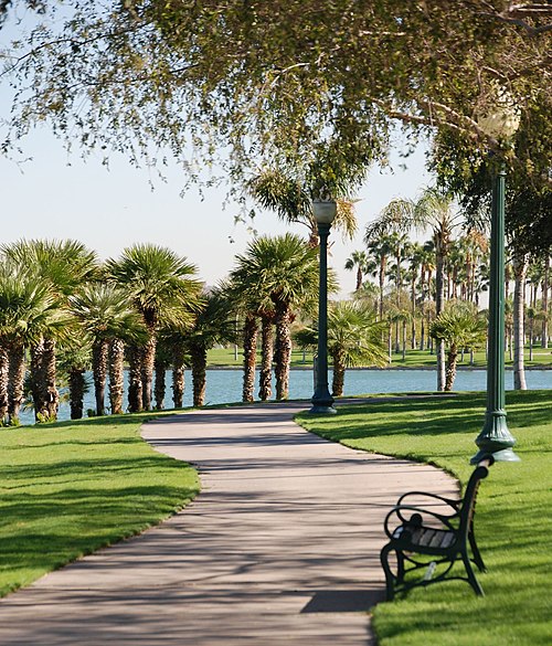
Goodyear was established in 1917 with the purchase of 16,000 acres (65 km2) of land by the Goodyear Tire and Rubber Company to cultivate cotton for vehicle tire cords. World War II was important to Goodyear in the 1940s as the current Phoenix Goodyear Airport was built, but after the war, the economy suffered. Goodyear became a town on November 19, 1946. At the time, it had 151 homes and 250 apartments, a grocery store, a barber shop, beauty shop and a gas station.
World War II
Luke Field Auxiliary #6 (Goodyear Field) was built by the United States Army Air Forces in 1943. It served as a satellite airfield for Luke Army Air Field (AAF). According to the History of Luke AFB, this airfield boasted the most facilities. It had separate buildings for crew chiefs, operations, supply, barracks, pit latrine, crash truck shed, generator shed and a control tower. Luke AF Auxiliary #6 ceased operations by 1971.
The property, which is in a state of complete abandonment, is owned by the State of Arizona, which has worked with developers on proposals for use.
Modern history
In January 1965, the Phoenix Trotting Park, a harness racing track, opened. The current Interstate 10 passes north of the site. As the region lacked major roads from Phoenix to Goodyear, there was not enough business and the track closed two years later. The park was demolished in 2017.
The town became a city in 1985. In 1987, the remaining 10,000 acres (40 km2) of the original farmland was sold to Suncor Development, a subsidiary of AZP (later renamed Pinnacle West Capital), for future development. The Phoenix Goodyear Airport received its current name in 1986.
Housing and growth
Although Goodyear was founded in 1917, the majority of construction and population growth happened after 1990. 22 communities that are completed and under construction have a total area of approximately 20,000 acres (31 mi2). These communities, along with another 21 communities for future suburban development, will contain almost 200,000 homes, with only 25,000 built.
Geography
Goodyear is approximately 17 miles (27 km) west of downtown Phoenix. Nearby cities include Avondale, Litchfield Park, Tolleson and Buckeye. From the original town center, the Goodyear city limits extend north 5 miles (8 km) to a border with Glendale and south-southeast into the Rainbow Valley 30 miles (48 km) to an area south of Arizona State Route 238.
According to the United States Census Bureau, the city has a total area of 191.334 square miles (495.55 km2), of which 191.305 square miles (495.48 km2) is land and 0.029 square miles (0.08 km2) (0.02%) is water. The Gila River passes through the city. The largest master-planned community is Estrella, south of the Gila River, located near the Estrella Mountains.
The Estrella Mountain Regional Park covers almost 20,000 acres (81 km2), most of which is still desert. It contains eight trails over 30 mi (48 km) in combined length, two baseball fields, and a 9.5-mile (15.3 km) track.
Climate
Goodyear has a hot desert climate (Köppen: BWh) due to its location in the Sonoran Desert. The city receives somewhere around ten inches of rain annually. The city has more than 300 sunny days per year.
Winters are sunny with mild temperatures—nighttime lows averaging between 40 and 50 °F (4 and 10 °C) and daytime highs ranging from 60 to 75 °F (16 to 24 °C). The lowest temperature ever recorded in Goodyear is 16 °F (−9 °C). Summers are very hot, with daily high temperatures at or above 100 °F (38 °C) for the entirety of June, July, and August, as well as many days in May and September. An occasional heat wave will spike temperatures over 115 °F (46 °C) briefly. Nighttime lows in the summer months average between 70 and 80 °F (21 and 27 °C), with an occasional overnight low above 80 °F (27 °C) not uncommon. The highest recorded temperature in Goodyear is 125 °F (52 °C).
Demographics

2020 census
As of the 2020 census, there were 95,294 people, 32,452 households, and 25,165 families in the city. The population density was 498.14 inhabitants per square mile (192.3/km2). There were 36,205 housing units at an average density of 189.26 per square mile (73.1/km2); 10.4% of housing units were vacant, with a homeowner vacancy rate of 2.1% and a rental vacancy rate of 10.3%.
Of the 32,452 households, 35.1% had children under the age of 18 living in them. Of all households, 61.5% were married-couple households, 12.6% were households with a male householder and no spouse or partner present, and 19.1% were households with a female householder and no spouse or partner present. About 17.1% of all households were made up of individuals and 7.8% had someone living alone who was 65 years of age or older.
The median age was 39.8 years. 23.3% of residents were under the age of 18 and 18.6% of residents were 65 years of age or older. For every 100 females there were 89.1 males, and for every 100 females age 18 and over there were 84.9 males age 18 and over.
97.4% of residents lived in urban areas, while 2.6% lived in rural areas.
The most reported ancestries in 2020 were:
2010 census
As of the 2010 census, there were 65,275 people, 21,491 households, _ families residing in the city. The population density was 341.43 inhabitants per square mile (131.8/km2). There were 25,027 housing units at an average density of 130.91 per square mile (50.5/km2). The racial makeup of the city was 71.89% White, 6.70% African American, 1.30% Native American, 4.34% Asian, 0.17% Pacific Islander, 11.68% from some other races and 3.93% from two or more races. Hispanic or Latino people of any race were 27.78% of the population.
2000 census
As of the 2000 census, there were 18,911 people, 6,179 households, and 4,986 families residing in the city. The population density was 162.4 inhabitants per square mile (62.7/km2). There were 6,771 housing units at an average density of 58.1 per square mile (22.4/km2). The racial makeup of the city was 78.13% White, 5.20% African American, 1.06% Native American, 1.71% Asian, 0.08% Pacific Islander, 10.87% from some other races and 2.95% from two or more races. Hispanic or Latino people of any race were 20.80% of the population.
Economy
Top Employers
According to the city's 2024 Annual Comprehensive Financial Report, the largest employers in the city are:
Government and infrastructure

Goodyear has a council-manager form of government. The current mayor is Joe Pizzillo, a former city councilman who is completing the mayoral term of Georgia Lord, who died in December 2021. Lord was elected to fill a two-year unexpired term as mayor of the city of Goodyear in March 2011, was re-elected to serve a second term as Mayor in 2013, and was elected to serve her final term in 2017. There are six councilmembers, with three-term limits.
Goodyear City Hall is located at 1900 N. Civic Square. Opening in August 2022, Goodyear City Hall was relocated from its previous location on Litchfield Road. The new city hall complex also houses a new two-story library (Georgia T. Lord Library, named after the late Mayor Lord), a two-acre park, office space, a parking garage, and space for new restaurants, retail and entertainment.
The Arizona Department of Corrections operates the Arizona State Prison Complex-Perryville in Goodyear. The prison houses the female death row.
Education
Several school districts serve the city of Goodyear. Elementary school districts include Avondale Elementary School District, Liberty Elementary School District, Litchfield Elementary School District, and Mobile Elementary School District. High school districts include Agua Fria Union High School District and Buckeye Union High School District.
High schools
Goodyear High School (Under construction by the Agua Fria Union High School District to open for the 2025–2026 school year)
Colleges and universities
Franklin Pierce University has had a campus here since 2008, when the New Hampshire-based university signed a lease with the city to purchase 30 acres (120,000 m2) of land. It offers a Doctor of Physical Therapy program and other healthcare-related programs.
Sports

Goodyear is known as a site for professional baseball teams' spring training sessions. The Cleveland Guardians of Major League Baseball's American League moved their spring training facility to Goodyear from Winter Haven, Florida and rejoined the Cactus League in February 2009, after a 15-year absence. Before that, the Guardians (then known as the Indians) held spring training for many years in Tucson.
On April 7, 2008, Goodyear's city council unanimously approved a memorandum to fund a new $33 million baseball spring training complex for Major League Baseball's Cincinnati Reds and Cleveland Guardians. This includes a 10,000-seat park, Goodyear Ballpark, that opened in 2009. The Reds and the Guardians have separate offices, clubhouses and practice fields. The Guardians had held their spring training in Tucson for many years until moving to Winter Haven in 1993. They agreed in 2006 to return their spring training location to Arizona at Goodyear.
The Goodyear Centennials, of the Freedom Pro Baseball League, played their home games at the Goodyear Ballpark. Two other baseball teams in the Arizona Complex League, the Arizona Complex League Guardians and the Arizona Complex League Reds, also play at the stadium.
Transportation
Air
Phoenix Goodyear Airport is located here. It has an 8,500 feet (2,600 m) runway capable of handling large jet aircraft. This airport, used by many international airlines for aircraft maintenance and storage, has no active commercial air service.
Rail
Union Pacific operates a railroad that goes through Goodyear. Rail lines provide Goodyear with access to 23 states in the western two-thirds of the United States.
Road transport
Interstate 10 passes through Goodyear, heading west to Buckeye and Los Angeles. I-10 heads east to Phoenix, Tucson, and the Southern states.
The city is also served by the western ends of several bus routes of the Valley Metro Bus.
Other roads and highways serve the area. Loop 303 starts as Cotton Lane then heads up north to Surprise and then to Interstate 17. Van Buren Street and McDowell, Indian School and Camelback Roads are major arterial roads leading from the extreme western Phoenix area to past Scottsdale in the east. MC 85 (Maricopa County Highway 85) is a highway running from Arizona State Route 85 in Buckeye to Loop 202 in Phoenix. The highway passes the southern sections of Goodyear.
Public transportation
Valley Metro operates public transportation in Goodyear. They operate the Avondale ZOOM neighborhood circulator, the 562 Goodyear Express during weekday rush hours, which connects Goodyear Park and Ride to Downtown Phoenix, and the 17 McDowell bus on Monday thru Saturday (Sunday service ends at 99th Avenue on the Avondale/Tolleson border). Goodyear is also a member of WeRIDE, which operates demand-responsive transport in Peoria, Goodyear, Avondale, and Surprise.
Road improvements
Interstate 10 was built through Goodyear in the late 20th century. Between 2008 and 2014, the road had significant expansions. It was expanded from two lanes in each direction to five or six (including one HOV lane starting near Loop 303 going east). There were also new interchanges, including Exit 122 (Perryville Road), Exit 123 (Citrus Road) and Exit 125 (Sarival Avenue).
Kaynak: Wikipedia – Goodyear, Arizona · CC BY-SA 4.0