
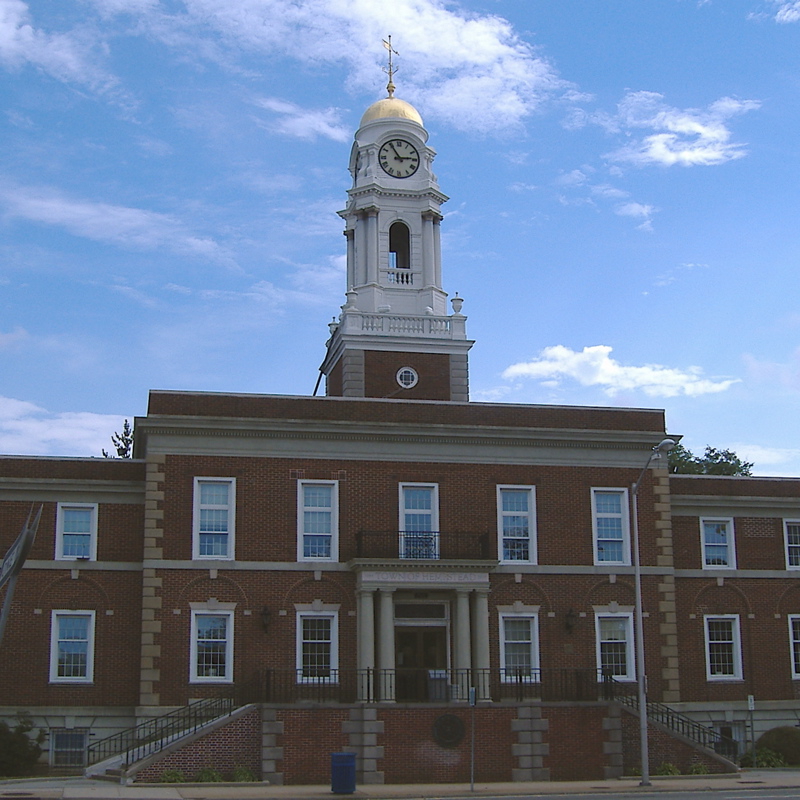
Hempstead
La ciudad de Hempstead es un pueblo ubicado en el condado de Nassau en el estado estadounidense de Nueva York.
Government administration · United States · 0 followers
Overview
La ciudad de Hempstead es un pueblo ubicado en el condado de Nassau en el estado estadounidense de Nueva York. En el año 2000 tenía una población de 755.924 habitantes y una densidad poblacional de 2,433.0 personas por km². Hempstead es uno de los tres pueblos del condado, junto con North Hempstead y Oyster Bay, y si fuera incorporado como ciudad se trataría de la 14.ª ciudad más poblada del país y la segunda del estado.
Interested in working with us in the future?
Follow to see new jobs and posts in your feed.
No news yet.
About

La ciudad de Hempstead es un pueblo ubicado en el condado de Nassau en el estado estadounidense de Nueva York. En el año 2000 tenía una población de 755.924 habitantes y una densidad poblacional de 2,433.0 personas por km². Hempstead es uno de los tres pueblos del condado, junto con North Hempstead y Oyster Bay, y si fuera incorporado como ciudad se trataría de la 14.ª ciudad más poblada del país y la segunda del estado.
Kaynak: Wikipedia · CC BY-SA 4.0
Geografía
Hempstead se encuentra ubicada en las coordenadas 40°42′17″N 73°37′2″O. Según la Oficina del Censo, la ciudad tiene un área total de 495,5 km² (191,3 mi²), de la cual 310,7 km² (120 mi²) es tierra y 184,8 km² (71,4 mi²) (37.30%) es agua.
Demografía
Según la Oficina del Censo en 2007 los ingresos medios por hogar en la localidad eran de $84,362, y los ingresos medios por familia eran $96,080. Los hombres tenían unos ingresos medios de $50,818 frente a los $36,334 para las mujeres. La renta per cápita para la localidad era de $28,153. Alrededor del 5.8% de la población estaban por debajo del umbral de pobreza.
Localidades
El pueblo de Hempstead tiene 22 villas y 37 aldeas:
History
The town was first settled around 1644 following the establishment of a treaty between English colonists, John Carman and Robert Fordham, and the Lenape Indians in 1643. Although the settlers were from the new English colony of New Haven (established in 1638), later incorporated into Connecticut (1662), a patent was issued by the government of New Netherland after the settlers had purchased land from the local natives. This transaction is depicted in a mural in the Hempstead Village Hall, reproduced from a poster commemorating the 300th anniversary of Hempstead Village.
In local Dutch-language documents of the 1640s and later, the town was invariably called Heemstede, and several of Hempstead's original 50 patentees were Dutch, suggesting that Hempstead was named after the Dutch town and/or castle of the same name, both of which are located near the cities of Haarlem and Amsterdam. However, the authorities possibly had Dutchified a name given by co-founder John Carman, who was born in 1606 in Hemel Hempstead, Hertfordshire, England, on land owned by his ancestors since the 13th century.
In 1664, the settlement under the new Province of New York adopted the Duke's Laws, austere statutes that became the basis upon which the laws of many colonies were to be founded. For a time, Hempstead became known as "Old Blue", as a result of the "Blue Laws". The Census of slaves, conducted in the Province of New York in 1755, lists more than 100 enslaved individuals in Hempstead.
During the American Revolution, the Loyalists in the south and the American sympathizers in the north caused a split in 1784 into "North Hempstead" and "South Hempstead". South Hempstead was renamed to Hempstead in 1796.
Richard Hewlett, who was born in Hempstead, served as a Lieutenant Colonel with the British Army under General Oliver De Lancey in the American Revolution. Afterwards, Hewlett departed the United States with other Loyalists and settled in the newly created Province of New Brunswick in what later became Canada. A settlement there was named Hampstead, in Queen's County next to Long Island in the Saint John River.
Geography

According to the United States Census Bureau, the town has a total area of 191.3 square miles (495.5 km2), of which 120.0 square miles (310.7 km2) is land and 71.4 square miles (184.8 km2) – or 37.30% – is water.
The western town line is Nassau County's border with Queens County in New York City. Its northern border, with the Town of North Hempstead and the town of Oyster Bay, is along the Main Line of the Long Island Rail Road and along Old Country Road in Garden City heading east towards the Wantagh Parkway. Its eastern border, also with the town of Oyster Bay, runs parallel to (and several hundred feet west of) Route 107. To the south is the Atlantic Ocean, off of Atlantic Beach, Lido Beach, Point Lookout, and Jones Beach, as well as the city of Long Beach.
The most popular beach on the east coast of the United States, Jones Beach State Park, is located in Hempstead. The beach is a popular destination for Long Islanders and residents of New York. The beach itself receives approximately six million visitors per year.
Communities
The town of Hempstead contains 22 villages and 38 hamlets:
Hamlets
In addition, there are a few areas that are not part of any incorporated village or census-designated place:
Jones Beach Island and nearby uninhabited islands in South Oyster Bay
A small area between Lynbrook and Rockville Centre that contains only Rockville Cemetery
Demographics
2019 data
The 2019 American Community Survey determined the population of the town of Hempstead was 759,793. The racial and ethnic makeup of the town was 54.0% non-Hispanic white, 17.4% Black or African American, 0.3% American Indian or Alaska Native, 6.2% Asian, 3.7% multiracial, and 20.9% Hispanic or Latin American of any race.
Of the population, there were 244,203 households and there was an owner-occupied housing rate of 80.8%. The average household size was 3.10 and the population was made of 22.7% foreign-born residents. In 2019, the U.S. Census Bureau estimated the median value of an owner-occupied housing unit was $455,700 and the median gross rent of rented units at $1,678. Residents of the town had a combined median household income of $111,072 and per capita of $44,958. Of the population in 2019, 6.0% lived at or below the poverty line.
2010 census
As of the census of 2010, there were 759,757 people, 246,828 households, and 193,513 families residing in the town. The population density was 6,301.3 inhabitants per square mile (2,432.9/km2). There were 252,286 housing units at an average density of 2,103.0 per square mile (812.0/km2). The racial makeup of the town was 59.9% White, 16.5% Black, 0.3% Native American, 5.2% Asian, 0.03% Pacific Islander, 4.5% from other races, and 2.2% from two or more races. Hispanic and Latin Americans of any race were 17.4% of the population.
There were 246,828 households, out of which 36.5% had children under the age of 18 living with them, 62.2% were married couples living together, 12.3% had a female householder with no husband present, and 21.6% were non-families. 18.1% of all households were made up of individuals, and 9.2% had someone living alone who was 65 years of age or older. The average household size was 3.02 and the average family size was 3.41.
Economy
Lufthansa United States had its headquarters in East Meadow, beginning in the 1970s, after it moved from Park Avenue in Manhattan, in order to save money. In 2019, the office had 206 employees; that year the headquarters moved to Uniondale.
At one time Swiss International Air Lines operated its United States office at 776 RexCorp Plaza in the EAB Plaza in Uniondale. The airline moved from 41 Pinelawn Road in Melville, Suffolk County around 2002.
Snapple was previously headquartered in East Meadow, prior to moving their corporate office. The office space is now currently occupied by the Epilepsy Foundation of Long Island.
Government

Town government
As of 2025, the Town of Hempstead is headed by John R. Ferretti, Jr. (R–Levittown). The responsibilities of the office include presiding over meetings of the Town Council and directing the legislative and administrative function of that body. The position also entails creating and implementing the town's budget. One famous former supervisor was Republican Alfonse D'Amato, who later represented New York in the United States Senate from 1981 to 1999.
Prior to 1994, the town also had a Presiding Supervisor, who along with the Supervisor, sat on what was then Nassau County's main governmental body, the Board of Supervisors, along with the Supervisors of the towns of North Hempstead and Oyster Bay and the independent cities of Long Beach—formerly a part of Hempstead Town until its incorporation as a separate municipality in 1922—and Glen Cove, which had been carved out of Oyster Bay Town in 1917. Typically, the Presiding Supervisor, besides chairing the weekly county Board of Supervisors meetings, acted as the senior official in the town government with the Supervisor in a more junior, subordinate role; a number of Supervisors moved up to Presiding Supervisor whenever that office became vacant, including, in succession during the 1970s, Ralph G. Caso and Francis T. Purcell, both of whom later went on to become the county executive, and then Al D'Amato, before he moved up to the Senate. Having the Presiding Supervisor on the county board along with the Supervisor gave Hempstead—by far the most populous of the county's three towns and two cities—the most clout on that body. However, in 1993–94, a federal judge ruled that the board's makeup violated the one-person, one-vote constitutional principle and also gave no representation to the country's growing minority population. As a result of that ruling, the Board of Supervisors was replaced by a 19-member county legislature. Gregory P. Peterson served as the last Presiding Supervisor, as the position was abolished with the demise of the county board.
Transportation

Railroad lines
The Long Island Rail Road's Main Line runs through the northwestern part of the town with stations from Bellerose through Merillon Avenue in Garden City. The Hempstead Branch breaks away from the Main Line in Floral Park, and uses stations from Bellerose into Hempstead. The West Hempstead Branch runs from Valley Stream northeast to West Hempstead. Further south in the town, the Babylon Branch runs from the New York City Line into southern portions of the Town of Oyster Bay with stations between Valley Stream and Seaford. Also the Far Rockaway Branch branches off from Valley Stream and curves to the southwest from that station through Inwood before finally re-entering the city in the Rockaways. Just east of there, the Long Beach Branch breaks away at Lynbrook and runs southeast into Long Beach.
Bus service
The Town of Hempstead is served primarily by Nassau Inter-County Express bus routes, though some MTA bus routes enter Nassau County from Queens. The City of Long Beach has a separate bus service, which also serves Lido Beach and Point Lookout on the Long Beach Barrier Island.
Major roads
Major roads within the Town of Hempstead include:
State parks
State parks located within the town of Hempstead include:
Kaynak: Wikipedia – Hempstead, New York · CC BY-SA 4.0