
Idaho Falls
Idaho Falls es una ciudad ubicada en el condado de Bonneville en el estado estadounidense de Idaho.
Government administration · United States · 0 followers
Overview
Idaho Falls es una ciudad ubicada en el condado de Bonneville en el estado estadounidense de Idaho. En el año 2010 tenía una población de 56.813 habitantes y una densidad poblacional de 1262,51 personas por km². Se encuentra sobre el curso alto del río Snake, afluente del río Columbia.
Interested in working with us in the future?
Follow to see new jobs and posts in your feed.
No news yet.
About

Idaho Falls es una ciudad ubicada en el condado de Bonneville en el estado estadounidense de Idaho. En el año 2010 tenía una población de 56.813 habitantes y una densidad poblacional de 1262,51 personas por km². Se encuentra sobre el curso alto del río Snake, afluente del río Columbia.
Kaynak: Wikipedia · CC BY-SA 4.0
Geografía

Idaho Falls se encuentra ubicado en las coordenadas 43°29′30″N 112°1′57″O. Según la Oficina del Censo, la localidad tiene un área total de 45 km² (17,4 mi²), de la cual 44,2 km² (17,1 mi²) es tierra y 0,8 km² (0,3 mi²) (1.67%) es agua.
Demografía
En el 2000 la renta per cápita promedia del hogar era de $40,512, y el ingreso promedio para una familia era de $47,431. En 2000 los hombres tenían un ingreso per cápita de $39,082 contra $23,001 para las mujeres. El ingreso per cápita para la localidad era de $18,857. Alrededor del 10.9% de la población estaba bajo el umbral de pobreza nacional.
Kaynak: Wikipedia – Idaho Falls · CC BY-SA 4.0
History

Montana Trail origins
The first European settlements in the area around Idaho Falls were sparse cattle and sheep ranches. No significant development took place until 1864, when a man named Harry Rickets built and operated a ferry on the Snake River at 43°36.112′N 112°3.528′W. The ferry served a new tide of westward migration and travel on the Montana Trail following the Bear River Massacre of Shoshone Indians in 1863.
The present-day site of Idaho Falls became a permanent settlement when freighter Matt Taylor built a timber-frame toll bridge across a narrow black basaltic gorge of the river 7 miles (11 km) downstream from the ferry. The bridge improved travel for settlers moving north and west, and for miners, freighters, and others seeking riches in the gold fields of Idaho and Montana –especially the boom towns of Bannack and Virginia City.
Eagle Rock
By the end of 1865, a private bank, small hotel, livery stable, eating house, post office, and stage station had sprung up near the bridge. The settlement was initially known as Taylor's Crossing, but postmarks indicate that by 1866, the emerging town had become known as Eagle Rock. The name was derived from an isolated basalt island in the river near the ferry, where approximately twenty eagles nested.
In 1874, water rights were established on nearby Willow Creek and the first grain was harvested. Settlement was sparse and consisted of only a couple of families and small irrigation ditches. The first child of European descent was born at Eagle Rock in 1874.
Soon, the Utah and Northern Railway (U&NR) was built, stretching north from Utah through Eagle Rock and crossing the Snake River at the same narrow gorge as Taylor's bridge. The railway would eventually connect to the large new copper mines at Butte, Montana. The U&NR had the backing of robber baron Jay Gould, as Union Pacific Railroad had purchased it a few years prior. Grading crews reached Eagle Rock in late 1878, and by early 1879, a wild camp-town with dozens of tents, and shanties had moved to Eagle Rock with a collection of saloons, dance halls, and gambling halls. The railroad company had 16 locomotives and 300 train cars working between Logan, Utah and the once-quiet stage stop. A new iron railroad bridge was fabricated in Athens, Pennsylvania at a cost of $30,000 and shipped by rail to the site, where it was erected in April and May 1879. The bridge was 800 feet (240 m) long and had two spans, with an island in the center. The camp-town moved on, but Eagle Rock now had regular train service and several U&NR buildings, shops, and facilities, which expanded and transformed the town.
Geography

According to the United States Census Bureau, the city has a total area of 22.80 square miles (59.05 km2), of which 22.35 square miles (57.89 km2), 98% is land and 0.45 square miles (1.17 km2, 2%) is water.
Natural disasters are rare in the area, although an F2 tornado hit the Idaho Falls area on April 7, 1978, causing up to $5 million in damage.
River Walk
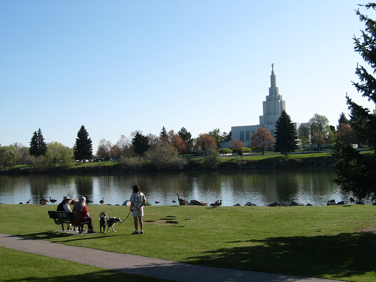
Idaho Falls has an extensive river walk trail featuring running and bike trails, art installations, and points of interest along several miles of the Snake River. Formerly known as the "Greenbelt", the city maintains the area and periodically receives donations and grants that allow for expansion.
Neighborhoods
Notable Idaho Falls neighborhoods include:
Downtown - Historic downtown Idaho Falls sits on several blocks of the original townsite along the east side of the river. It features restaurants, plazas, shops, and cultural amenities including the Museum of Idaho, Colonial Theatre, Art Museum of Eastern Idaho, Idaho Falls Public Library, and Japanese Friendship Garden. It is home to the Idaho Falls Farmers' Market and many other community events.
The Numbered Streets - The numbered streets area was the first planned neighborhood in Idaho Falls. The numbered streets run west and east between South Boulevard and Holmes Avenue. Kate Curley Park is located in the neighborhood, as is the Wesley W. Deist Aquatic Center and the Eleventh Street Historic District.
West Side - The West Side houses the Idaho Falls Regional Airport.
Snake River Landing - A large, mixed-use development on the west side of the river near I-15, which includes residential, restaurant, park, and community event space, including the Mountain America Center.
Climate
Idaho Falls experiences a semi-arid climate, bordering on a humid continental climate, with warm summers and cold winters (Köppen BSk). Precipitation is relatively sparse.
Demographics
2020 census
As of the 2020 census, Idaho Falls had a population of 64,818 and 24,090 households. The population density was 2,700.5 inhabitants per square mile. 99.7% of residents lived in urban areas, while 0.3% lived in rural areas.
The median age was 34.1 years. 27.4% of residents were under the age of 18, including 7.3% under age 5, and 15.0% of residents were 65 years of age or older. For every 100 females, there were 98.5 males, and for every 100 females age 18 and over, there were 96.5 males age 18 and over.
Of the households, 34.0% had children under the age of 18 living in them. 49.0% were married-couple households, 18.5% were households with a male householder and no spouse or partner present, and 25.6% were households with a female householder and no spouse or partner present. About 27.7% of all households were made up of individuals, and 11.2% had someone living alone who was 65 years of age or older.
There were 25,394 housing units, of which 5.1% were vacant. The homeowner vacancy rate was 0.9%, and the rental vacancy rate was 5.5%.
2010 census
As of the census of 2010, there were 56,813 people, 21,203 households, and 14,510 families residing in the city. The population density was 2,542.0 inhabitants per square mile (981.5/km2). There were 22,977 housing units at an average density of 1,028.1 per square mile (397.0/km2). The racial makeup of the city was 89.3% White, 1.0% Native American, 1.0% Asian, 0.1% Pacific Islander, 0.7% African American, 5.6% from other races, and 2.3% from two or more races. Hispanic or Latino people of any race were 12.9% of the population.
There were 21,203 households, of which 37.1% had children under the age of 18 living with them, 52.4% were married couples living together, 11.3% had a female householder with no husband present, 4.7% had a male householder with no wife present, and 31.6% were non-families. 26.5% of all households were made up of individuals, and 9.7% had someone living alone who was 65 years of age or older. The average household size was 2.63, and the average family size was 3.20.
Economy
Idaho Falls serves as a regional hub for health care, travel, and business in eastern Idaho.
The community's economy was mostly agriculturally focused until the opening of the National Reactor Testing Station in the desert west of Idaho Falls in 1949. The city subsequently became largely dependent on high-income jobs from the Idaho National Laboratory (INL), known locally simply as "The Site." Since the 1990s, the city has added a significant retail, entertainment, and restaurant sector, as well as a regional medical center.
Idaho Falls hosts the headquarters of the United Potato Growers of Idaho and District 7 of the Idaho Department of Health and Welfare. It is the home to several small-to-medium-sized national corporations such as North Wind, Inc. and Melaleuca, Inc.
The median home price in Idaho Falls was $400,448 in 2026.
Public transport in Idaho Falls is run by the Greater Idaho Falls Transit, which runs the GIFT On Demand demand-responsive transport system.
Arts and culture

The Willard Arts Center including the historic Colonial Theatre as well as the Frontier Center for the Performing Arts host musical concerts, plays, and events. The Willard Arts Center also houses multiple art galleries. The Idaho Falls Arts Council owns or administrates these venues as well as The Artitorium, opened in 2014, which is an interactive art experience aimed at children.
The Mountain America Center, a multi-purpose arena and convention center, opened to the public in November 2022.
The Museum of Idaho showcases local artifacts and history. It also brings in major traveling exhibits such as fossilized dinosaurs, Gutenberg Bibles, Titanic remnants, and "Bodies: the Exhibition."
An interactive art exhibit, Art You Can Sit On, has been expanded over the years since the initial installation in 2003. It encompasses many art pieces throughout the city that you can also sit on, making it interactive art.
Tautphaus Park has hosted the Idaho Falls Zoo since 1935. It includes over 300 animals. The zoo also runs Funland, the fully restored mini-amusement park dating back to 1947.
Education

Higher education
The College of Eastern Idaho was established in 1969 as a vocational-technical college named Eastern Idaho Technical College. In 2017 it transitioned into Eastern Idaho's only community college.
A campus of the University of Idaho in Idaho Falls provides access to the university's resources.
Primary and secondary education
The vast majority of Idaho Falls is within the Idaho Falls School District #91. A portion of Idaho Falls to the east is within the Bonneville Joint School District #93.
Schools located in Idaho Falls administered by the Idaho Falls School District #91 include:
Bonneville Joint School District #93 operates multiple schools with Idaho Falls, ID postal addresses.
Of them, one, Falls Valley Elementary School, is in the city limits. Some areas zoned to Falls Valley are zoned to Rocky Mountain Middle School and Bonneville High School while others are zoned to Sandcreek Middle School and Hillcrest High School.
Each fall, the varsity football teams of Idaho Falls and Skyline compete in a rival football game called the Emotion Bowl. Each year, after the game, the winning team and its fans traditionally paint the goalposts of the stadium in their school colors (orange for Idaho Falls and blue for Skyline). Bonneville and Hillcrest participate in a similar event known as the Civil War.
Media
The Post Register, a daily newspaper, serves the Idaho Falls area. Online news outlet East Idaho News also provides digital news coverage focused on eastern Idaho communities. The region is also home to more than a dozen AM and FM stations.
Five major network affiliates serve the Idaho Falls/Pocatello television market: KIDK (MeTV, with a simulcast of Fox affiliate KXPI-LD on DT2), KIFI-TV (ABC with CBS on DT2, The CW Plus on DT3 and Telemundo on DT5), KPVI-DT (NBC, licensed to Pocatello), and Idaho Public Television.
Sister city
Idaho Falls has a sister city, as designated by Sister Cities International:
Kaynak: Wikipedia – Idaho Falls, Idaho · CC BY-SA 4.0