

Overview
مصراتة، هي مدينة في شعبية مصراتة في شمال غرب ليبيا، تقع على بعد 187 كم إلى الشرق من طرابلس على ساحل البحر الأبيض المتوسط عند الحافة الغربية لخليج السدرة بالقرب من رأس مصراتة على خط عرض 32,22 شمالا وخط طول 15,06 شرقا. يبلغ عدد سكان شعبية مصراته سنة 2020م حوالي 663,853 نسمة وتعداد مدينة مصراته 391,137 نسمة وفقا لتعداد سكان مصراته 2022م، وهي ثالث أكبر مدينة في ليبيا بعد طرابلس وبنغازي.
Interested in working with us in the future?
Follow to see new jobs and posts in your feed.
No news yet.
About
مصراتة، هي مدينة في شعبية مصراتة في شمال غرب ليبيا، تقع على بعد 187 كم إلى الشرق من طرابلس على ساحل البحر الأبيض المتوسط عند الحافة الغربية لخليج السدرة بالقرب من رأس مصراتة على خط عرض 32,22 شمالا وخط طول 15,06 شرقا. يبلغ عدد سكان شعبية مصراته سنة 2020م حوالي 663,853 نسمة وتعداد مدينة مصراته 391,137 نسمة وفقا لتعداد سكان مصراته 2022م، وهي ثالث أكبر مدينة في ليبيا بعد طرابلس وبنغازي.
Kaynak: Wikipedia · CC BY-SA 4.0

الاسم ومنشأهُ
يعود الاسم إلى قبيلة «مسراتة» وهي بطن من بطون بني اللهان من قبيلة هوارة، ذكرها ابن خلدون ويرسم الاسم بالسين بدل الصاد وليس كما هو الآن مصراتة.
التاريخ
قبل الإسلام
تعود الجذور التاريخية للمدينة إلى 3000 سنة على ما يعتقد، عندما أسّس الفينيقيون ثوباكتس أو تابكت كما يقول بعض اللغويين، واستخدموها محطة تجارية كغيرها من المحطات الأخرى التي أسسوها على البحر الأبيض المتوسط.
تنقيب أثري
في مطلع السبعينات قامت مصلحة الآثار بالاستكشاف الأثري في منطقة مصراته وتحديداً في منطقة الجزيرة عند مـوقع مصيف الجزيرة حـيث اكتشفت الجرّافات الثقيلة عند بداية أعمـال البنـاء فيه عـن بعض الشواهد الأثرية منها أسـاسات لمباني وجـدران وبمعاينة الأثريين برئاسة كــل من (عمر المحجوب وعبد الحميد السيد) وبمشاركة العالمة الإنجليزية (ألوين برجا)، كشف عن عدد من العملات الفينيقية والرومانية وأساسات من الطـوب أكّدت على وجود سور تحصين يعتقد أنه يخص أسوار ثوباكتس القديمة.
وفي منطـقة قصر أحمـد كشف مصـادفة عن عدة معالم أثرية تتمثل في بعض العملات والفخاريات وبعض القبور كما كشف عن وجود حمامات رومانية أسفل المنارة يعتقد أنها ترجع إلى عهود محطة الميناء القديم «كيفالاي برومنتوريوم القديمة».
في منطقة الدافنية وزاوية المحجوب كُشِف عن عدد من المقابر التحت أرضية المـهمة التي احتــوت على الأثاث الجنائزي الخاص بها على الطراز البونيقي والروماني، كذلك في منطقـة السّكت ويعتقد أنها كانت منطقة استيطان زراعي قديم.
وفـي منطقة يدّر حيث عُثر على مقبرة كبيرة غنية باللقى الأثرية من الفخاريات والعملات. وفي جنوب مصراتة أو ما يعرف باسم البَّر، تنتشـر على مسـافات متفاوتة من جنوب الخمس وزليتن ومصراتة عـدد من الوديان التي توزعـت عليها عدة مزارع قديمة لا زالت معالمها ظاهرة مثل السدود القديمة والقصور والمعاصر.
وفي العام 1993م تم الكشف لأول مرة عن امتـداد لسلسة الفيلات الرومانية في مصراته، حيث قام الباحث الحبيب الأميـن بالكشف عن أول فيـلا رومانية في مصراتة تقـع عند منطقة غربا مرفأ زريق عند منطقة شط الحمـام ولقد تم تسميتها باسم فيلا شط الحمام، كشف عن وجود حمـامـات وأحـواض وقنـوات ولوحات فسيفسائية جميلة وأعمدة حجرية ورخامية وكســرات من الفخار وتم تسجـيلها في محفوظات مراقبة آثار لبدة كمقـر روماني وفيلا تعود إلى القرن الثاني الميلادي ويقع بالقرب من شاطئ البحر في منطقة قصر أحمد.
السكان
بلغ عدد سكان مدينة مصراتة 281 ألف نسمة في 2012. فيما بلغ عدد سكان بلدية مصراتة(وهي تضم مدن البلدية، وليست مدينة مصراتة وحدها.) عام 2020 نحو 663,853 نسمة، وتعد مدينة مصراتة من المناطق التي تشهد نشاطاً تجارياً واقتصادياً كبيراً في ليبيا. ويوجد في نطاق هذه البلدية مؤسسات إدارية وتعليمية وصناعية مهمة، منها: الشركة الليبية للحديد والصلب.
الصحة
المركز الصحي الرئيسي بمصراتة هو مستشفى مصراتة المركزي.
المراكز الصحية
المعهد القومي لعلاج الأورام _National Cancer Institute
بالإضافة إلى وجود عدد من المستشفيات والعيادات الخاصة بالمدينة.
روابط خارجية
موقع «بلـديـة مصراتـة» نسخة محفوظة 2 أكتوبر 2023 على موقع واي باك مشين
Kaynak: Wikipedia – مصراتة · CC BY-SA 4.0

Demografi
Şehir Libya Türkleri'nin ana merkezi kabul edilir. Şehrin 2/3'ü Türklerden oluşmaktadır (270.000 2019 verisi)
Kaynak: Wikipedia – Mısrata · CC BY-SA 4.0
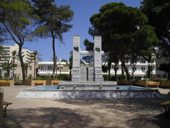
Etymology
The name "Misrata ⵎⵙⵔⴰⵜⴰ" derives from the Misrata tribe, a section of the larger Berber Hawwara confederacy, whose homeland in Antiquity and the early Islamic period was coastal Tripolitania.
"Trirone Acrone", the oldest description mentioned by Ptolemy III Euergetes of Misrata because it consists of three heads of land stretching into the sea depth, and got Misrata importance by being at the crossroads of many convoys and also because it is in the middle of an agricultural area with the name of "Cephalae Promentorium" (Kevalay) of the Greek geographer Strabo. And the city of Misrata is one of the commercial stations that have been built by the Phoenicians, since more than 3000 years (The Tenth Century BC) to the north-western parts of the Libyan coast. The flag then by the name of Thubactis Misrata and know that name in relation to the Berber tribe of Misurata (The Misurateens), which means the sailors.
History

Early history
Modern Misrata was established around the 7th century AD during the beginning of modern Libya's rule by the Caliphate. Some contemporary sources claim the town existed prior to Islamic rule, during the Roman Empire era and that its initial Arabic name derived from its Roman name Thubactis. David Mattingly, author of Tripolitania, a comprehensive reference book on northwestern Libya, stated that identification of Misrata as the ancient Thubactis is particularly problematic, complicated and "defies an easy answer." Nonetheless, the Roman town was located at some point on the oasis upon which the modern city sits. The two common identifications are at the eastern and western anchorages of modern Misrata or south and inland of the city, respectively. The Roman town was recorded as one of the six municipia (small self-governing cities) of the Tripolitania province, a rank below coloniae (cities with full citizenship rights.)
In any case, in the 7th century, Misrata served as a caravan supply center and an important port. Merchant traders from Misrata were well known throughout the Sahara during the years of the Caliphate (7th–19th centuries). In addition to its strategic location, the city established itself as one of Libya's oldest producers of luxury carpets. The Misrata tribe, a section of the larger Berber Hawwara confederacy, inhabited the coastal region of Tripolitania during the Roman and early Arab eras.
Ottoman era
The region of Tripolitania, which included Misrata, came under the regency of the Ottoman Empire in 1551. By the beginning of the 19th century, Misrata had established itself as a major center for the Trans-Saharan trade route, where caravans carrying gold, leather, and slaves regularly stopped. Because of the rainfall along the coast, which was abundant compared to other cities in Tripolitania, and supplemental water from springs, Misrata's inhabitants were able to engage in unusually fertile agriculture in this largely arid region. The city was filled with thick areas of vegetable gardens while the surrounding countryside included fields of wheat, barley, date palms and olive orchards. Misrata's artisans also expanded on the city's ancient carpet industry for which it was regionally renowned. Although Misrata contained a well-built harbor, most of its long-distance trade was overland because the city of Benghazi to the east served as the preferable substitute for maritime shipping.
Geography
Misrata lies on the coast of the Mediterranean Sea 187 km (116 mi) east of Tripoli and 825 km (513 mi) west of Benghazi. The location of the city creates a dualism of sea and sand, bounded by the sea to the north and east and to the south by golden sands dotted with palm and olive trees.
Like Benghazi and Tripoli, Misrata is divided into two distinct sections. Older Misrata consists of small stone houses and narrow arched streets while the newer part of the city, which began to develop in the 20th century, consists of modern buildings, homes, factories and industrial areas. Aside from its distinct location, which makes it a centre for the exchange of commodities and materials with the rest of the cities of the country, Misrata has modern infrastructure, including paved roads, electricity and communications.
Climate
The Köppen-Geiger climate classification system classifies Misrata's climate as a hot semi-arid climate (BSh).
Demographics
The city is considered to be the "main center of the Turkish-origin community in Libya"; in total, the Turks form approximately two-thirds (est.270,000 in 2019) of Misrata's 400,000 inhabitants.
Economy

Serving the role of Libya's commercial hub, Misrata is notably clean and construction is well-organized. Its citizens are largely viewed by other Libyans as business oriented. The city's steel mill industry (which is dominated by the government-owned Libyan Iron and Steel Company) is one its principal income producers and sources of employment. Due to the 1970s-80s renovation of Misrata's marina to better supply the industrial plants with raw material, the industry has been able to expand and the steel mill authorities hold considerable influence in the city. Al-Naseem Dairy, one of the largest private companies in Libya, is also located in Misrata and employs around 750 workers.
A historic aspect of the local economy is the cloth and textile industry. Situated near the city's central square are souks ("open-air markets") where, usually three times a week, merchants continue to sell luxury carpets, furniture cloth and traditional clothing, including abayas (cloaks worn by males for celebratory occasions.)
Most major businesses, shops and social centers are located on Tripoli Street, Misrata's main thoroughfare. During the Siege of Misrata, most of the buildings housing these assets were destroyed. However, several small businesses are beginning to rebuild and reopen. Nonetheless, recovery remains relatively slow partially due to the shortage of banknotes since Libyan banks are only allowing citizens to withdraw or borrow limited amounts of funds. Once the Libyan Central Bank receives most of the assets that had been internationally frozen during the civil war, it is probable that local banks would ease these restrictions.
The city has a great potential for expansion since it attracts a lot of internal immigration and is surrounded by uninhabited flat land with no obstacles. It is home to Misrata Airport, one of Libya's largest airports. There is a port in the neighbouring town of Qasr Ahmad. Misrata is the seat of many national companies such as the Libyan Ports Company, Libyan Iron and Steel Company, the Libyan publishing, distribution and Advertising Company. Besides that, it has branches of public and private sector banks and one locally and privately owned bank.
Government
Misrata is governed by a local council consisting of 28 seats. The city held its first free elections on 20 February 2012 after a month of organizing. It was the first major city to hold local elections in post-Gaddafi Libya while other cities had their municipal officials by the national interim government. Voter registration was at 101,486 and the number of candidates was 28, all of whom were independents. The mayor of Misrata during the civil war was Khalifa al-Zwawy, while first elected mayor became Yousef Ben Yousef.
Education
Misurata University, with its 15 faculties, is located in the city of Misrata. There are several higher education institutions including a number of university faculties that are administratively linked to universities of other cities in Libya. Misurata University is a modern university which was established in 1983, persisting a long-term goal to have an educated community and to end illiteracy and innumeracy in society. Despite its short age, the university has gained excellence in providing the knowledge and skills required for higher education studies, and has enjoyed a great reputation for the teaching, research and training it provides. It has constantly topped the university rankings league in Libya and was recently ranked first in Libya and the 55th in Africa according to the Webometrics Rankings 2013. (e.g. Al-Tahadi University of Sirte and Tripoli University of Tripoli).
Sports clubs
Alittihad Misurata Sports Club (founded 1965)
Alahly Misurata Sports Club (founded 1974)
Attahaddy Misurata Sports Club (founded 1979)
Annajem Arrefi Sports Club (founded 1979)
Attasaddy Misurata Sports Club (founded 1983)
Transport

A railway line was proposed in 2008 but as of 2016 no actual construction had taken place. It is also served by Misrata Airport.
In September 2019 an express bus service was launched connecting the airport to Tripoli.
Kaynak: Wikipedia – Misrata · CC BY-SA 4.0