

Overview
El Municipio de San Miguel de Allende es uno de los 46 municipios del estado mexicano de Guanajuato, su cabecera es la ciudad de San Miguel de Allende, reconocido centro turístico y uno de los centros de inicio de la guerra de Independencia de México. Se denominaba únicamente como Municipio de Allende hasta el 18 de marzo de 2005 en que el Decreto n.º 165 del Congreso de Guanajuato le dio su nombre actual.
Interested in working with us in the future?
Follow to see new jobs and posts in your feed.
No news yet.
About

El Municipio de San Miguel de Allende es uno de los 46 municipios del estado mexicano de Guanajuato, su cabecera es la ciudad de San Miguel de Allende, reconocido centro turístico y uno de los centros de inicio de la guerra de Independencia de México. Se denominaba únicamente como Municipio de Allende hasta el 18 de marzo de 2005 en que el Decreto n.º 165 del Congreso de Guanajuato le dio su nombre actual.
Kaynak: Wikipedia · CC BY-SA 4.0
Geografía
El municipio se encuentra localizado en la zona centro-este del territorio de Guanajuato, tiene límites territoriales al noroeste con el municipio de Dolores Hidalgo, al norte con el municipio de San Luis de la Paz, al noroeste con el municipio de San José Iturbide, al sureste con el municipio de Apaseo el Grande, al sur con el municipio de Comonfort, al suroeste con el municipio de Santa Cruz de Juventino Rosas y con el municipio de Salamanca; al este sus límites son con el estado de Querétaro, correspondiendo estos al municipio de Querétaro. Su extensión territorial total es de 1,537.19 kilómetros cuadrados que representan el 5.06% de la extensión total del estado de Guanajuato.
Orografía e hidrografía
La principal corriente luz del municipio de San Miguel de Allende es el río Laja, que proviene del municipio de Dolores Hidalgo; corre en sentido de norte a sur por el centro del territorio, continuando posteriormente hacia Comonfort y, finalmente, desembocando en el río Lerma. San Miguel de Allende es regulado por la Presa Ignacio Allende, situada en el centro del territorio al oeste de San Miguel de Allende, su principal función es controlar las avenidas del río Laja, además de proporcionar almacenamiento de agua con fines agrícolas. Además del río Laja, existen otros arroyos menores, como La Cañadita, El Atascadero, Las Cachinches y El Obraje que cruzan la cabecera municipal y que alimentan otras presas menores, como la presa Las Colonias y la presa El Obraje. Hidrológicamente todo el territorio municipal, con excepción de su zona extrema al suroeste, pertenece a la Cuenca del río Laja, y el extremo mencionado forma parte de la Cuenca río Lerma-Salamanca, ambas cuencas forman parte de la Región hidrológica Lerma-Santiago.
Clima y ecosistemas
El clima del municipio se divide en dos zonas, la zona oriental registra un clima que es considerado como Semiseco templado, mientras que la zona occidental tiene un clima Templado subhúmedo con lluvias en verano, una pequeña zona en el sur del municipio tiene clima Semicálido subhúmedo con lluvias en verano; la temperatura media anual se afectada principalmente por la elevación del terreno, de esta manera la mayor parte de las zonas planas del municipio registran un promedio que va de los 16 a los 18 °C, zonas del sur y del suroeste alcanzan un promedio de 18 a 20 °C, mientras que zonas más elevadas el centro y este del territorio tienen un promedio entre 14 y 16 °C; la precipitación promedio anual sigue un patrón de cinco bandas que avanzan en sentido suroeste-noreste a través del municipio, la zona registrada más al suroeste tiene un promedio superior a los 800 milímetros de lluvia al año, la siguiente zona registra entre 700 y 800 mm, la franja central entre 600 y 700 mm, la cuarta zona entre 500 y 600 mm y finalmente el extremo más al noreste tiene entre 400 y 500 mm de promedio anual de lluvia.
Demografía
San Miguel de Allende es uno de los municipio que mayor crecimiento poblacional ha registrado en el estado de Guanajuato, principalmente por ser considerado una zona de descanso y retiro por poblaciones de otros puntos del país e inclusive del extranjero, siendo conocida la emigración de estadounidenses hacia la cabecera municipal. De acuerdo con los resultados del Conteo de Población y Vivienda de 2005 realizado por el Instituto Nacional de Estadística y Geografía, la población total del Municipio de San Miguel de Allende es de 139,297 personas, siendo de estas 65,487 hombres y 73,810 mujeres; teniendo por tanto un índice de masculinidad del 47.0%, el 36.7% de sus habitantes son menores de 15 años de edad, mientras que el 56.8% se encuentran entre los 15 y los 64 años de edad, el 46.5% de la población es considerada urbana por habitar en localidades que superan los 2,500 habitantes y apenas un 0.3% de sus habitantes mayores de 5 años hablan alguna lengua indígena.
Localidades
En el censo de 2020 el municipio de San Miguel de Allende contaba con 477 localidades.
Política
El gobierno del municipio le corresponde al Ayuntamiento estando éste conformado por el presidente Municipal, el síndico y un cabildo compuesto de por diez regidores, de los cuales cinco son electos por mayoría relativa y cinco mediante el principio de representación proporcional. Todo el ayuntamiento es electo para un periodo de tres años que no son renovables para el periodo consecutivo, pero si de forma no continua y entra a ejercer su cargo el día 10 de octubre del año de la elección.
Representación legislativa
Para la elección de Diputados locales al Congreso de Guanajuato y de Diputados federales a la Cámara de Diputados, el municipio de San Miguel de Allende se encuentra integrado en los siguientes distritos electorales:
IX Distrito Electoral Local de Guanajuato con cabecera en San Miguel de Allende.
Distrito electoral federal 2 de Guanajuato con cabecera en San Miguel de Allende.
Kaynak: Wikipedia – Municipio de San Miguel de Allende · CC BY-SA 4.0
Demographics
As the municipal seat, the town of San Miguel de Allende has been the center of local government for about 950 other communities, many of which have fewer than 50 people. As of 2005, the municipality had a total population of 139,297 with 62,034 living or about 44.5% living in the town proper. The largest communities outside of the municipal seat include Los Rodriguez (2,795 people), Corral de Piedras de Arriba (1,841 people) and Los Galvanes (1,402 people). Sometimes the municipality is called Allende to distinguish it from the town of San Miguel de Allende, but as both governments are located in the town, they are generally known as San Miguel de Allende.
Geography
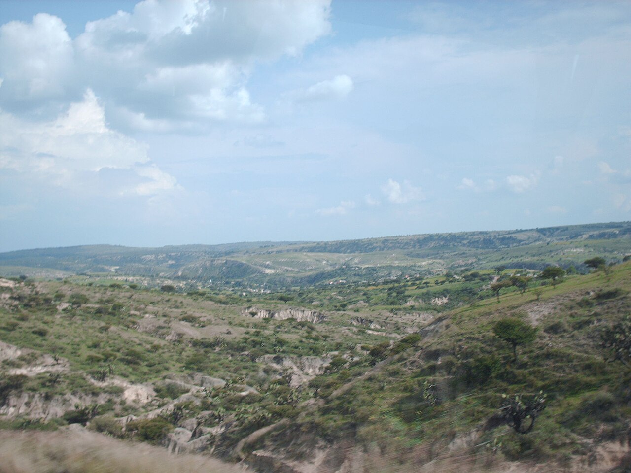
The municipality is located in the far eastern side of the state of Guanajuato. It has an average altitude of 1,870 metres (6,140 ft) above sea level. It borders the municipalities of San Luis de la Paz, Dolores Hidalgo, Salamanca, Juventino Rosas, Comonfort, Apaseo el Grande and San José Iturbide. It has a territory of 1,537.19 km2 (594 mi2).
The altitude varies from between 850 and 2,700 metres (2,790 and 8,860 ft) above sea level, with the town of San Miguel at 1,910 metres (6,270 ft). The municipality extends over two of the state's natural regions: the Sierras Volcanicas and the Cuencas Lacustres del Sur, with most of the territory over the latter. The entire municipality belongs to the national Trans-Mexican Volcanic Belt. Most of the territory inclines gently from between zero and five percent grade, with some exceptions where inclines can be as high as 25%. This restricts urban development and agriculture in the area. Prominent elevations include Cerro La Silleta, Cerro Prieto, Cerro La Piena, Cerro La Campana, El Cerro de El Picacho, Tambula, El Maguey, Palo Colorado, Mesa el Peñón, Loma Cuacuato, Mesa la Junta, Loma La Trinidad, Cerro El Común, La Loma, El Cuache and El Carmen. These peaks have an average altitude of 2,200 metres (7,200 ft).
The main river in the area is the Laja, which crosses from north to south before finally emptying in the Lerma River in the municipality of Salamanca. The river currently has serious pollution issues because it is used for discharge of wastewater without prior treatment. Most of this discharge is from the residential areas of San Miguel and Dolores Hidalgo. In addition to the river, there are four principal arroyos that pass by the municipal seat: the La Cañadita, El Atascadero, Las Cachinches and El Obraje. The last receives most of the area's runoff during the rainy season and feeds the Las Colonias and El Obraje dams. The most important dam in the area is the Ignacio Allende dam, located in the west of the municipality. While this dam controls flooding along the Laja River, local residents say that the water collected in its reservoir goes to the area around Guadalajara, far to the west of San Miguel, due to the provisions of the federal act creating the dam and reservoir. Other dams in the area include La Cantera and Bordo Grande located in the south and north of the municipality, respectively, along with the aforementioned Las Colonias and El Obraje, which are mostly used for irrigation. The municipality also has fresh water, thermal and alkaline springs, many of which are used as ecotourist attractions, such as the El Chorro, Montecillo, El Cortijo, Cieneguita, Atotonilco and Taboada spas. One other spa is the El Xoté, which has sulfur-laden waters.
Landmarks

Atotonilco
With only 597 people as of 2005, Atotonilco (formally Sanctuary of Atotonilco) is not the largest community in the municipality, but it is the best known due to its religious sanctuary, which has World Heritage Site status along with the historic center of San Miguel. The sanctuary is located 14 kilometres (8.7 mi) outside of the main town and dates from the 18th century. The church building itself has high plain walls on the outside, and consists of one large church with several smaller chapels. It is officially called the "Santuario de Dios y de la Patria" (Sanctuary of God and Country), but it is better known as the Sanctuary of Jesús Nazareno de Atotonilco. It is the church from which Miguel Hidalgo took the Virgin of Guadalupe standard for his army.
The Atotonilco sanctuary has plain high fortress-like walls. However, the inside walls and ceilings are completely covered in murals with a large number of personages and scenes from the Bible without much overall structure in how these images were placed. This mural work was done by Miguel Antonio Martínez de Pocasangre over thirty years. The style of the painting imitates Flemish painting, which was known through Belgian prints that the Spanish brought from Europe. The World Heritage Organization calls it an "exceptional example of the exchange between European and Latin American cultures" and "one of the finest examples of Baroque art and architecture in the [sic] New Spain". The structure and the mural work reflect the doctrine of Saint Ignatius of Loyola, and the church has been called the "Sistine Chapel of America". Atotonilco has been a pilgrimage site since the colonial period. The complex functions as a religious retreat for people from Mexico.
El Charco del Ingenio
El Charco del Ingenio, located outside of the town, is an ecological reserve and botanical garden and is privately funded. It is dedicated to the restoration and preservation of Mexican flora and propagates mainly cactus species in danger of extinction. The reserve is centered on a canyon, at the bottom of which is a fresh spring that forms a natural pool. The canyon was the center of a number of myths and legends during the pre-Hispanic period. There are the remains of a colonial-era aqueduct and other waterworks on the property. This spring was so powerful it was the hydraulic power for an enormous water wheel and water supply to the city (thus, the name "Ingenio"). The water from this spring rose in the fountains throughout colonial San Miguel. An old dam that was part of this complex of hydraulic power became silted. A great flood ensued when the dam broke in 1999 during heavy rains. It is a stable wetland area now for the botanic gardens, with areas of the reserve crisscrossed with walking paths. There are opportunities for mountain biking, rock climbing, bird watching, camping and horseback riding.
Kaynak: Wikipedia – San Miguel de Allende (municipality) · CC BY-SA 4.0