
Quincy
Quincy es una ciudad ubicada en el condado de Norfolk en el estado estadounidense de Massachusetts.
Government administration · United States · 0 followers
Overview
Quincy es una ciudad ubicada en el condado de Norfolk en el estado estadounidense de Massachusetts. En el Censo de 2010 tenía una población de 92 271 habitantes y una densidad poblacional de 1.324,09 personas por km².
Interested in working with us in the future?
Follow to see new jobs and posts in your feed.
No news yet.
About

Quincy es una ciudad ubicada en el condado de Norfolk en el estado estadounidense de Massachusetts. En el Censo de 2010 tenía una población de 92 271 habitantes y una densidad poblacional de 1.324,09 personas por km².
Kaynak: Wikipedia · CC BY-SA 4.0
Geografía
Según la Oficina del Censo de los Estados Unidos, Quincy tiene una superficie total de 69,69 km², de la cual 42,92 km² corresponden a tierra firme y (38,41%) 26,76 km² es agua.
Demografía
Según el censo de 2010, había 92 272 personas residiendo en Quincy. La densidad de población era de 1.324,09 hab./km². De los 92.271 habitantes, Quincy estaba compuesto por el 67,3% blancos, el 4,6% eran afroamericanos, el 0,19% eran amerindios, el 24,03% eran asiáticos, el 0,02% eran isleños del Pacífico, el 1,74% eran de otras razas y el 2,11% pertenecían a dos o más razas. Del total de la población el 3,35% eran hispanos o latinos de cualquier raza.
History

Pre-Colonial Period to the Revolution
The road that eventually became the Old Coast Road from Boston to Plymouth, going through Quincy and Braintree, started out as a Native American trail.
Massachusett Sachem Chickatawbut had his seat on a hill called Moswetuset Hummock prior to the settlement of the area by English colonists, situated east of the mouth of the Neponset River near what is now called Squantum. It was visited in 1621 by Plymouth Colony commander Myles Standish and Squanto, a native guide.
Four years later, a party led by Captain Richard Wollaston established a post on a low hill near the south shore of Quincy Bay east of present-day Black's Creek. The settlers found the area suitable for farming, as Chickatawbut and his group had cleared much of the land of trees. (The Indians used the name Passonagessit ("Little Neck of Land") for the area.) This settlement was named Mount Wollaston in honor of the leader, who left the area soon after 1625, bound for Virginia.
The Wollaston neighborhood in Quincy still retains Captain Wollaston's name. Upon the departure of Wollaston, Thomas Morton took over leadership of the post. Morton's history of conflict with the Plymouth settlement and his free-thinking ideals antagonized the Plymouth settlement, who maligned the colony and accused it of debauchery with Indian women and drunkenness. Morton renamed the settlement Ma-re-Mount ("Hill by the Sea") and later wrote that the conservative separatists of Plymouth Colony to the south were "threatening to make it a woefull mount and not a merry mount", in reference to the fact that they disapproved of his libertine practices. In 1627, Morton was arrested by Standish for violating the code of conduct in a way harmful to the colony. He was sent back to England, only to return and be arrested by Puritans the next year. The area of Quincy now called Merrymount is located on the site of the original English settlement of 1625 and takes its name from the punning name given by Morton.
Geography

Quincy shares borders with Boston to the north (separated by the Neponset River), Milton to the west, Randolph and Braintree to the south, and Weymouth (separated by the Fore River) and Hull (maritime border between Quincy Bay and Hingham Bay) to the east. Historically, before incorporation when it was called "Mount Wollaston" and later as the "North Precinct" of Braintree, Quincy roughly began at the Neponset River in the north and ended at the Fore River in the south.
Quincy Bay, within city limits to the northeast, is part of Boston Harbor and Massachusetts Bay. There are several beaches in Quincy, including Wollaston Beach along Quincy Shore Drive. Located on the western shore of Quincy Bay, Wollaston Beach is the largest Boston Harbor beach. Quincy's territory includes Hangman Island, Moon Island (restricted access, and all land is owned by the City of Boston), Nut Island (now a peninsula), and Raccoon Island in the Boston Harbor Islands National Recreation Area.
According to the United States Census Bureau, the city has a total area of 26.9 square miles (70 km2), of which 16.8 square miles (44 km2) is land and 10.1 square miles (26 km2) is water. The total area is 37.60% water.
Although Quincy is primarily urban, 2,485 acres (3.9 sq mi; 10.1 km2; 1,005.6 ha) or fully 23 percent of its land area lies within the uninhabited Blue Hills Reservation, a state park managed by the Massachusetts Department of Conservation and Recreation. This undeveloped natural area encompasses the southwestern portion of Quincy and includes the city's highest point, 517-foot (158 m) Chickatawbut Hill. Other hills within Quincy include Forbes Hill in Wollaston, Presidents Hill in Quincy Center and Penns Hill in South Quincy.
Demographics

2020 census
As of the 2020 United States census, there were 101,636 people and 46,789 households, making it the eighth-largest city in the state. The population density was 6,137.6 inhabitants per square mile (2,369.7/km2). There were 51,156 housing units.
The racial makeup of the city was 56.2% White (non-Hispanic), 6.4% African American alone, 0.1% Native American alone, 28.9% Asian alone (15.6% Chinese, 3.2% Vietnamese, 2.6% Indian), 0.1% Native Hawaiian or Pacific Islander, 0.85% from other races, and 5.3% from two or more races. Hispanic or Latino of any race were 5.4% of the population. 33.5% were of Irish, 12.7% Italian and 5.0% English ancestry according to the 2000 Census. 58.1% spoke only English, while 8.0% spoke Chinese or Mandarin, 2.6% Cantonese, 1.9% Spanish, 1.5% Vietnamese and 1.3% Italian in their homes.
Of the city's 46,789 households, approximately 56.6% were married couples living together, 12.5% had a female householder with no spouse present, 5.2% were male householders with no spouse present, and 25.8% were non-families. 50.1% of Quincy's population was male, and 49.9% female. The average household size was 2.2 people, and most people (84.3%) were in the same house a year ago.
In the city, the age distribution of the population shows 14% under the age of 18, 66.2% from 18 to 64, and 19.9% who were 65 years of age or older. The median age was 40.8 years.
The median income for a household in the city was $90,668. Males had a median income of 1.31 times greater than females ($97,905 compared to $74,737 for females). The per capita income for the city was $53,082. About 7.3% of families and 9.8% of the population were below the poverty line, including 15.2% of those under age 18 and 11.1% of those age 65 or over.
Asian community
As of 2010, Quincy has the highest per capita concentration of persons of Asian origin in Massachusetts. As of 2003 about 66% of the Asians in Quincy are ethnic Chinese, giving the city one of the largest Chinese populations in the state. There is also a community of persons of East Indian origins, with most of them working in information technology and other skilled professions. A growing number of people with Vietnamese origins live in the area as well and make up the second largest Asian American group in Quincy; it is estimated that nearly 4,000 Vietnamese people live in the city.
Neighborhoods

Quincy is divided into numerous neighborhoods with individual histories and characteristics.
Adams Shore was originally developed as a summer resort location and is now a year-round residential area.
Germantown is the site of a former planned manufacturing community begun in the 1750s to encourage German immigration, it is now a densely populated residential neighborhood featuring several public housing developments.
Houghs Neck is a northeastern peninsular community named for Atherton Hough, who was granted the land in 1636 for use as a farm and orchard. Hough's Neck has a substantial Irish-American population.
Marina Bay is a residential-commercial area developed in the 1980s on the site of the closed Naval Air Station Squantum with high-rise condominiums, restaurants and a large marina.
Merrymount is a primarily residential neighborhood and the site of Quincy's initial settlement.
Montclair is the northwestern section of the city along West Squantum Street, bordering the town of Milton.
North Quincy is a residential and commercial neighborhood along Hancock Street and Quincy Shore Drive that is home to a substantial Asian-American population, the community is regionally notable for its culturally diverse small business sector, and it is the location of the city's largest high school, North Quincy High School.
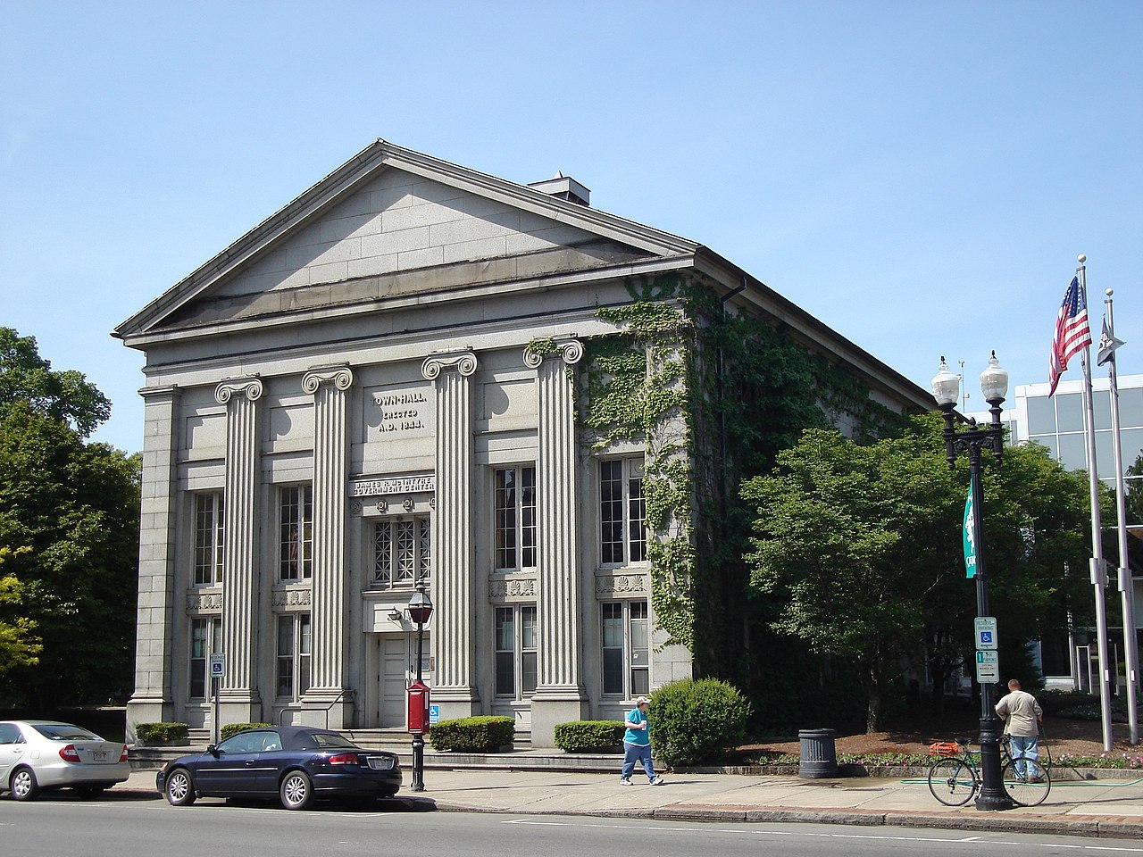
Quincy Center is a historic commercial and government center of the city where City Hall, Thomas Crane Public Library, the United First Parish Church (Old Stone Church), Quincy Masonic Building, The Adams Academy building, The Woodward School for Girls, and numerous office buildings and residential streets can be found.
Quincy Point is a densely populated residential area east of Quincy Center, with commercial areas along Quincy Avenue and Southern Artery, it is also the site of the Fore River Shipyard.
Economy

During its history, Quincy has been known as a manufacturing and heavy industry center, with granite quarrying dominating employment in the 19th century and shipbuilding at the Fore River Shipyard and Squantum Victory Yard rising to prominence in the 20th century. The recent decades have seen a shift in focus to several large employers in the professional and service sector of the economy. Quincy is the location of the corporate headquarters of several firms, including Boston Financial Data Services, the Stop & Shop supermarket chain, Arbella Insurance Group and The Patriot Ledger, the publisher of the South Shore's largest regional newspaper.
Other major employers with offices in Quincy are State Street Corporation, Blue Cross Blue Shield of Massachusetts, Harvard Pilgrim Health Care and Boston Scientific. TACV, national flag carrier airline of Cape Verde, has its United States corporate office in Quincy. Icelandair has its North American headquarters in the city as well.
Income
Data is from the 2009–2013 American Community Survey 5-Year Estimates.
Government

Local
Quincy has a strong mayor government. The incumbent mayor, Thomas P. Koch, has served since 2008; he is the 33rd mayor of the city. Mayors in the city were elected to two-year terms. In 2013, the city's voters opted to extend the mayoral term to four years, beginning after the 2015 election.
In addition to the mayor, the city has a nine-member city council, with Anne Mahoney serving as president as of 2026. One councilor is elected to represent each of the city's six wards, and three are elected at large. Councilors serve two-year terms. The city also has a school committee with seven members—the mayor and six members elected to staggered four-year terms.
Public safety
The Quincy Police Department was formed in 1888, currently headquartered at the original Quincy Police Station which was built in 1925 as the city's first purpose-built police station and added to the National Register of Historic Places in 1990. In 2010, the city of Quincy was the first in the US to have its police department carry the nasal spray Narcan (Nalaxone) to combat the overdose outbreak associated with the opioid epidemic in the US. When the program first began, the city's officers were reviving an overdose victim every four to five days. By 2014, police officers had administered the opioid antagonist over 300 times. Other cities and police departments throughout the US developed their own Narcan-dispensing programs based on the model pioneered by the Quincy PD. In 2017, overdose deaths in the city and the Commonwealth of Massachusetts had declined, it was thought, due to the use of naloxone by the police and others. The state legislature, in 2018, required all pharmacies to keep Narcan in stock and available to anyone, without a prescription.
Fire emergencies are handled by the Quincy Fire Department, which was founded in 1889 and includes the Central Fire Station, which is on the National Register of Historic Places and is still active as of 2023. The city's Emergency Medical Services are privately contracted, with ambulance response being handled by Brewster Ambulance Service since 2015.
Education

Quincy is home to various educational institutions, public and private, including a Montessori school, a Catholic academy, and one independent college-preparatory school. Eastern Nazarene College, a private liberal arts and sciences college that is currently in the process of closing after the 24–25 school year, and Quincy College, a public community college, two public high schools, five public middle schools, and 12 public elementary schools. In the 19th century, the city became an innovator in progressive public education with the Quincy Method, developed by Francis W. Parker while he served as Quincy's superintendent of schools. Four years after its implementation, a state survey found that Quincy students excelled at reading, writing, and spelling, and ranked fourth in their county in math.
Higher education
The city is home to Eastern Nazarene College, a former college of the liberal arts and sciences located in Wollaston Park. The college relocated to the area in 1919 from its original location in Saratoga Springs, New York, where it was established as a "holiness college" in 1900. In June 2024, The Board of Trustees of Eastern Nazarene College announced that the institution was preparing a plan to take steps toward closure, with the goal of closing the college at the end of the 2024–2025 school year. The future of its campus is uncertain as of November 2024.
Quincy College, a community college in Quincy Center, operates under the auspices of the City of Quincy. The college is unusual in this respect, as it is the only one of Massachusetts' 16 community colleges to be run by a city rather than by the state. It is one of only two colleges in the United States organized this way.
Public primary and secondary education
Public education at the primary and secondary levels is managed by Quincy Public Schools, a system that includes one early childhood center, eleven elementary schools, five middle schools and two high schools.
Transportation

As part of Metro Boston, Quincy has easy access to transportation facilities. State highways and the Interstate system connect the Greater Boston area to the airport, port, and intermodal facilities of Boston. Due to its proximity to Boston proper, Quincy is connected not only by these modes of transportation but also to the regional subway system, operated by the Massachusetts Bay Transportation Authority (MBTA), known locally as "The T". The four subway or "T" stops in Quincy, which are on the MBTA's Red Line, are North Quincy Station, Wollaston Station, Quincy Center Station, and Quincy Adams Station.
Highways and roads
Interstate 93 and U.S. Route 1 travel south to north concurrently through Quincy beginning in the southwest, where the Quincy–Randolph border bisects the median between the northern and southern halves of the Exit 5 cloverleaf at Massachusetts Route 28. Following a route around the southern extent of the Blue Hills Reservation, this I-93 and US 1 alignment is along the former southern section of Route 128. The highway travels along a wooded wetland region of the Reservation, entering Quincy completely just beyond Exit 5 and then crossing into Braintree as it approaches the Braintree Split, the junction with Massachusetts Route 3. Weekday traffic volume averages 250,000 to 275,000 vehicles per day at this intersection, the gateway from Boston and its inner core to the South Shore and Cape Cod.
As Route 3 joins I-93 and US 1 at the Braintree Split, the three travel north together toward Boston around the eastern extent of the Blue Hills Reservation, entering West Quincy as the Southeast Expressway. The expressway provides access to West Quincy at Exit 8—Furnace Brook Parkway and Exit 9—Bryant Avenue/Adams Street before entering Milton. The Furnace Brook Parkway exit also provides access to Ricciuti Drive and the Quincy Quarries Reservation as well as the eastern entrance to the Blue Hills Reservation Parkways.
Sports
Quincy has had brief flirtations with professional sports. The Quincy Chiefs of the minor league Eastern Basketball Association (the predecessor to the defunct Continental Basketball Association) played a single season in 1977–1978. Quincy's professional baseball team, the Shipbuilders, competed in the New England League in 1933, recording a 12–6 record before moving to Nashua midseason; a revival of the team played in the NEL from 1941 through to 1944. The final season of the Boston Minutemen of the North American Soccer League was played at Veterans Memorial Stadium, in 1976, finishing 7–17.
The Real Boston Rams of the soccer 4th division Premier Development League, an affiliate club of the New England Revolution, played in Veterans Memorial Stadium from 2014 to 2015.
In 2019, the Boston Cannons, a professional men's field lacrosse team in the Premier Lacrosse League (PLL) moved their home stadium from Boston to Veterans Memorial Stadium. The team played two seasons there before the MLL–PLL merger.
The New England Free Jacks of Major League Rugby moved to Veterans Memorial Stadium in 2021, relocating from Weymouth.
Quincy has had several football teams in the semi-pro Eastern Football League over the years. The current club, the Quincy Militia, played its inaugural season in the EFL in 2009. Founded in 2009 by long-time Quincy resident Vaughn Driscoll, new owners came into the team picture in 2013. Militia games are played July to October with home games at Veterans Memorial Stadium on Saturday nights. An earlier team, the Quincy Giants, played in the minor league Atlantic Coast Football League between 1969 and 1971.
Quincy's only college sports program was the "Lions" of Eastern Nazarene College, in the D-III Conference of New England of the National Collegiate Athletic Association (NCAA) and the Eastern College Athletic Conference (ECAC), before the closure of the college in June 2025.