

São Mateus
São Mateus é um município brasileiro no litoral norte do estado do Espírito Santo, Região Sudeste do país.
Government administration · Brazil · 0 followers
Overview
São Mateus é um município brasileiro no litoral norte do estado do Espírito Santo, Região Sudeste do país. Localiza-se a nordeste da capital estadual, distando desta cerca de 220 km. Ocupa uma área de aproximadamente 2 350 km², sendo que 32 km² estão em área urbana, e sua população foi estimada em 134 423 habitantes em 2025, sendo então o oitavo mais populoso do estado.
Interested in working with us in the future?
Follow to see new jobs and posts in your feed.
No news yet.
About

São Mateus é um município brasileiro no litoral norte do estado do Espírito Santo, Região Sudeste do país. Localiza-se a nordeste da capital estadual, distando desta cerca de 220 km. Ocupa uma área de aproximadamente 2 350 km², sendo que 32 km² estão em área urbana, e sua população foi estimada em 134 423 habitantes em 2025, sendo então o oitavo mais populoso do estado.
Kaynak: Wikipedia · CC BY-SA 4.0
Etimologia
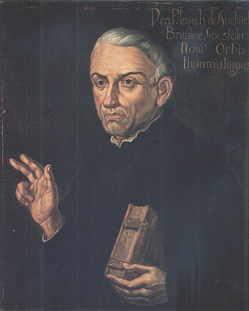
Do início da colonização, em 1544, até meados do século XVI, a pequena povoação que se formou às margens do rio São Mateus era apenas conhecida como Povoação do Cricaré. O nome São Mateus é em homenagem ao evangelista Mateus, pois o padre José de Anchieta, em 1566, ano de uma de suas peregrinações pela então Capitania do Espírito Santo, ao visitar a pequena povoação, celebrou uma missa no dia 21 de setembro, dia de São Mateus. Como era costume na época batizar locais e acidentes geográficos com o nome do santo do dia, Anchieta rebatizou a Povoação do Cricaré para São Mateus.
História
Período pré-cabralino
Antes do início da colonização portuguesa a região de São Mateus era habitada por índios aimorés, também conhecidos como Botocudos. Urnas funerárias encontradas na região de Barra Nova, na década de 1960, além de peças de cerâmica encontradas em uma escavação ao lado do Hospital Roberto Silvares, em 1998, são atribuídas à etnia tupi, da qual os aimorés não fazem parte, e são datados como sendo do período que vai do século X até o século XVI.
Há relatos em manuscritos, que datam do início da colonização, que havia nessa região a incidência de índios antropófagos. Estes índios não sabiam nadar, como os demais índios Tupis, mas remavam com habilidade e manuseavam argila com destreza.
As tentativas dos padres jesuítas em tentar catequizar os indígenas foram fracassadas. Afonso Brás, primeiro missionário do Espírito Santo, afirmou, em carta de 1551, que após receberem o batismo os índios fugiam, tornando a cultuar suas crenças e a praticar seus costumes.
Chegada dos primeiros colonizadores
Não há data precisa da chegada dos primeiros colonos, nem a indicação dos seus nomes, mas, pela tradição oral, os primeiros colonizadores portugueses chegaram a São Mateus por volta de 1544. Há notícias de que, sobressaltados com as frequentes investidas dos índios, os colonos de Vasco Fernandes Coutinho dividiram-se em grupos abandonando a capitania, fugindo para as capitanias mais próximas, ou dirigindo-se ao interior. Alguns desses colonos poderiam ter rumado para o norte, em direção ao rio São Mateus.
A falta de informação sobre os primeiros anos da colonização faz com que muitos historiadores levantem hipóteses, nem sempre prováveis. Uma delas é que o povoamento de São Mateus poderia ter se iniciado com a chegada de náufragos. Na história do padre José de Anchieta lê-se que, ao passar pelo rio São Mateus, em 1596, celebrou missa para alguns náufragos. Carece, no entanto, de documentação para tornar-se fato histórico.
Geografia

A área do município, segundo o Instituto Brasileiro de Geografia e Estatística, é de 2 346,049 quilômetros quadrados, constituindo-se no segundo maior município (em área) do Espírito Santo. Destes, 32,22 km² constituem a zona rural. Situa-se a 64 km da divisa com o estado da Bahia, estando na latitude de 18º43’15” Sul e longitude de 39°51’46” Oeste. Seus municípios limítrofes são Conceição da Barra ao norte, Pinheiros e Boa Esperança a noroeste, Nova Venécia ao oeste, São Gabriel da Palha e Vila Valério a sudoeste, Jaguaré e Linhares ao sul, estando o oceano Atlântico a leste.
Relevo
O relevo mateense é, predominante, plano, estando a sede do município a 37,7 metros no nível do mar. A parte central do município, é constituída de chapadões terciários com leve declividade para o litoral, possuindo altura entre 30 e 100 metros. Na parte oeste, são encontradas formações graníticas com até 350 metros de altitude e o litoral constitui-se num relevo plano, com regiões alagadiças e dunas, não ultrapassando 4 metros de altitude.
Sendo assim, pode-se encontrar no município três tipos distintos de solos, sendo estes:
Faixa Pré-cambriana: De aspecto gnaíssico por quase toda sua totalidade, faz parte do Escudo Cristalino Brasileiro, sendo encontrado desde o distrito de Nestor Gomes até a divisa com Nova Venécia. Este tipo de solo também é encontrado no leito do rio São Mateus.
Faixa Terciária: Solo predominante no município, caracterizado como sendo latossolo vermelho-amarelo distrófico e podzólico, com fertilidade de média à baixa e com pH em torno de 5,0, sendo formado pelos tabuleiros sedimentares e com argilitos e arenitos. Estes tabuleiros são caracterizados como chapadões que variam entre 30 e 100 metros de altura, iniciando-se na bairro Pedra d'água e estendendo-se até o início da Faixa Pré-cambriana em Nestor Gomes.
Demografia

Em 2010, a população do município foi contada pelo Instituto Brasileiro de Geografia e Estatística (IBGE) em 109 028 habitantes. Segundo o censo daquele ano, 53 930 habitantes eram homens e 55 098 habitantes eram mulheres. Ainda segundo o mesmo censo, 84 541 habitantes viviam na zona urbana e 24 487 na zona rural. Na primeira década do século XXI, o número de habitantes em São Mateus cresceu 20,56%, sendo, nesse período, um dos municípios com maior crescimento populacional do Espírito Santo. Já segundo estatísticas divulgadas em 2014, a população municipal era de 122 668 habitantes, sendo o sétimo mais populoso do estado. Da população total em 2010, 28 124 habitantes (25,80%) tinham menos de 15 anos de idade, 74 752 habitantes (68,56%) tinham de 15 a 64 anos e 6 152 pessoas (5,64%) possuíam mais de 65 anos, sendo que a esperança de vida ao nascer era de 75,6 anos e a taxa de fecundidade total por mulher era de 2,0.
O Índice de Desenvolvimento Humano Municipal (IDH-M) de São Mateus é considerado alto, segundo o Programa das Nações Unidas para o Desenvolvimento (PNUD) no ano de 2010. Seu valor era de 0,735, sendo então o oitavo maior de todo o estado do Espírito Santo e o 897º maior do Brasil. Considerando apenas a educação, o índice é de 0,655, o índice da longevidade é de 0,843; e o de renda é de 0,719. De 2000 a 2010, a proporção de pessoas com renda domiciliar per capita de até meio salário mínimo reduziu em 49,7% e em 2010, 84,6% da população vivia acima da linha de pobreza, 9,7% encontrava-se na linha da pobreza e 5,7% estava abaixo e o coeficiente de Gini, que mede a desigualdade social, era de 0,577, sendo que 1,00 é o pior número e 0,00 é o melhor. A participação dos 20% da população mais rica da cidade no rendimento total municipal era de 60,9%, ou seja, 19,9 vezes superior à dos 20% mais pobres, que era de 3,1%.
Política e administração

Segundo a Lei orgânica municipal, aprovada em 5 de abril de 1990, a administração municipal se dá pelos poderes executivo e legislativo. O primeiro representante do poder executivo foi João dos Santos Neves, então Presidente do Governo Municipal, cabendo ressaltar que anteriormente a administração era feita de forma integral pela Câmara de Vereadores. Amadeu Boroto, do Partido Socialista Brasileiro (PSB), é o prefeito eleito nas eleições municipais em 2012, ao conquistar um total de 38 742 votos (69,27% dos eleitores), tendo Keydson Quaresma Gomes como vice-prefeito.
O poder legislativo, por sua vez, é constituído pela câmara municipal, composta por onze vereadores eleitos para mandatos de quatro anos (em observância ao disposto no artigo 29 da Constituição) e em janeiro de 2015 estava composta por quatro cadeiras do Partido Socialista Brasileiro (PSB); duas cadeiras do Partido da Mobilização Nacional (PMN); uma cadeira do Partido Social Democrático (PSD); uma cadeira do Partido Comunista do Brasil (PC do B); uma cadeira do Partido Humanista da Solidariedade (PHS); uma cadeira do Partido dos Trabalhadores (PT) e uma do Partido Democrático Trabalhista (PDT). Cabe à casa elaborar e votar leis fundamentais à administração e ao executivo, especialmente o orçamento participativo (Lei de Diretrizes Orçamentárias).
A cidade sedia a Comarca de São Mateus, que é classificada como de terceira entrância e cuja área abrange apenas ao próprio município. Havia 77 697 eleitores em dezembro de 2014, o que representava 2,923% do total do estado do Espírito Santo. São Mateus também possui duas cidades-irmãs, sendo estas Sondrio (Itália ) e Luoyang (China ). A iniciativa de adotar Sondrio como cidade-irmã é da Diocese de São Mateus, visto que Dom Aldo Gerna, bispo emérito da diocese, é natural dessa cidade. Já a parceria com Luoyang é iniciativa do poder executivo municipal e visa a cooperação comercial entre as duas cidades.
Subdivisões
O município de São Mateus é subdividido em cinco distritos, sendo eles: Barra Nova, Itauninhas, Nestor Gomes, Nova Verona e a Sede. Segundo o censo demográfico de 2010, a Sede contava com 77 090 habitantes, seguido de Barra Nova com 16 342, Nestor Gomes com 10 823, Itauninhas com 3 343 e Nova Verona com 1 430.. A cidade possuía em 2015, 56 bairros divididos em 6 zonas, 15 bairros na zona leste; 15 na Zona Oeste; 9 na Zona Central; 8 na Zona Sul; 7 na Baixada do Cricaré e 2 na Zona Norte. Dentre os bairros mateenses, Guriri destaca-se como o mais populoso, contando em 2010 com 12 470 habitantes.
Kaynak: Wikipedia – São Mateus (Espírito Santo) · CC BY-SA 4.0
Etymology
From its founding in 1544 until the mid-16th century, the small settlement along the banks of the São Mateus River was known as Povoação do Cricaré. The name São Mateus honors the evangelist Matthew, as Father Joseph of Anchieta, during one of his pilgrimages through the then Captaincy of Espírito Santo in 1566, celebrated a mass on September 21, Saint Matthew's Day. Following the custom of naming places and geographical features after the saint of the day, Anchieta renamed the Povoação do Cricaré to São Mateus.
History

Pre-Cabral period
Before Portuguese colonization, the São Mateus region was inhabited by Aimorés, also known as Botocudos. Funerary urns found in the Barra Nova region in the 1960s, along with ceramic pieces unearthed near the Roberto Silvares Hospital in 1998, are attributed to the Tupi ethnic group, to which the Aimorés do not belong, and are dated from the 10th century to the 16th century.
Manuscripts from the early colonization period report the presence of cannibalistic Indians in the region. Unlike other Tupi Indians, these did not know how to swim but were skilled at rowing and working with clay.
Efforts by Jesuit priests to catechize the indigenous population were unsuccessful. Afonso Brás, the first missionary in the Captaincy of Espírito Santo, wrote in a 1551 letter that after receiving baptism, the Indians fled, returning to their beliefs and customs.
Arrival of the first colonizers
There is no precise date or record of the first settlers' names, but oral tradition suggests Portuguese colonizers arrived in São Mateus around 1544. Alarmed by frequent indigenous attacks, settlers from Vasco Fernandes Coutinho's group reportedly split up, abandoning the Captaincy of Espírito Santo. Some fled to neighboring captaincies or moved inland, possibly heading north toward the São Mateus River.
The lack of records from the early colonization years leads to speculative hypotheses. One suggests São Mateus may have been settled by shipwreck survivors. Father Joseph of Anchieta's accounts note that in 1596, while passing through the São Mateus River, he celebrated mass for shipwrecked individuals, though no documentation confirms this as historical fact.
More likely, the first colonists came from the neighboring Captaincy of Porto Seguro, led by Pero do Campo Tourinho. The earliest documented Portuguese presence in the region relates to the Battle of Cricaré, which occurred in late January 1558. Another record is a letter describing a Jesuit mission by Father Fernão Cardin, who visited the Village of São Mateus in September 1583.
Geography
According to the Brazilian Institute of Geography and Statistics, the municipality's area is 2,338.727 square kilometres (902.988 sq mi), making it the second largest municipality by area in Espírito Santo. Of this, 2,332.3007 square kilometres (900.5063 sq mi) is rural area and 155.49 square kilometres (60.04 sq mi) is urban area. Located in the northeast of Brazil's Southeast Region, in the North Coast Mesoregion of Espírito Santo (São Mateus Microregion), it is 64 kilometres (40 mi) from the border with Bahia, at a latitude of 18º43’15” South and a longitude of 39º51’46” West. Its neighboring municipalities are Conceição da Barra to the north, Pinheiros and Boa Esperança to the northwest, Nova Venécia to the west, São Gabriel da Palha and Vila Valério to the southwest, Jaguaré and Linhares to the south, with the Atlantic Ocean to the east.
Topography
The topography of São Mateus is predominantly flat, with the municipal seat at 37.7 metres (124 ft) above sea level. The central region consists of Tertiary plateaus with a gentle slope toward the coast, ranging from 30 to 100 meters in height. The western part features granitic formations up to 350 meters, while the coastal area is flat with flood-prone regions and dunes, not exceeding 4 meters in altitude.
Three distinct soil types are found in the municipality:
Precambrian Zone: Predominantly gneissic, part of the Brazilian Crystalline Shield, extending from the Nestor Gomes district to the border with Nova Venécia. This soil type is also found in the bed of the São Mateus River.
Tertiary Zone: The predominant soil, characterized as dystrophic and podzolic red-yellow latosol, with medium to low fertility and a pH around 5.0. Composed of sedimentary plateaus with argillites and sandstone, these plateaus, ranging from 30 metres (98 ft) to 100 metres (330 ft), start in the Pedra d'Água neighborhood and extend to the Precambrian Zone in Nestor Gomes.
Climate

Ecology and environment
In São Mateus, the coastal region was historically dominated by restinga. The remaining restinga is part of the Atlantic Forest Biosphere Reserve, and the entire São Mateus coastline is within the buffer zone of the Abrolhos Marine National Park.
In the plateaus and river valleys, the original cover was Atlantic Forest, rich in hardwoods. Most of the Atlantic Forest has been replaced by monoculture reforestation (eucalyptus), livestock farming, and crops such as coffee, coconut, and black pepper. However, some biodiversity persists in undisturbed patches, including bromeliads, orchids, indaiá palms, golden trumpet trees, pumpwoods, purple glory trees, and ferns.
The only ecological station in the municipality is Barra Nova. Its creation was a condition imposed on Petrobras for the establishment of the North Capixaba Terminal in the Barra Nova district. This area is considered extremely important for fish, amphibians, birds, and mammals, and serves as a spawning ground for four of the seven species of sea turtles worldwide.
According to the National Institute for Space Research (INPE), in 2013, only 15.425 square kilometres (5.956 sq mi) (7%) of the municipality's area was covered by native vegetation, including 9.899 square kilometres (3.822 sq mi) of Atlantic Forest, 2.066 square kilometres (0.798 sq mi) of restinga, 1.452 square kilometres (0.561 sq mi) of mangroves, and 2.008 square kilometres (0.775 sq mi) of floodplain vegetation. Preserved areas are home to animals such as spiders, crabs, butterflies, and dragonflies among invertebrates; snakes, tortoises, and lizards among reptiles; frogs and toads among amphibians; parakeets, pigeons, thrushes, tanagers, and toucans among birds; and giant otters, capybaras, otters, and marmosets among mammals.
Demographics
In 2010, the Brazilian Institute of Geography and Statistics (IBGE) recorded a population of 109,028 inhabitants. According to the census that year, 53,930 were men and 55,098 were women. Of the total, 84,541 lived in the urban area and 24,487 in the rural area. In the first decade of the 21st century, São Mateus' population grew by 20.56%, making it one of the fastest-growing municipalities in Espírito Santo during this period. According to 2014 statistics, the population was 122,668, ranking as the seventh most populous in the state. In 2010, 28,124 inhabitants (25.80%) were under 15 years old, 74,752 (68.56%) were aged 15 to 64, and 6,152 (5.64%) were over 65. The life expectancy at birth was 75.6 years, and the total fertility rate was 2.0 children per woman.
The Human Development Index (HDI-M) of São Mateus is considered high, at 0.735 in 2010 according to the United Nations Development Programme (UNDP), ranking as the eighth highest in Espírito Santo and 897th in Brazil. The education index was 0.655, the longevity index was 0.843, and the income index was 0.719. From 2000 to 2010, the proportion of people with a per capita household income of up to half the minimum wage decreased by 49.7%. In 2010, 84.6% of the population lived above the poverty line, 9.7% were at the poverty line, and 5.7% were below it. The Gini coefficient, measuring social inequality, was 0.577, where 1.00 is the worst and 0.00 is the best. The wealthiest 20% of the population accounted for 60.9% of the municipal income, 19.9 times higher than the 3.1% share of the poorest 20%.
Ethnicities and migration
São Mateus is a multiracial city, originally populated by Indians, Portuguese, Africans, and, from the late 19th century, Italians. According to the 2010 IBGE census, based on self-declaration, the population consisted of 62,464 pardos (57.29%), 30,717 whites (28.17%), 14,842 blacks (13.61%), 905 Asians (0.83%), and 101 indigenous people (0.09%). In the same year, 108,897 inhabitants were Brazilian (99.88%), of whom 108,835 were native-born (99.82%) and 62 were naturalized Brazilians (0.06%), and 131 were foreigners (0.12%).
Evangelical Churches
Although the city developed within a predominantly Catholic social framework, it is now possible to find the presence of various Protestant denominations. The city is home to a wide range of Protestant or Reformed faiths, with notable representation from the Assemblies of God with 9,843 members, the Baptist Church with 7,908, the Universal Church of the Kingdom of God with 1,630 members, and the Maranatha Christian Church with 1,315 members.
Politics and administration
According to the municipal organic law, enacted on April 5, 1990, municipal administration is carried out by the executive and legislative powers. João dos Santos Neves, the then President of the Municipal Government, was the first representative of the executive power. Prior to this, the City Council managed the administration entirely. Amadeu Boroto, from the Brazilian Socialist Party (PSB), was elected mayor in the 2012 municipal elections, securing a total of 38,742 votes (69.27% of voters), with Keydson Quaresma Gomes as deputy mayor.
The legislative power is exercised by the municipal chamber, composed of eleven councilors elected for four-year terms, in accordance with Article 29 of the Constitution. As of January 2015, the chamber consisted of four seats held by the Brazilian Socialist Party (PSB), two by the National Mobilization Party (PMN), one by the Social Democratic Party (PSD), one by the Communist Party of Brazil (PCdoB), one by the Humanist Party of Solidarity (PHS), one by the Workers' Party (PT), and one by the Democratic Labour Party (PDT). The chamber is responsible for drafting and voting on fundamental laws for the administration and the executive, particularly the participatory budget (Budget Guidelines Law).
The city is the seat of the São Mateus Judicial District, classified as a third-tier jurisdiction, covering only the municipality itself. In December 2014, there were 77,697 registered voters, representing 2.923% of the total in the state of Espírito Santo. São Mateus has two sister cities: Sondrio (Italy ) and Luoyang (China ). The initiative to adopt Sondrio as a sister city originated from the Diocese of São Mateus, as Bishop Emeritus Dom Aldo Gerna hails from that city. The partnership with Luoyang, initiated by the municipal executive, aims to foster commercial cooperation between the two cities.
Subdivisions
The municipality of São Mateus is divided into five districts: Barra Nova, Itauninhas, Nestor Gomes, Nova Verona, and the Seat. According to the 2010 demographic census, the Seat had 77,090 inhabitants, followed by Barra Nova with 16,342, Nestor Gomes with 10,823, Itauninhas with 3,343, and Nova Verona with 1,430. In 2015, the city had 56 neighborhoods divided into six zones: 15 neighborhoods in the East Zone, 15 in the West Zone, 9 in the Central Zone, 8 in the South Zone, 7 in the Cricaré Lowland, and 2 in the North Zone. Among the neighborhoods, Guriri stands out as the most populous, with 12,470 inhabitants in 2010.
Economy

In 2012, São Mateus's gross domestic product (GDP) was approximately one billion four hundred million reais, accounting for 49.8% of the total GDP of its microregion, making it the largest in the region and the eleventh in the state. Of the total GDP in that year, R$278,692,000 came from the primary sector, R$245,387,000 from the secondary sector, R$854,086,000 from the tertiary sector, and R$96,320,000 were collected from taxes on products net of subsidies at current prices. The per capita GDP was R$13,184.81.
In 2010, 71.3% of the population over 18 years old was economically active, with an unemployment rate of 8.7%.
In 2012, the primary sector generated approximately 280 million reais in São Mateus, making it the second-largest contributor to the GDP. In 2010, of the employed population aged 18 or older, 22.75% worked in agriculture and 2.82% in extractive industries. Among the primary activities, notable are the extraction of petroleum and natural gas, silviculture, and the cultivation of coconut. Other significant crops include macadamia, coffee, black pepper. Horticulture and livestock farming are also important, though to a lesser extent.
Petroleum and natural gas: The first productive oil and gas fields in Espírito Santo were discovered in São Mateus in 1967. According to the Espírito Santo Institute for Research, Technical Assistance, and Rural Extension (INCAPER), in 2013, an average of 2,800 barrels of oil were produced daily from 150 onshore wells and the Cação Platform, with the municipality accounting for 23% of the state's oil production.
Silviculture: Eucalyptus is the main crop in the municipality, introduced by Aracruz Celulose in the early 1970s. In 2013, 745,124 cubic meters of this wood were harvested, with 700,581 m³ used for pulp production, 15,537 m³ for charcoal, and 29,006 m³ for various other purposes.
Infrastructure

Healthcare
In 2009, the municipality had 63 healthcare facilities, including hospitals, emergency services, health centers, and dental services, with 32 public and 31 private facilities. These provided 165 beds for hospitalization, with 123 in public facilities and 42 in private ones, the latter also serving the Unified Health System (SUS).
In 2012, 68.8% of births in the municipality were C-sections, and 1% of children were born without prenatal exams. There was one maternal death among 1,748 births, representing a rate of 57.2 deaths per 100,000 births, and 20.5% of children were born to teenage mothers (under 20 years old). In 2013, 96.1% of children under one year old had up-to-date vaccination records.
In 2012, 21 cases of AIDS were reported, with nine in men and twelve in women. In 2011, there were 648 cases of dengue, two of malaria, and one of leishmaniasis.
According to the Brazilian Institute of Geography and Statistics (IBGE), in 2012, there were 512 deaths in São Mateus hospitals, with 384 men and 242 women. The most frequent causes included 167 deaths from respiratory diseases, 124 from circulatory diseases, 72 from digestive diseases, and 58 from external causes such as accidents, injuries, and poisonings.
The city has a public municipal pharmacy providing free medications. Additionally, the municipality conducts vaccination campaigns against influenza in May and against rabies in the same month.
Education
In 2013, the average Basic Education Development Index (IDEB) for São Mateus public schools was 5.4 for early years and 4.3 for final years. The municipality ranked 2,171 among Brazil's 5,565 municipalities for early years and 2,054 for final years. Among Espírito Santo's 78 municipalities, São Mateus ranked 36th for early years and 30th for final years. The Human Development Index (HDI) for education was 0.655 in 2010, compared to Brazil's 0.849, up from 0.251 in 1991.
Culture

Theater, music, and events
São Mateus was the first city in Espírito Santo to have a theater. The city has a history of various theater groups, including the Mateense Amateur Theater Group (GRUMATA), the Improvisando Arte Teatral Group (IMPROART), the Popular Theater Group, the Elenco Theater Academy, the Epic Theater Group, the Gêneses do Interlúdio Theater Company, and the Ascensão Theater Group, which has staged the Passion of Christ in the Ponte neighborhood since 1987.
The city has an orchestra, also serving as a marching band, called Lira Mateense. Founded on September 21, 1909, it is, alongside the Espírito Santo State Symphony Orchestra, one of the state’s two main musical groups. It offers free music education to youths and adults and is currently led by conductor Datan Coelho. Several other popular music bands have gained state and national recognition, including the defunct Bandoasis and Black-Out Band, the former Pinzindim group, and the forró group Trio Chapahalls.
Regarding events, the National Theater Festival (FENATE) is traditionally held in July, featuring street theater performances and performing arts workshops. Performances take place at Mesquita Neto Square in Centro and Largo do Chafariz in the Port of São Mateus, where theater groups compete for the Anchieta Trophy. Other events include festivals for Saint Matthew in September and Saint Benedict in December, the city’s patron saints; the city’s anniversary, celebrated with national shows, agricultural exhibitions, and civic parades, held on September 21 but spanning several days; the Guriri Road Fest, a national motorcycle rally held in Guriri Island since 2003; the Summer Festival, featuring nationally known bands in Guriri; and New Year's Eve, with regional or national artists and fireworks, alongside other smaller events.
Tourist attractions
São Mateus is among Brazil’s oldest continuously inhabited cities and boasts one of Espírito Santo’s most significant colonial architectural ensembles, the Port buildings, designated a heritage site by the State Culture Council in 1976. In the upper city, the municipality’s oldest heritage assets, built between the 18th and 19th centuries, are located. The municipality also features beaches, rivers, waterfalls, dunes, and mangroves. Notable attractions include:
Places of interest
São Mateus is among Brazil’s oldest continuously inhabited cities and boasts one of Espírito Santo’s most significant colonial architectural ensembles, the Port buildings, designated a heritage site by the State Culture Council in 1976. In the upper city, the municipality’s oldest heritage assets, built between the 18th and 19th centuries, are located. The municipality also features beaches, rivers, waterfalls, dunes, and mangroves. Notable attractions include:
Guriri Beach: The municipality’s main beach, located 12 from downtown. It features rough, warm waters forming natural pools at low tide. From September to March, sea turtles nest on the beach, which is recognized for its conservation efforts. These efforts balance high tourist traffic with measures such as adjusted lighting and restricted construction in nesting areas. Four of the world’s seven sea turtle species nest in Guriri.
Barra Nova Beach: Located 25 km south of Guriri, at the mouth of the Mariricu River. It features a fishing village, mangroves, lagoons, and reefs. The beach formed after an artificial bar was opened by Commander Reginaldo Gomes da Cunha, brother of the Baron of Aymorés, to drain the Suruaca Lagoon for livestock farming.
Urussuquara Beach: Located near the border with Linhares, characterized by restinga vegetation along the shore, fine yellowish sand in some areas, dunes, mangroves, a stretch of Atlantic Forest, and the mouth of the Barra Seca River. Its strong waves make it an ideal spot for surfing and snook fishing. "Urussuquara" is a Tupi term meaning "large spot-winged wood quail’s den," from uru (spot-winged wood quail), usu (large), and kûara (den).
Waterfalls: Within the municipality, there are three waterfalls, all located along the São Mateus River: the Cachoeira do Inferno, situated at kilometer 47 of the São Mateus x Nova Venécia Highway, characterized as a rapid stretching over 1,000 meters in length, mistakenly named a waterfall. Its name is linked to the existence of a pool known as Caldeirão do Diabo (Devil’s Cauldron), responsible for the deaths of many swimmers; the Cachoeira da Jararaca, located just downstream from Cachoeira do Inferno, which is the most frequented by swimmers among the three; and the Cachoeira do Cravo, located 3 km from the administrative center of the Nestor Gomes District, distinguished by the large mansion on the banks of the São Mateus River, built in the 19th century by the Baron of Aymorés to serve as a water-powered mill.
Kaynak: Wikipedia – São Mateus, Espírito Santo · CC BY-SA 4.0