

Southfield
Southfield es una ciudad situada en el condado de Oakland, Míchigan, Estados Unidos.
Government administration · United States · 0 followers
Overview
Southfield es una ciudad situada en el condado de Oakland, Míchigan, Estados Unidos. Tiene una población estimada, a mediados de 2022, de 75 431 habitantes.
Interested in working with us in the future?
Follow to see new jobs and posts in your feed.
No news yet.
About

Southfield es una ciudad situada en el condado de Oakland, Míchigan, Estados Unidos. Tiene una población estimada, a mediados de 2022, de 75 431 habitantes.
Kaynak: Wikipedia · CC BY-SA 4.0
Geografía
Según la Oficina del Censo de los Estados Unidos, la ciudad tiene una superficie total de 68.01 km², de los cuales 68.00 km² corresponden a tierra firme y 0.01 km² están cubiertos de agua.
Demografía
Censo de 2020
Según el censo de 2020, en ese momento la ciudad tenía una población de 76 618 habitantes. La densidad de población era de 1126.74 hab./km².
Del total de la población, el 2.23% eran hispanos o latinos de cualquier raza.
Censo de 2010
Según el censo de 2010, en ese momento la ciudad tenía una población de 71 739 habitantes. La densidad de población era de 1053.98 hab./km². El 70.3% de los habitantes eran afroamericanos, el 24.92% eran blancos, el 0.2% eran amerindios, el 1.72% eran asiáticos, el 0.02% eran isleños del Pacífico, el 0.45% eran de otras razas y el 2.39% eran de una mezcla de razas. Del total de la población, el 1.33% eran hispanos o latinos de cualquier raza.
Demografi
2010 Sayımı
15 Mart 2010 tarihinde yapılan nüfus sayımına göre şehirde 72,125 kişi, 26,970 ev ve 18,128 aile bulunmaktadır. Şehrin nüfus dağılımı ise %79,0 Beyaz, %11,3 Afrikan Amerikan, %0,3 Yerli Amerikan, %5,2 Asyalı, %0,1 Pasifik Adalı, %1,1'i ise diğer gruplardandır.
2000 Sayımı
1 Nisan 2000 tarihinde yapılan nüfus sayımına göre şehirde 69,368 kişi, 26,536 ev ve 17,540 aile bulunmaktadır. Şehrin nüfus dağılımı ise %79,0 Beyaz, %11,3 Afrikan Amerikan, %0,3 Yerli Amerikan, %5,2 Asyalı, %0,1 Pasifik Adalı, %1,1'i ise diğer gruplardandır.
Kaynak: Wikipedia – Southfield, Michigan · CC BY-SA 4.0
History
Southfield was surveyed in 1817 according to the plan by Michigan territorial governor Lewis Cass. The first settlers came from nearby Birmingham and Royal Oak, Michigan, as well as New York and Vermont. The area that became Southfield was settled by John Daniels in 1823. Among the founders were the Heth, Stephens, Harmon, McClelland and Thompson families.
Town 1 north, 10 east was first organized as Ossewa Township on July 12, 1830, but the name was changed to Southfield Township 17 days later. The township took its name from its location in the "south fields" of Bloomfield Township. A US post office was established in 1833 and the first town hall built in 1873.
The Southfield Fire Department was formed on April 6, 1942, and the Southfield Police Department in 1953. In the 1950s, cities and villages began to incorporate within the township, including Lathrup Village in 1950, and Beverly Hills in 1957. Most of what was left of the township was formally incorporated as a city on April 28, 1958, to protect it from annexation attempts by the municipalities within it and especially by adjacent Detroit; whites who had migrated to the suburbs did not want to be associated with Detroit's expanding black community.
City Hall was built in 1964 as part of the new Civic Center complex, which also became home to Southfield's police headquarters. The Civic Center was expanded in 1971 to include a sports arena with swimming pool. Evergreen Hills Golf Course was added in 1972, and in 1978, a new public safety building, the Southfield Pavilion, and a new court building were added. In 2003, an expanded and redesigned Southfield Public Library opened to the public on the Civic Center grounds, featuring state-of-the-art facilities. Outside the Civic Center complex, Southfield has municipal parks and recreation facilities, largely developed in the 1970s, including Beech Woods Recreation Center and John Grace Community Center.
Geography
According to the United States Census Bureau, the city has an area of 26.28 square miles (68.06 km2), of which 26.27 square miles (68.04 km2) is land and 0.01 square miles (0.03 km2) (0.04%) is water.
The main branch of the River Rouge runs through Southfield. The city is bounded to the south by Eight Mile Road, its western border is Inkster Road, and to the east it is bounded by Greenfield Road. Southfield's northern border does not follow a single road, but lies approximately along Thirteen Mile Road. The city is bordered by Detroit and Redford Township to the south, Farmington Hills to the west, Franklin, Bingham Farms, and Beverly Hills to the north and Royal Oak, Berkley and Oak Park to the east. The separate city of Lathrup Village sits as an enclave in the eastern part of the city, completely surrounded by Southfield.
Demographics

2020 census
As of the 2020 census, Southfield had a population of 76,618. The median age was 44.0 years. 17.3% of residents were under the age of 18 and 22.4% of residents were 65 years of age or older. For every 100 females there were 80.3 males, and for every 100 females age 18 and over there were 76.7 males age 18 and over.
100.0% of residents lived in urban areas, while 0.0% lived in rural areas.
There were 34,911 households in Southfield, of which 21.6% had children under the age of 18 living in them. Of all households, 29.0% were married-couple households, 21.8% were households with a male householder and no spouse or partner present, and 44.3% were households with a female householder and no spouse or partner present. About 40.9% of all households were made up of individuals and 18.2% had someone living alone who was 65 years of age or older.
There were 37,650 housing units, of which 7.3% were vacant. The homeowner vacancy rate was 1.4% and the rental vacancy rate was 8.5%.
2010 census
As of the census of 2010, there were 71,739 people, 31,778 households, and 18,178 families residing in the city. The population density was 2,730.8 inhabitants per square mile (1,054.4/km2). There were 35,986 housing units at an average density of 1,369.9 units per square mile (528.9 units/km2). The racial makeup of the city was 70.3% African American, 24.9% White, 0.2% Native American, 1.7% Asian, 0.4% from other races, and 2.4% from two or more races. Hispanic or Latino of any race were 1.3% of the population.
There were 31,778 households, of which 26.7% had children under the age of 18 living with them, 33.5% were married couples living together, 19.4% had a female householder with no husband present, 4.4% had a male householder with no wife present, and 42.8% were non-families. 37.9% of all households were made up of individuals, and 13.7% had someone living alone who was 65 years of age or older. The average household size was 2.22 and the average family size was 2.96.
Economy

Southfield is a commercial and business center for the metropolitan Detroit area, with 27,000,000 square feet (2,508,400 m2) of office space, second in the Detroit metro area to Detroit's central business district of 33,251,000 square feet (3,089,100 square meters). Several internationally recognized corporations have major offices and headquarters in Southfield, including Veoneer, Huf Hülsbeck and Fürst, Denso, Peterson Spring, Federal-Mogul, Lear, R.L. Polk & Co., International Automotive Components, Stefanini, Inc., and Guardian Alarm. More than 100 Fortune 500 companies have offices in Southfield.
Prominent in Southfield is Southfield City Centre, a mixed-use area consisting of a major business center, private university, and residential neighborhoods, near the intersection of Interstate 696 (I-696, Walter P. Reuther Freeway) and the M-10 (Lodge Freeway). Southfield City Centre was created in 1992 as a special assessment district, and was originally planned to improve pedestrian amenities and facilitate economic development.
On October 28, 2014, Fifth Third Bank announced plans to move its Michigan regional headquarters from Southfield to downtown Detroit in what will be named the Fifth Third Bank Building at One Woodward. The office had 150 employees.
Northland Center, one of the nation's first shopping malls, opened in Southfield in 1954 and closed in 2015. As of 2022, the property is being redeveloped as a mixed-use residential and commercial complex. Southfield is home to over 780 acres (3.2 km2) of parkland and a nationally recognized public school district.
The Consulate of Macedonia in Detroit and Consulate of Lebanon in Detroit are located in the Southfield Town Center, and the Consulate of Iraq in Detroit is in Southfield.
Arts and culture

Southfield has various Mid-century modern style architecture buildings including Percival Goodman's brutalist Congregation Shaarey Zedek and many early works by Minoru Yamasaki, including his Reynolds Aluminum building.
Penguicon has been held in Southfield regularly since 2014.
Parks and recreation
The Southfield Parks and Recreation Department is responsible for 775 acres of parks, nature preserves and open space and historic properties at 33 sites within the city. There are numerous ball fields, tennis and handball courts, picnic areas and shelters. There are soccer fields, play lots and sand volleyball courts throughout the city.
Government
Southfield uses the council-manager form of government, and thus is governed by a City Council consisting of seven council members. The city council appoints a City Administrator, who manages the day-to-day operations of the city. The popularly elected mayor, who does not vote on council actions, has the right to veto council actions and appoints the city's planner, assessor, attorney, and members of various commissions. The city's clerk and treasurer are also popularly elected officials. All these officials hold nonpartisan positions.
Education
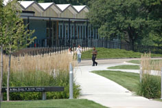
Southfield Public Schools operates area public schools. Southfield Senior High School for the Arts and Technology (commonly known as Southfield A&T) is the district's sole high school. There were originally two high schools in the district, Southfield and Southfield-Lathrup, but they were consolidated after the 2015–16 school year. Students living in parts of Northern Southfield attend schools in the Birmingham City School District, while students living in the southeast corner of Southfield attend schools in the Oak Park School District. Southfield A&T also competes in the Oakland Activities Association in the Red Division for high school sports, and has membership in the MHSAA.
AGBU Alex and Marie Manoogian School is an Armenian charter school in Southfield. Farber Hebrew Day School – Yeshivat Akiva and Southfield Christian School are private schools in the city.
Southfield Public Library operates public libraries in the city.Providence Medical Center offers residency training in various fields of medicine.
Southfield is home to Lawrence Technological University and Oakland Community College. The Specs Howard School of Media Arts is in also Southfield.
Media
Southfield is the broadcast media center for the Detroit area, with studios and broadcast facilities for several television stations, including WXYZ-TV, WJBK, WKBD-TV, WMYD-TV, WWJ-TV, and City Cable 15. Metro Detroit's regional sports network Bally Sports Detroit is in Southfield on 11 Mile and Evergreen roads. A transmitter for WDIV-TV is in the city; it is the only television station based in downtown Detroit.
The city is home to Audacy's Detroit studios. Southfield is also served by WSHJ 88.3 FM, a student-run radio station sponsored by Southfield Public Schools.
In 1970, radio pioneer and entertainer Specs Howard founded the Specs Howard School of Media Arts in Southfield.
In addition to The Detroit News and Free Press, Detroit's two metropolitan daily newspapers, Southfield is served by the Southfield Eccentric, a suburban paper that reports on local and community events, which is published twice a week, on Sunday and Thursday. The headquarters of The Detroit Jewish News is in Southfield. The Chaldean News is also headquartered in Southfield.
Transportation

Suburban Mobility Authority for Regional Transportation (SMART) operates local and regional bus transit. The major thoroughfares in the city include the John C. Lodge Freeway (M-10), which is among the first urban to suburban highways constructed in the United States. The city also contains I-696, Southfield Freeway (M-39), and US 24 (Telegraph Road). The city has several freeway interchanges connecting local roads to the freeways. Most prominently, "The Lodge" freeway connects downtown Detroit to "The Mixing Bowl," the sprawling interchange of I-696, US 24, M-10, Lahser Road, and Franklin Road, all of which are in Southfield.
Most major streets adhere to a north–south/east–west orientation, forming a grid of major streets spaced one mile (1.6 km) apart from each other. The major east–west streets are 8 Mile Road (which forms the southern boundary of the city), 9 Mile Road, 10 Mile Road, 11 Mile Road (which is split by the Lodge and Telegraph), and 12 Mile Road. Major north–south streets are Telegraph Road, Lahser Road, Evergreen Road, Southfield Road (the northern extension of the Southfield Freeway) and Greenfield Road (which forms the eastern boundary of the city).
Kaynak: Wikipedia – Southfield, Michigan · CC BY-SA 4.0