

سطيف
سطيف مدينة وبلدية وهي عاصمة لدائرة وولاية جزائرية بنفس الاسم، وهي من أهم مدن الشرق الجزائري، عُرفت بأكثر من اسم عبر التاريخ، منها سيتيفيس وأزديف.
Government administration · Algeria · 0 followers
Overview
سطيف مدينة وبلدية وهي عاصمة لدائرة وولاية جزائرية بنفس الاسم، وهي من أهم مدن الشرق الجزائري، عُرفت بأكثر من اسم عبر التاريخ، منها سيتيفيس وأزديف. تقع في هضاب الجهة الشماليّة الشرقيّة للجزائر في جنوب جبال الأطلس التلي، وتُشرف على هضبة جبال مقرس وبابور.
Interested in working with us in the future?
Follow to see new jobs and posts in your feed.
No news yet.
About

سطيف مدينة وبلدية وهي عاصمة لدائرة وولاية جزائرية بنفس الاسم، وهي من أهم مدن الشرق الجزائري، عُرفت بأكثر من اسم عبر التاريخ، منها سيتيفيس وأزديف. تقع في هضاب الجهة الشماليّة الشرقيّة للجزائر في جنوب جبال الأطلس التلي، وتُشرف على هضبة جبال مقرس وبابور.
Kaynak: Wikipedia · CC BY-SA 4.0
لمحة عن المدينة

مدينة سطيف بلدية تقع في الشمال الشرقي الجزائري، شرق العاصمة الجزائرية، (مدينة الجزائر)، بولاية سطيف، وهي مركز الولاية، وهي إحدى أهم ولايات الجزائر من حيث الكثافة السكانية، ومكانتها الاقتصادية، كما تعرف بنشاطاتها الثقافة المكثفة، والفعاليات الفكرية، والدينية، والفلسفية، وهي مدينة نظيفة، وجميلة، وتشتهر بسطيف العالي، عاصمة الهضاب العليا، مدينة عين الفوارة.
التسمية
«أزديف»، «سيتيفيس»، و«سطيف» كلها تسميات لمنطقة سطيف التاريخية.
جغرافيا

الموقع
توجد، مدينة سطيف، بولاية سطيف، والتي تقع شمال شرق البلاد، على ارتفاع حوالى 1096متر، فوق سطح البحر، وعلى بعد 300 كلم، شرق الجزائر العاصمة، في جبال الاطلس التلى، على هضبات جبل مقرس.
جيولوجية
تقع مدينة سطيف قي منطقة تمتاز باختلاف كبير قي تكويناتها الجيولوجية سواء من حيث العمر، الطبيعة، أو من حيث الانتماء إلى الوحدات البنيوية، وهذا ما توضحه الخريطة الجيولوجية للمدينة، حيث توجد ثلاث مجموعات رئيسية هي:
تكوينات العصر الرباعي والتي تنقسم إلى ثلاثة أنواع:
تكوينات حديثة: تتمثل في كل من الطمي، الغرين، الحصى، توجد بالقرب من الأودية الرئيسية، حيث النحت لا يزال نشطا، وهذه الترسبات تتسع وتشكل مجموعة من المساحات بالقرب من هذه الأودية خاصة على طول وادي بوسلام.
تكوينات غير محددة: تتشكل من ترسبات المنحدرات، الطمي والغرين، وتشكّل أراضي صالحة للزراعة، تنشر على طول الأودية الرئيسية على شكل السنة. وتكون في بعض الأحيان مجموعة عن السهول الصغيرة، أهمها سهل فرماتو.
تكوينات قديمة: تتمثل قي الكلس البحيري وقشور من الفيلاقرونشيان مع خاصية تتميز بها لهضاب العليا السطايفية.
تكوينات العصر الثالث تكوينات البليوسينية القارية: تتمثل في الرمل، الحصر الطمي والكلس. تتواجد على شكل شريط عريض في الجهة الشرقية، يضيق غربًا مع بعض التفرعات شمالًا وجنوبًا. وتشكل هذه التكوينات القاعدة التي تتموضع عليها مدينة سطيف.
تكوينات البيريسيان واللوتيسيان السفلي: تتمثل قي كلس أبيض مع كسور من السيليس الأسود. يتواجد في نطاقات ضيقة شمال المدينة
تكوينات الكامباني العلوي والماسترخي السفلي عبارة عن كلس أبيض وصوان أسود يتواجد غرب المدينة (هضبة شوف لكداد) وجزء يتوسط سهل فرماتو .
تاريخ المدينة

ما قبل التاريخ
يقع شرق مدينة سطيف موقعي عين الحنش وعين بوشريط وهما من من عصور ما قبل التاريخ يرجع تاريخهما إلى ما يصل إلى 2,4 مليون سنة (Ma)
الفترة الفينيقية
تأسست مدينة سطيف على يد الفينيقيين حوالي القرن السادس. عُثر على شواهد المولك الفينيقية في المدينة تعود إلى القرن الثلاث قبل الميلاد.
الفترة النوميدية
واختلفت الأقوال حول ما إذا كانت سطيف تابعة لمملكة ماسينسا أو مملكة سيفاكس، والأرجح أنها كانت تابعة لمملكة ماسيسيل النوميديّة. بالقرب من سطيف قام يوغرطة بحملته وخسر ضد ماريوس عام 105 قبل الميلاد. ُنقل على إثرها إلى روما حيث تم إعدامه في سجن توليانوم. لم يُعثر على بقايا من هذه الفترة. كانت المدينة صغيرة تحت حكم الملوك النوميديين.
الفترة الرومانية
أسس الرومان سيتيفيس في عهد نيرفا (96 إلى 98 م) مستعمرةً لقدامى المحاربين. على الرغم من عدم وجود مبانٍ معروفة في هذه الفترة، إلا أنه عثر خلال عملية التنقيب في الستينيات على مقبرة تحتوي على قبور من أوائل المستعمرات.
وقد أصبحت سطيف عاصمة للموريطانيا السطايفية من سنة 293م إلى أن أسس الإمبراطور البيزنطي موريكيوس عام 585 م مقاطعة «موريتانيا بريما» وسحق «موريطنيا سيتيفينسيس» القديمة.
اهتم الرومان بسطيف نظرا لموقعها الجغرافي الممتاز الذي يسيطر على السهول والهضاب العليا الشاسعة والغنية بالقمح، وتوفرها على حقول كبيرة للمياه الجوفية، وموقعها الإستراتيجي عند سفح جبل بابور، التي كانت مناسبة للمقاومة ونقطة انطلاق للثورات ضد الرومان.
ولهذه الأسباب قرر الإمبراطور «نيرفا» سنة 97 م إنشاء مستعمرة لقدماء الجيش في موقع «سيتيفيس» والتي أطلق عليها عدة تسميات منها: كولونيا نيرفانيا، كولونيا أوغيسطا، كولونيا مارطاليس، كولونيا فيتيرنانة، ستيفانسيوم سيتيفيس.
موريطانيا السطايفية
وفي بداية التوسع العمراني للرومان اتخذوا من «سيتيفيس» و«كويكول» مراكز عسكرية تطورت فيما بعد لتصبح مدنا، وبنهاية القرن الثالث الميلادي ارتقت مدينة سطيف لتصبح عاصمة لموريطانيا السطائفية. والتي مكنتها من استقلالية إدارية انعكست على الجانب الاقتصادي في صبغة محلية ودولية أوصلها إلى التحكم في التبادل التجاري وبخاصة الحبوب.
ومن أجل تثبيت أقدام الاستعمار الروماني وفرض سيطرته، تم إنشاء مراكز للحراسة تسمى:
المناخ
سطيف لديها مناخ شبه جاف (BSk وفق تصنيف كوبن للمناخ). صيفها حار وجاف، بينما شتاءها بارد مع هطول أمطار منخفضة معتدلة.
نظرًا لموقع سطيف في الهضاب العليا على ارتفاع متوسط 1096 مترًا (3596 قدمًا)، فهي واحدة من أبرد المناطق خلال فصل الشتاء في الجزائر. تشهد الولاية بشكل متكرر تساقط ثلوج سنوي يصل إلى 40 سم. تعد الفيضانات المفاجئة نادرة ولكنها حدثت مؤخرًا في فصلي الربيع والخريف. الصيف حار إلى حد ما حيث تكون موجات الحرارة الشديدة شائعة في حوالي شهر يوليو حيث يمكن أن تصل درجات الحرارة في بعض الأحيان إلى 40 درجة مئوية (104 درجة فهرنهايت).
السياحة

تعتبر بلدية سطيف، اليوم، من أهم المناطق السياحية نظرا لما تتميز به من آثار رومانية، المتواجدة بحديقة التسلية، كائنة بها، والآثار المتواجد في المناطق التابعة للولاية السطايفية، والقريبة من البلدية السطايفية، مركز ولاية سطيف، وعاصمتها، من مثل، الآثار رومانية، الموجودة بصرح جميلة، وغيره، وآثار فاطمية، من مثل، منطقة بني عزيز، كمطقة ايكجان، ومناطق أخرى كالمهدية، وغيرها، وآثار اسلامية أخرى، في مناطق متعددة من الولاية، ومن ضمنها، منطقة قجال، وحمامات معدنية، كحمام السخنة، وحمام قرقور، وحمام أولاد يلس، وحمام أولاد تبان، وكذلك حمام الصالحين بالحامة سطيف سطيف جنوبا المعروف بدرجة الحرارة العالية لمياهه المعدنية، كما تستقطب المدينة السواح، بشكل مستمر، وذلك بسبب النشاط التجاري، المكثف بالمنطقة، بالإضافة إلى الفعاليات الفكرية، والدينية، والثقافية...
الاقتصاد
تتميز سطيف بتنوع الأنشطة الاقتصادية، الفلاحية منها بجميع أنواعها من الزراعة، وتربية المواشي، وغيرها، والصناعية، حيث ازدهرت بها، الصناعة بنوعيها، الخفيفة منها، والثقيلة، والتجارية، حيث نجد بلدية سطيف، مليئة بأسواق الجملة، كما تعرف، بأسواق التجزئة المميزة، التي يجد بها المستهلك، كل ما يحتاج إليه، ومراكز تجارية، قل مثيلها في الوطن الجزائري مثل المركز التجاري الذي دشن مؤخرا «بارك مول» وهو أكبر مركز تجاري في الجزائر حيث يحتوي على الكثير من المرافق وهو مركز تجاري عصري زاد مدينة سطيف جمالا...
التعليم
يوجد في بلدية سطيف الكثير من المؤسسات التعليمية، من مدارس ابتدائية، ومتوسطة، وثانوية، ومؤسسات التعليم الحر، كمدارس التدريس عبر المراسلة، ومؤسسات التعليم الخاص، ومراغكز التعليم والتكوين المهني، كما يوجد بها جامعتين كبيرتين ،جامعة فرحات عباس، وجامعة محمد لمين دباغين، بالإضافة إلى المعاهد العلمية والمعرفية، ومؤسسات التعليم العالي، والتي تديرها مديرية التربية لولاية سطيف، التابعة لوزارة التربية والتعليم الجزائرية، وهي تخدم المواطنين الجزائريين، كما تخدم الوافدين من الوطن العربي، والدول الأفريقية.
النشاطات والفعاليات الفكرية والدينية والثقافي

تعتبر مدينة سطيف مركزاً للفعاليات، والنشاطات، الفكرية، والدينية، والثقافية
من الأسماء الثقافية والأدبية المعروفة حاليا والتي تنتمي إلى منطقة سطيف:
مساجد البلدية

تتوفر مدينة سطيف على عدد كبير من المساجد، ومن أهمها :
النقل والمواصلات

تعد سطيف من أكبر المدن الجزائرية وتعد ثاني أكبر مدينة من حيث عدد السكان بعد الجزائر العاصمة بعدد سكان يناهز ثلاث ملايين نسمة، وتمتلك شبكة طرق واسعة طولها 3131 كلم منها 600 كلم وطنية، و516 كلم طرق ولائية، و2015 كلم طرق بلدية لذا من الطبيعي أن تتوفر على أجهزة مواصلات متنوعة لتلبية حاجات سكانها، فهناك سيارات الأجرة والحافلات العمومية منها والخاصة، وهناك قطاع السكك الحديدية أو القطار، وأيضا المطار المعروف باسم مطار 8 ماي 1945 م، ومستقبلا سيتم الانتهاء من إنشاء ترامواي سطيف إن شاء الله، والذي من المقرر أيضا أن يكون أطول خط ترامواي في الجزائر بطول يناهز 22,4 كم.
النقل البري
تتميز سطيف بوجود شبكة مواصلات برية ضخمة، متمثلة في شبكة طرق سريعة، إضافة إلى أسطول ضخم من الحافلات الكبيرة، والصغيرة، وسيارات الأجرة الصفراء وغيرها، ونقل سكة الحديد، كما تعرف مشروع ترامواي سطيف....
نقل المسافرين (حافلات)
تتميز سطيف بوجود شبكة حافلات ضخمة لنقل المسافرين، وهذا الأسطول الضخم من الحافلات المتمثلة في حافلات تابعة لشركات خاصة، وأخرى تابعة لمؤسسات حكومية، وتنقسم إلى قسمين، قسم منها يعمل داخل ولاية سطيف، يعني يعمل على نقل المسافرين بين بلديات ودوائر ولاية سطيف، وقسم الآخر يعمل على نقل المسافرين بين ولاية سطيف، وباقي ولاية الوطن الجزائري الحبيب...
النقل الحضري (حافلات)
تعد حافلات النقل الحضري الصغيرة منها والكبيرة، من أهم وأكثر وسائل المواصلات استعمالا في مدينة سطيف وذلك لكبر المدينة وكبر عدد سكانها، وتنقسم إلى نوعين: حافلات خاصة وهي الأكثر عددا، وكذلك الحافلات الحكومية، سعر التذكرة : 15 دينار في كلا النوعين.
الحافلات الخاصة
محطة نقل المسافرين (SNTV) > حي المعبودة > حي الأسوار (Les Remparts) > وسط المدينة (محطة قصاب) > حي محطة القطار (La Gare) > حي الشيمينو (Chimino) > حي سينيسطال (Sinestal) > حي طانجة > حي مسكن 1006 > حي لحشامة > حي الهضاب.
محطة نقل المسافرين (SNTV) > حي المعبودة > حي الاسوار (Les Remparts) > وسط المدينة (محطة قصاب) > حي طانجة > حي مسكن 1006> حي لحشامة > حي الهضاب.
محطة نقل المسافرين (SNTV) > حي المعبودة > حي الاسوار (Les Remparts) > وسط المدينة (محطة قصاب) > حي 600 مسكن > حي لعرارسة > حي مسكن 500 > حي لحشامة > حي 1006 مسكن.
الرياضة
تتميز بلدية سطيف، بكثافة النشاطات الرياضية، بشتى أنواعها، ويوجد في البلدية السطايفية، الكثير من النوادي الرياضية، العريقة، والمشهورة، التي تمتلك فروع، في شتى أنواع، الألعاب الرياضية، كما تمتلك البلدية، مركب 8 ماي 1945 الرياضي، وقرية الباز الرياضية، الفريدة من نوعها في القطر الجزائري....
الألعاب الرياضية
كرة القدم، كرة اليد، الكرة الطائرة، كرة الماء، كرة السلة، كرة الطاولة (تنس الطاولة)، كرة المضرب (التنس)، كرة القدم الخماسية، كرة القاعدة، ألعاب القوى، السباحة، الكاراتيه، كونغ فو، تايكوندو، الفول كونتاكت، آيكيدو (الآيكيدو)، المبارزة، الملاكمة، ورياضة الشطرنج العقلية....
كرة القدم
تمثل كرة القدم في بلدية سطيف أهمية بالغة وتلقى متابعة من طرف السكان خصوصاً لفريق وفاق سطيف. حيث يحتل المراتب الأولى رياضيا، وقد فاز عدة مرات بكأس الجزائر، وألقاب قارية، ودولية...
الوفاق الرياضي السطايفي، ناد رياضي جزائري يملك عدة فروع أهمها فرع كرة القدم، أسسه علي بن عودة الملقّب ب«لاياص» في سنة 1958، في مدينة سطيف بالجزائر. فريق كرة القدم يلعب في البطولة الوطنية الجزائرية.
يعتبر وفاق سطيف من أكبر وأرقى الفرق الجزائرية والعربية حيث يعتبر الفريق الجزائري الوحيد المتحصل على الكأس أفروآسيوية ودوري أبطال العرب. وهو الفريق رقم واحد في الشرق الجزائري.
حمل الوفاق تسمية الوفاق الرياضي السطايفي E.S.S من 1960 إلى 1977، أين أصبحت تسميته وفاق نفط سطيف E.P.S حتى 1984، ثم وفاق بلاستيك سطيف وبنفس الرمز الفرنسي E.P.S حتى 1988، حينما توج بالكأس الإفريقية واسمه وفاق سطيف E.S.S، وبعد سنة 1990، استعاد تسميته الشرعية الوفاق الرياضي السطايفي E.S.S.
وإذا كان أغلبية الناس يعتبرون أن حمل الأسود جاء حزنا على مأساة 08 ماي 1945، إلاّ أن الفقيد علي لاياص، ذكر في كتاب حميد فرين «الوفاق وأسطورة النفس الثاني» أنه في إحدى اللقاءات في ملعب برج غدير، كانت عناصر الوفاق تلبس الأخضر والأبيض ودخلت عساكر المستعمر إلى الملعب، وأوقفت الجميع في الاستعداد، من أجل تفتيش وثائقهم، ووجهت ملاحظات عنيفة للسطايفية على حملهم الأخضر والأبيض وتم بعدها اختيار الأسود حزنا على ضحايا 8 ماي.
وصلات خارجية
الموقع الرسمي لإذاعة الهضاب: استمع إلى البث الحي هنا.
Kaynak: Wikipedia – سطيف · CC BY-SA 4.0
Etymology
Sétif was Numidian before undergoing Roman rule. The name of Sétif comes from Latin "Sitifis", that is drawn from a Berber word "Zdif" which means "black lands" referring to the fertility of its lands.
History

Prehistory
The prehistory of Setif begins with the first traces of human occupation, about 2.4 million years ago, and ends with the first Carthaginian texts, in the first millennium BC.
Aïn El Ahnech in Guelta Zerka comprises several sites that, although lacking associated human fossils, have yielded very ancient lithic remains of the Oldowan type—a tool tradition first identified at Olduvai Gorge by archaeologist Louis Leakey in the 1930s. The Aïn Boucherit site delivered in 2018 lithic industry remains (carved stone tools), dated between 1.9 and 2.4 million years ago. On November 29, 2018, the journal Science announced the dating of the site by four corroborating methods: negative geomagnetic polarity reported to the Matuyama chron, ESR dating, biochronology (fossil species assemblages) and sedimentation rate. Aïn Boucherit could be the third oldest African site after Lomekwi 3 in Kenya (3.3 Ma), and Kada Gona in Ethiopia (2.55 Ma). The prehistoric site of Ain El Ahnech is located a few kilometers east of the city, and the age of the lithic remains is estimated by archaeomagnetism to be about 2.4 million years old. It is an ancient lake, located in the commune of Guelta Zerka. The site was discovered in 1947 by the French paleoanthropologist Camille Arambourg (1885-1969), during his paleontological research of continental deposits in the Setif region. On November 29, 2018, a discovery of tools dating back 2.4 million years was published, making this site, at the time of its discovery, the cradle of Humanity before that of Tanzania. Professor Mohamed Sahnouni confirms this discovery.
Numidia
The city, of Numidian origin, was part of the kingdom of Massaesyli in the year 225 BC. It was also considered as a capital before Juba II preferred Cherchell.
It was near Sétif that Jugurtha campaigned and lost against Marius in 105 BC. Overcome by Marius, he was taken to Rome where was executed in the prison of Tullianum. No remains of this period have been found. The city was small under the Numidian kings.
Geography
Location
Sétif is the capital of Sétif Province, and it has a population of 288,461 inhabitants as of the 2008 census. It is located in northeastern Algeria, 270 kilometers (170 mi) east of Algiers, 65 km (40 mi) from Bordj Bou Arreridj and 132 km (82 mi) from Constantine in the Hautes Plaines region of southern Little Kabylia. the city is located 1,096 m (3,596 ft) above sea level, making it the second-highest provincial capital in Algeria. The city of Sétif is located in the central part of the wilaya, bordered to the north by the commune of Ouricia, to the east by the commune of Ouled Saber, to the west by the communes of Mezloug and Ain Arnet, and to the south by the commune of Guedjel.
Topography
The natural structure of Sétif is characterized by its non-homogeneity due to its location between two distinct regions; the Tellian Atlas in the north and the Aures mountains in the south, with the plain region in the middle. This diversity results in a city with both a wide and elevated terrain, reaching an altitude of 1,100 meters (3,600 ft). The city also has a unique geographical position that separates the Tellian Atlas in the north and the desert chain in the south. This combination of diverse landscapes and geographical features makes the city of Sétif a unique and attractive place to live and visit.
Hydrography
The hydrography of Sétif is characterized by its wadis, or dry riverbeds, which have an irregular flow due to climatic data and precipitation patterns. The main waterways are the Boussalem and El Kébir wadis.
The hydrography of Sétif plays a crucial role in the city's water management and availability. The unpredictable flow of the wadis can make access to water resources challenging, but they also provide a source of water for both the city and surrounding agricultural lands. Effective management and conservation of these resources is necessary for sustainable development in the region.
Administration
The municipality of Sétif was created at the beginning of independence, on July the 5th, 1962.
The municipality of Setif includes 12 administrative annexes elaborating the activities that affect the civil status of citizens. These annexes are: Downtown, Cité El Moustakbel (Birguey), Cité Yahaoui (Tandja), Cité 1er Novembre (1014), Bouaroua, El Hidhab, El Hassi, Ain Trik, El Baz, Chouf Lekdad, Chikh El Aifa, Tlidjan (Beau marché).
Cityscape
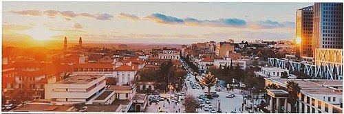
Urbanism and architecture
Setif saw a significant growth in modern architecture between 1930 and 1962, reflecting the urban dynamics of the city and being influenced by various factors such as financial measures, technological processes, and the work of architects and contractors. The introduction of reinforced concrete was a catalyst for the development of modern architecture in the city, with François Hennebique design agency being instrumental in enabling the use of the material in various architectural works such as grain silos, banks, and townhouses. The colonial state was involved in social housing programs starting from the early 20th century, creating suburban housing districts, garden cities, and workers' housing schemes. The city center of Setif was reinvested twice, with modern architecture being promoted in the 1930s with public operations, and after World War 2 by the holders of agricultural capital, who consolidated the best locations to form tall buildings made with reinforced concrete structures. The new modern urban form neighborhood, The Pines, located at the southern boundary of the public hospital, which was highly regarded for its architecture and modern amenities. The architecture in The Pines was utilitarian, focusing on functionality and the absence of ornament, while the Bouaroua district located at the eastern end of the city saw a similar situation. Some buildings in Setif showed a return to the past with an Arabist style, drawing on Islamic architecture, and this return was seen as more of a Situationist approach than a doctrine. Setif was a testing ground for the Modern Movement, with the application and experimentation of modern architecture and building techniques, and a mix of traditional and modern elements being incorporated into the city's architectural language.
Demographics
According to data from 2008, Setif had a population of 288,461, which ranked it as the eighth largest city in the country. The population is estimated at 410,000 by 2015. The city serves as the capital of the second most populated wilaya of Algeria and has experienced significant growth over the years. In 1900, the estimated population of Setif was 21,289 and by 1950, the population had grown to 37,235, which represents a 1.3% annual increase.
The population of Setif is relatively young, with a median age of 25.9 years. Women make up 49.6% of the population while men account for 50.4%. Despite the fact that the city has experienced rapid growth in recent years, it has managed to maintain its unique cultural identity and continues to attract people from all over the country.
The population of the municipality is growing at a sustained pace, particularly in the main hub of Sétif and the urban centers that surround it from all sides within the municipality. It is a population of different social scales and from various backgrounds, it is dispersed over the municipal territory with a more pronounced concentration in the town center that conquers new lands or encompasses old centers due to its all-around expansion. The municipality had 286,715 residents in 2006, of which 260,910 were in the town center. This figure represents a concentration percentage (91%) due to an average annual increase of approximately 5,000 residents per year since independence. In 2008, the last census gave a figure of 300,000 residents in the Sétif municipality. More than 90% of the population represents residents in the town center of the municipality, which has experienced significant expansions in the last fifty years.
Economy

Sétif is a very dynamic city, it is one of the most industrialized municipalities in Algeria. The city is an economic hub with great potential for growth and investment. The region has a strong focus on agriculture and industry, and is home to many small and medium-sized enterprises (SMEs) which are key to its continued growth.
Employment
Sétif has an important potential of training almost 9,000 posts of professional and specialized training which can be readapted to the current context, and of two university poles with 5 249 students; thus, the job seekers will present themselves on the labor market with a diversified and increasingly high qualification.
In terms of SMEs, the wilaya of Sétif has 4,384 businesses employing over 19,000 workers in the industry sector. The region also has two industrial zones in Sétif and El Eulma, and the mega industrial zone of Ouled Saber, which is expected to create an additional 19,000 jobs. In total, 15 activity zones have been created to support the growth of SMEs, and the public authorities have committed to creating 9 micro-zones to meet the growing demand for land.
Adviser to the President of the Republic for the economy, Abdelaziz Khellaf, has praised the wilaya of Sétif as one of the most important poles of industry in the country, thanks to the efforts and determination of its economic operators. Out of the 2,379 investment applications received, 1,175 have received a favorable opinion, resulting in 81,000 jobs being created in sectors such as industry, agro-food, building materials, and services. The director of industry and mines, Mermouchi Mohamed, also believes that the wilaya of Sétif is poised for a prosperous future in terms of investment, wealth creation, and job growth.
Cost of living
Setif is considered to be one of the least expensive cities in the world. According to the information provided, the average cost of living in Setif is €282, which puts it in the top 1% of the cheapest cities and ranks 12th out of 9,294 cities globally. In Algeria, Setif ranks 5th out of 30 cities in terms of cost of living. The median after-tax salary in Setif is €214, which is sufficient to cover living expenses for 0.8 months. This puts Setif at 9th best city to live in Algeria. It is a relatively affordable city to live in, with a cost of living that is lower compared to many other cities in the world. However, the median after-tax salary may not be enough to cover all living expenses for a full month, but the city's ranking as one of the best places to live in Algeria highlights its appeal as a potential destination for those seeking a good quality of life.
Culture

Music
The third most popular music genre in Algeria is definitely Staifi after Rai and Kabyle. Based on the zendali rhythm, originally from Constantine, and also on keyboard accompaniment, this music is now very present in all Maghreb celebrations.
The first were Groupe Saada, then Samir Staifi, Bekhachi, Djamel, Nordine and others. Today, Editions Charihene (Batna), El Amir (Constantine), Intherlux (Sétif) and Boualem (Marseille) are very representative of the "staifi" music. Katchou, Cheb Farat, Khalasse, Rochdi, Ghania, Fella, Djamal, Hasna, Yamina... are today the pillars of "staifi" music.
Cuisine and restaurants
The Berboucha dish is typically Setifian, a couscous mainly with lamb, turnips and chard. The Mferemsa dish is also typical of the city, large sheets of dough, cooked and drizzled with a sweet, salty, sour and spicy red sauce, made up of onions, spices, tomatoes, chickpeas, apricots, and raisins, all accompanied by meat. Chorba frik, a traditional soup, is also very present in Setif, it's made of frik (cracked wheat), lamb, chicken, tomato, onion, spices; it is often served with bourek, an Algerian pastry made of a thin flaky dough with a variety of fillings, such as meat, cheese, spinach, or potatoes. Tagines, mechoui, ghraif (traditional pancakes) are other dishes we can find in the city.
For local pastries, we can mention makrout, gazelle horns, griouech, mbardja...
The economic intensity of Setif has favored the opening of several establishments offering menus of local, national international origin. The famous type of restaurants that specialize in traditional cuisine is locally known as Khaima, translates simply to "tent". These restaurants offer a diverse selection of local and national dishes, including Chakhchoukha, Zviti, Hmis, Mfaouer, Kesra... Khaimas are highly sought after, attracting both tourists and locals alike.
Education

The school system in Setif is no different from the rest of Algeria, the city has many educational institutions, including primary, middle, and secondary schools, educational institutions through correspondence, and institutions of private education, and there are two large universities, the University of Setif 1 Farhat Abbas, the University of Setif 2 Mohamed Lamine Dabaghin, as well as institutes and institutions of higher education, which are run by the Directorate of Education of Setif, affiliated to the Algerian Ministry of Education, and they serve Algerian citizens, as well as those coming from the Arab world and African countries.
Sports

Setif has a football club, the Entente Sportive de Sétif (ESS) founded in total discretion in September 1958, on the orders of the command of the FLN revolution, for a mission of Fidaye. Since then, the Entente has become a major club in the Algerian football scene with several national titles (8 Algerian Cups, 8 Championships including 2 doubles, and two Algerian Super Cups), as well as regional and international (2 Arab Cups of Champions Clubs, 2 African Cups of Champions Clubs, an Afro-Asian Cup, and an African Super Cup).
The city also has two other football teams: the Union Sportive Madinet Sétif (USMS) founded in 1933 (finalist in the Algerian Cup in 2005) and the Stade Africain Sétifien (SAS) founded in 1947.A new Olympic swimming pool in El Bez was inaugurated in 2014.
Setif is the location of two international cycling competitions:
The Criterium international de Setif: cyclists race on a closed circuit of 40 laps totaling 128 kilometers (80 mi). The departure is in front of the headquarters of the wilaya of Sétif, avenue du 1er Novembre.
The International Tour of Setif: cyclists race in the wilaya of Sétif in three stages for a route totaling 346 kilometers (215 mi).
Infrastructure

Transportation
Setif is a major city in Algeria and boasts a variety of transportation options to accommodate its residents. These include taxis, both public and private buses, the railway system, and the May 8, 1945, airport. In the future, the Setif Tramway, which will be the longest tramway line in Algeria at approximately 22.4 km (13.9 mi), is expected to be completed.
Buses
Road transportation in Setif is abundant and well-connected, with a vast network of highways and a variety of buses ranging from small to large.
The transport in the city is largely served by buses, which are operated by both private companies and government institutions. There are two types of bus service, one that operates within the boundaries of the city and the other that connects Setif to the rest of the province and other regions of Algeria. Urban transport buses, both large and small, are widely used in the city due to its large population, dense network and cheap price, ticket prices for both private and government buses are set at 20 dinars.
Taxis
Taxi services in Setif are extensive and come in three different forms: urban transport within the city, transportation between different departments within the city, and transportation to and from Setif and other areas of Algeria.
Rail
The Setif train station is estimated to be around 118 years old (1897-2015). Its construction was agreed upon during the city's municipal meeting in 1877. The meeting decided that the construction of the station would be an appropriate way to celebrate the arrival of the train once the construction was completed in 1897. The station is located on the ALGER-CONSTANTINE (AC) line, with five (5) trains, three (3) of which go to the capital Algiers, one (1) to Constantine, and one (1) to Annaba. Approximately twelve (12) trains carrying goods from various places arrive daily at the Setif station.
International relations
Twin towns – sister cities
Setif is twinned with 13 cities from 5 continents:
Places of interest
Monuments and attractions
Ain El Fouara fountain is one of the most important historical monuments in the city of Sétif. It was moved to the city of Sétif during the time of French colonialism in 1899 AD and was placed in the heart of the old city in the middle of three religious monuments, the old mosque, the Jewish temple and the church, in the middle of Independence Square. This fountain represents a huge sculpture created by the French sculptor Francis de Saint-Vidal, the stories differed on the true history of the construction of this monument. No one is sure they know the history of Ain El Fouara, nor the story of the woman depicted in the statue, it was carefully sculpted by François de Saint Vidal, and it was previously on display in the French Louvre Museum before being transferred to Sétif in 1898, this statue was classified as a national heritage on November 3, 1999.
The Byzantine citadel of Sétif is a largely preserved carved stone wall that surrounded a Byzantine fortress built in the first half of the 6th century, around 540 AD. It was built by General Solomon with the aim of securing the Byzantine camp from surprise attacks. After the Islamic conquest of the city of Setif, the citadel was used for various purposes, including grain storage and as stables for animals. During the French colonial period, the citadel regained its original function as a defensive structure, with a military barracks and hospital being built inside it. The citadel is built from massive blocks of cut stone, 2.5 meters (8.2 ft) thick, in a rectangular shape.
Park Mall Setif is a shopping mal that has been open since February 2016. Located along the Avenue de l'ALN, between the seat of the Wilaya to the east and the amusement park to the west, the large building includes a 5-storey shopping center, the largest in Algeria, a business center, a hotel and a multipurpose room The Dome
Kaynak: Wikipedia – Sétif · CC BY-SA 4.0